Kaeng Khoi elevation
Kaeng Khoi (Sara Buri), Thailand elevation is 23 meters and Kaeng Khoi elevation in feet is 75 ft above sea level [src 1]. Kaeng Khoi is a seat of a second-order administrative division (feature code) with elevation that is 102 meters (335 ft) smaller than average city elevation in Thailand.
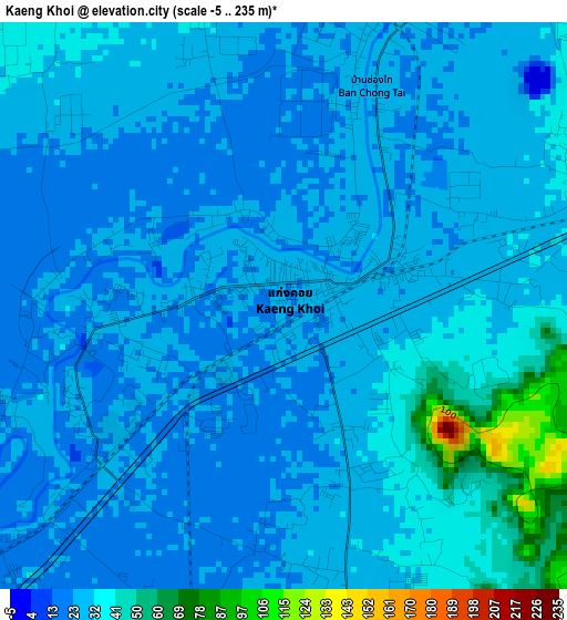
Below is the Elevation map of Kaeng Khoi, which displays elevation range with different colors. Scale of the first map is from -5 to 235 m (-16 to 771 ft) with average elevation of 29.6 meters (=97 ft) [note 1]
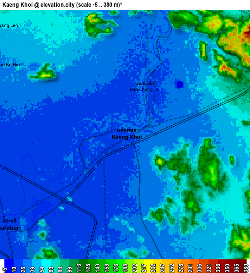
These maps also provides idea of topography and contour of this city, they are displayed at different zoom levels. More info about maps, scale and edge coordinates you can find below images.
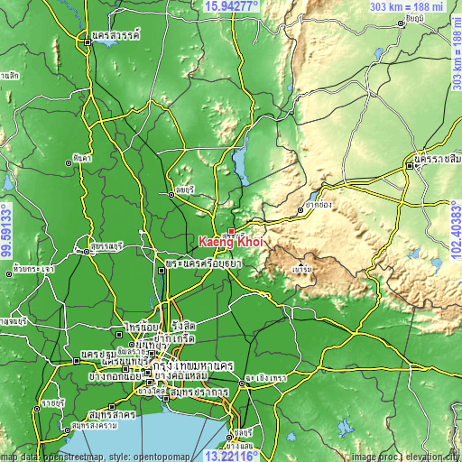
| \ | Map #1 | Map #2 | Topo.Map |
| Scale [m] | -5..235 m | -5..380 m | × |
| Scale [ft] | -16..771 ft | -16..1247 ft | × |
| Average | 29.6 m = 97 ft | 47.6 m = 156 ft | × |
| Width | 9.46 km = 5.9 mi | 18.92 km = 11.8 mi | 302.6 km = 188 mi |
| Height | 9.46 km = 5.9 mi | 18.92 km = 11.8 mi | 302.6 km = 188 mi |
| ↑Max Latitude | 14.628695° | 14.671211° | 15.94277° |
| Latitude at center | 14.58617° | 14.58617° | 14.58617° |
| ↓Min Latitude | 14.543637° | 14.501096° | 13.22116° |
| ← Min Longitude | 100.953635° | 100.909689° | 99.59133° |
| Longitude center | 100.99758° | 100.99758° | 100.99758° |
| →Max Longitude | 101.041525° | 101.085471° | 102.40383° |
Nearby cities:
Cities around Kaeng Khoi sort by population:
• Saraburi elevation 22 m
10.5 km,  235°
235°
• Phra Phutthabat 50 m
26.7 km,  305°
305°
• Nong Khae 9 m
30.7 km,  207°
207°
• Tha Ruea 13 m
29.3 km,  265°
265°
• Ban Mo 13 m
29.3 km,  276°
276°
• Wang Muang 70 m
31.6 km,  25°
25°
• Phatthana Nikhom 46 m
30.1 km,  357°
357°
• Wihan Daeng 10 m
26.7 km,  181°
181°
• Nong Saeng 12 m
25.2 km,  245°
245°
• Muak Lek 221 m
23 km,  71°
71°
• Sao Hai 17 m
17 km,  256°
256°
• Chaloem Phra Kiat 27 m
10 km,  286°
286°
Multilingual:
 En español:
Kaeng Khoi elevación 23 m.
 En France:
Kaeng Khoi élévation 23 m.
 Auf Deutsch:
Kaeng Khoi höhe über dem Meeresspiegel ist 23 m.

Sources and notes:
- [note 1] Map square and city borders are not equal. Map elevation data is calculated only from area inside that square.
- [src 1] Elevation data from geonames database provided with same terms of usage.
- [src 2] The elevation map of Kaeng Khoi is generated using elevation data from NASA's 3 arcsec (90m) resolution SRTM data.
- [src 3] Base (background) map © OpenStreetMap contributors tiles are generated by Geofabrik and OpenTopoMap.
Copyright & License:
This Kaeng Khoi Elevation Map is licensed under CC BY-SA. You may reuse any part from this page, if you give a proper credit by linking to this URL:
 More info on terms of use page.