Non Sung elevation
Non Sung (Nakhon Ratchasima), Thailand elevation is 170 meters and Non Sung elevation in feet is 558 ft above sea level [src 1]. Non Sung is a seat of a second-order administrative division (feature code) with elevation that is 45 meters (148 ft) bigger than average city elevation in Thailand.
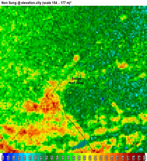
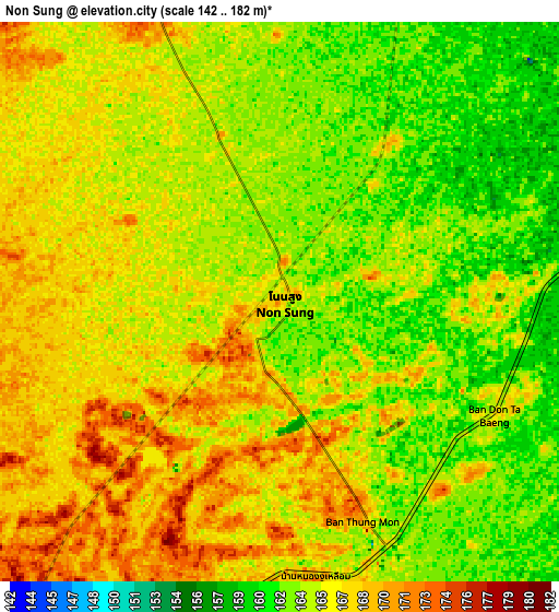
Below is the Elevation map of Non Sung, which displays elevation range with different colors. Scale of the first map is from 154 to 177 m (505 to 581 ft) with average elevation of 164.9 meters (=541 ft) [note 1]
These maps also provides idea of topography and contour of this city, they are displayed at different zoom levels. More info about maps, scale and edge coordinates you can find below images.
| \ | Map #1 | Map #2 | Topo.Map |
| Scale [m] | 154..177 m | 142..182 m | × |
| Scale [ft] | 505..581 ft | 466..597 ft | × |
| Average | 164.9 m = 541 ft | 165.1 m = 542 ft | × |
| Width | 9.43 km = 5.9 mi | 18.86 km = 11.7 mi | 301.8 km = 187.5 mi |
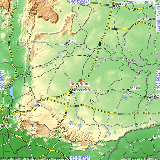
| Height | 9.43 km = 5.9 mi | 18.86 km = 11.7 mi | 301.8 km = 187.5 mi |
| ↑Max Latitude | 15.222548° | 15.264947° | 16.53284° |
| Latitude at center | 15.18014° | 15.18014° | 15.18014° |
| ↓Min Latitude | 15.137724° | 15.095299° | 13.81872° |
| ← Min Longitude | 102.213005° | 102.169059° | 100.8507° |
| Longitude center | 102.25695° | 102.25695° | 102.25695° |
| →Max Longitude | 102.300895° | 102.344841° | 103.6632° |
Nearby cities:
Cities around Non Sung sort by population:
• Nakhon Ratchasima elevation 187 m
28.6 km,  215°
215°
• Ban Huai Thalaeng 195 m
47.5 km,  117°
117°
• Phimai 157 m
26 km,  79°
79°
• Non Thai 177 m
20 km,  274°
274°
• Kham Sakae Saeng 189 m
19.2 km,  331°
331°
• Huai Thalaeng 196 m
46.6 km, 115°
• Kham Thale So 211 m
41.2 km,  233°
233°
• Non Daeng 162 m
39.7 km,  49°
49°
• Khong 178 m
30.3 km,  14°
14°
• Phra Thong Kham 190 m
27.2 km,  290°
290°
• Chakkarat 176 m
25 km,  137°
137°
• Chaloem Phra Kiat 165 m
19.5 km,  175°
175°
Multilingual:
 En español:
Non Sung elevación 170 m.
 En France:
Non Sung élévation 170 m.
 Auf Deutsch:
Non Sung höhe über dem Meeresspiegel ist 170 m.

Sources and notes:
- [note 1] Map square and city borders are not equal. Map elevation data is calculated only from area inside that square.
- [src 1] Elevation data from geonames database provided with same terms of usage.
- [src 2] The elevation map of Non Sung is generated using elevation data from NASA's 3 arcsec (90m) resolution SRTM data.
- [src 3] Base (background) map © OpenStreetMap contributors tiles are generated by Geofabrik and OpenTopoMap.
Copyright & License:
This Non Sung Elevation Map is licensed under CC BY-SA. You may reuse any part from this page, if you give a proper credit by linking to this URL:
 More info on terms of use page.