Phayakkhaphum Phisai elevation
Phayakkhaphum Phisai (Maha Sarakham), Thailand elevation is 139 meters and Phayakkhaphum Phisai elevation in feet is 456 ft above sea level [src 1]. Phayakkhaphum Phisai is a seat of a second-order administrative division (feature code) with elevation that is 14 meters (46 ft) bigger than average city elevation in Thailand.
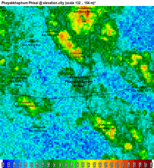
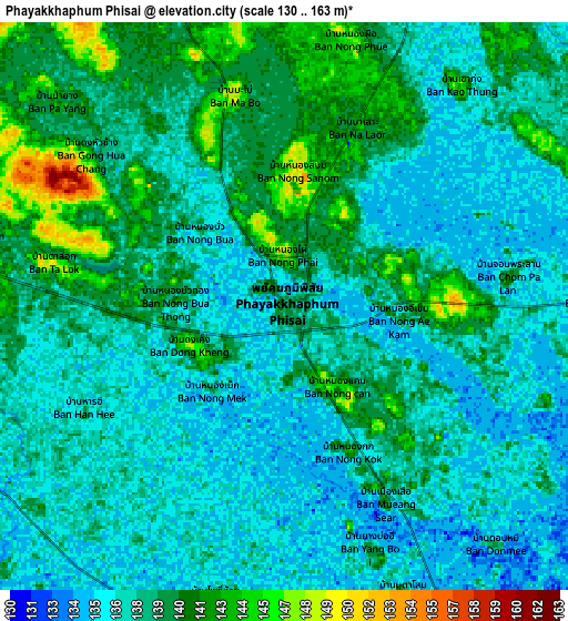
Below is the Elevation map of Phayakkhaphum Phisai, which displays elevation range with different colors. Scale of the first map is from 132 to 154 m (433 to 505 ft) with average elevation of 138.1 meters (=453 ft) [note 1]
These maps also provides idea of topography and contour of this city, they are displayed at different zoom levels. More info about maps, scale and edge coordinates you can find below images.
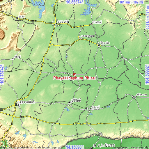
| \ | Map #1 | Map #2 | Topo.Map |
| Scale [m] | 132..154 m | 130..163 m | × |
| Scale [ft] | 433..505 ft | 427..535 ft | × |
| Average | 138.1 m = 453 ft | 138.3 m = 454 ft | × |
| Width | 9.42 km = 5.9 mi | 18.83 km = 11.7 mi | 301.3 km = 187.2 mi |
| Height | 9.42 km = 5.9 mi | 18.83 km = 11.7 mi | 301.3 km = 187.2 mi |
| ↑Max Latitude | 15.558649° | 15.60098° | 16.86674° |
| Latitude at center | 15.51631° | 15.51631° | 15.51631° |
| ↓Min Latitude | 15.473962° | 15.431605° | 14.15698° |
| ← Min Longitude | 103.149725° | 103.105779° | 101.78742° |
| Longitude center | 103.19367° | 103.19367° | 103.19367° |
| →Max Longitude | 103.237615° | 103.281561° | 104.59992° |
Nearby cities:
Cities around Phayakkhaphum Phisai sort by population:
• Satuek elevation 135 m
26.6 km,  156°
156°
• Na Chueak 165 m
35.3 km,  330°
330°
• Lam Thamen Chai 150 m
34.6 km,  238°
238°
• Khu Mueang 182 m
34.1 km,  217°
217°
• Mueang Yang 145 m
34 km,  251°
251°
• Na Pho 158 m
29.1 km,  298°
298°
• Chumphon Buri 133 m
28.3 km,  131°
131°
• Na Dun 164 m
22.6 km,  9°
9°
• Khaen Dong 141 m
22.3 km,  196°
196°
• Yang Si Surat 158 m
21 km, 332°
• Pathum Rat 157 m
20.7 km,  50°
50°
• Phutthaisong 142 m
18.4 km,  280°
280°
Multilingual:
 En español:
Phayakkhaphum Phisai elevación 139 m.
 En France:
Phayakkhaphum Phisai élévation 139 m.
 Auf Deutsch:
Phayakkhaphum Phisai höhe über dem Meeresspiegel ist 139 m.
 На русском:
Phayakkhaphum Phisai высота над уровнем моря 139 м
Sources and notes:
- [note 1] Map square and city borders are not equal. Map elevation data is calculated only from area inside that square.
- [src 1] Elevation data from geonames database provided with same terms of usage.
- [src 2] The elevation map of Phayakkhaphum Phisai is generated using elevation data from NASA's 3 arcsec (90m) resolution SRTM data.
- [src 3] Base (background) map © OpenStreetMap contributors tiles are generated by Geofabrik and OpenTopoMap.
Copyright & License:
This Phayakkhaphum Phisai Elevation Map is licensed under CC BY-SA. You may reuse any part from this page, if you give a proper credit by linking to this URL:
 More info on terms of use page.