Phu Khiao elevation
Phu Khiao (Chaiyaphum), Thailand elevation is 213 meters and Phu Khiao elevation in feet is 699 ft above sea level [src 1]. Phu Khiao is a seat of a second-order administrative division (feature code) with elevation that is 88 meters (289 ft) bigger than average city elevation in Thailand.
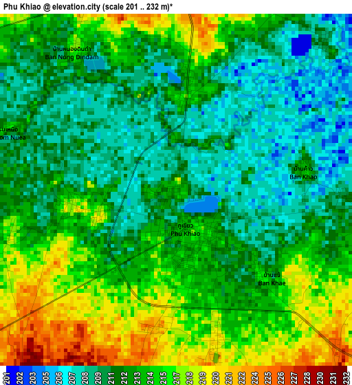
Below is the Elevation map of Phu Khiao, which displays elevation range with different colors. Scale of the first map is from 201 to 232 m (659 to 761 ft) with average elevation of 212.7 meters (=698 ft) [note 1]
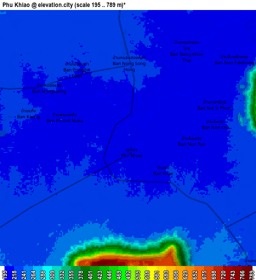
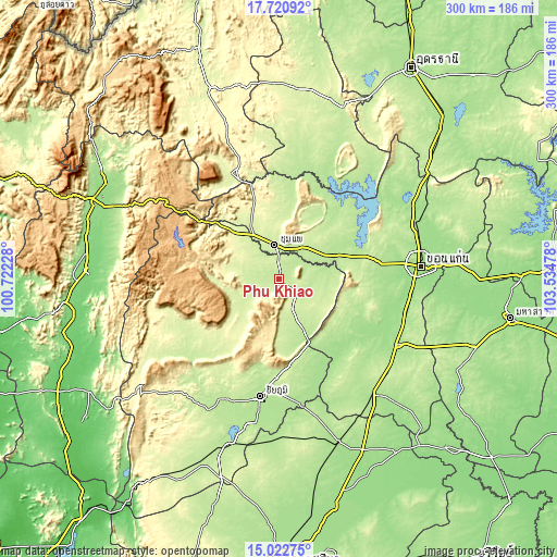
These maps also provides idea of topography and contour of this city, they are displayed at different zoom levels. More info about maps, scale and edge coordinates you can find below images.
| \ | Map #1 | Map #2 | Topo.Map |
| Scale [m] | 201..232 m | 195..789 m | × |
| Scale [ft] | 659..761 ft | 640..2589 ft | × |
| Average | 212.7 m = 698 ft | 233.3 m = 765 ft | × |
| Width | 9.38 km = 5.8 mi | 18.75 km = 11.7 mi | 300 km = 186.4 mi |
| Height | 9.38 km = 5.8 mi | 18.75 km = 11.7 mi | 300 km = 186.4 mi |
| ↑Max Latitude | 16.418658° | 16.460807° | 17.72092° |
| Latitude at center | 16.3765° | 16.3765° | 16.3765° |
| ↓Min Latitude | 16.334333° | 16.292157° | 15.02275° |
| ← Min Longitude | 102.084585° | 102.040639° | 100.72228° |
| Longitude center | 102.12853° | 102.12853° | 102.12853° |
| →Max Longitude | 102.172475° | 102.216421° | 103.53478° |
Nearby cities:
Cities around Phu Khiao sort by population:
• Chum Phae elevation 227 m
18.9 km,  350°
350°
• Kaeng Khro 205 m
32.8 km,  155°
155°
• Kaset Sombun 234 m
21.4 km,  240°
240°
• Nong Bua Daeng 254 m
48 km,  226°
226°
• Si Chomphu 209 m
47.3 km,  7°
7°
• Khok Pho Chai 190 m
43.5 km,  138°
138°
• Phu Wiang 205 m
40.4 km,  40°
40°
• Phu Pha Man 249 m
38.8 km,  321°
321°
• Wiang Kao 219 m
37.9 km,  26°
26°
• Nong Ruea 200 m
35 km,  68°
68°
• Khon San 250 m
34.5 km, 319°
• Ban Thaen 201 m
23 km,  82°
82°
Multilingual:
 En español:
Phu Khiao elevación 213 m.
 En France:
Phu Khiao élévation 213 m.
 Auf Deutsch:
Phu Khiao höhe über dem Meeresspiegel ist 213 m.

Sources and notes:
- [note 1] Map square and city borders are not equal. Map elevation data is calculated only from area inside that square.
- [src 1] Elevation data from geonames database provided with same terms of usage.
- [src 2] The elevation map of Phu Khiao is generated using elevation data from NASA's 3 arcsec (90m) resolution SRTM data.
- [src 3] Base (background) map © OpenStreetMap contributors tiles are generated by Geofabrik and OpenTopoMap.
Copyright & License:
This Phu Khiao Elevation Map is licensed under CC BY-SA. You may reuse any part from this page, if you give a proper credit by linking to this URL:
 More info on terms of use page.