Si Chiang Mai elevation
Si Chiang Mai (Nong Khai), Thailand elevation is 175 meters and Si Chiang Mai elevation in feet is 574 ft above sea level [src 1]. Si Chiang Mai is a seat of a second-order administrative division (feature code) with elevation that is 50 meters (164 ft) bigger than average city elevation in Thailand.
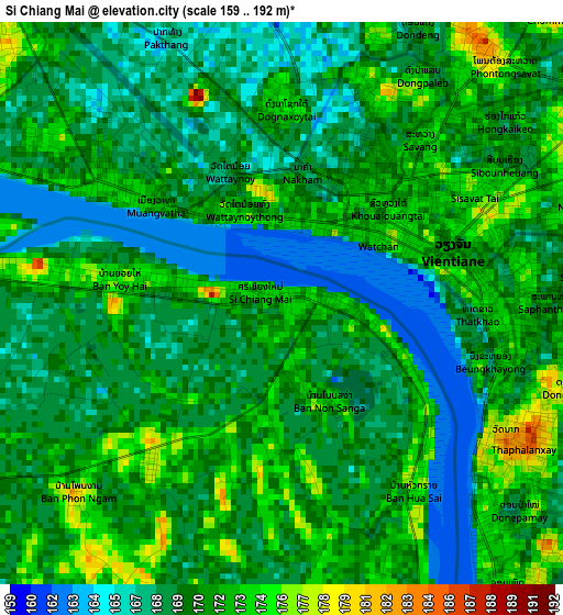
Below is the Elevation map of Si Chiang Mai, which displays elevation range with different colors. Scale of the first map is from 159 to 192 m (522 to 630 ft) with average elevation of 170 meters (=558 ft) [note 1]
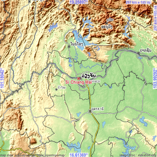
These maps also provides idea of topography and contour of this city, they are displayed at different zoom levels. More info about maps, scale and edge coordinates you can find below images.
| \ | Map #1 | Map #2 | Topo.Map |
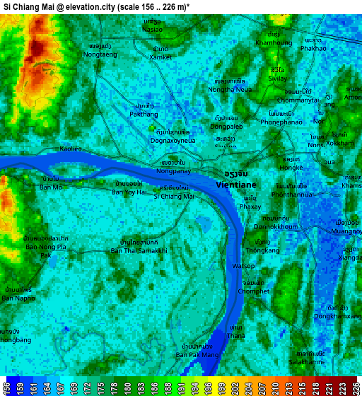
| Scale [m] | 159..192 m | 156..226 m | × |
| Scale [ft] | 522..630 ft | 512..741 ft | × |
| Average | 170 m = 558 ft | 173.1 m = 568 ft | × |
| Width | 9.3 km = 5.8 mi | 18.59 km = 11.6 mi | 297.5 km = 184.9 mi |
| Height | 9.3 km = 5.8 mi | 18.59 km = 11.6 mi | 297.5 km = 184.9 mi |
| ↑Max Latitude | 17.99819° | 18.03998° | 19.28897° |
| Latitude at center | 17.95639° | 17.95639° | 17.95639° |
| ↓Min Latitude | 17.91458° | 17.872761° | 16.61369° |
| ← Min Longitude | 102.542725° | 102.498779° | 101.18042° |
| Longitude center | 102.58667° | 102.58667° | 102.58667° |
| →Max Longitude | 102.630615° | 102.674561° | 103.99292° |
Nearby cities:
Cities around Si Chiang Mai sort by population:
• Nong Khai elevation 168 m
18.6 km,  117°
117°
• Tha Bo 182 m
11.8 km,  182°
182°
• Nam Som 231 m
46.8 km,  243°
243°
• Sangkhom 184 m
35.2 km,  289°
289°
• Suwanna Khuha 225 m
54.5 km,  216°
216°
• Phon Phisai 167 m
52.3 km,  82°
82°
• Phonphisai 167 m
52.3 km, 82°
• Na Yung 233 m
46.7 km,  261°
261°
• Phen 180 m
44.6 km,  130°
130°
• Sa Khrai 173 m
35.7 km,  150°
150°
• Ban Phue 187 m
31.9 km,  200°
200°
• Pho Tak 186 m
21.3 km, 244°
Multilingual:
 En español:
Si Chiang Mai elevación 175 m.
 En France:
Si Chiang Mai élévation 175 m.
 Auf Deutsch:
Si Chiang Mai höhe über dem Meeresspiegel ist 175 m.

Sources and notes:
- [note 1] Map square and city borders are not equal. Map elevation data is calculated only from area inside that square.
- [src 1] Elevation data from geonames database provided with same terms of usage.
- [src 2] The elevation map of Si Chiang Mai is generated using elevation data from NASA's 3 arcsec (90m) resolution SRTM data.
- [src 3] Base (background) map © OpenStreetMap contributors tiles are generated by Geofabrik and OpenTopoMap.
Copyright & License:
This Si Chiang Mai Elevation Map is licensed under CC BY-SA. You may reuse any part from this page, if you give a proper credit by linking to this URL:
 More info on terms of use page.