Kantang elevation
Kantang (Trang), Thailand elevation is 11 meters and Kantang elevation in feet is 36 ft above sea level [src 1]. Kantang is a seat of a second-order administrative division (feature code) with elevation that is 114 meters (374 ft) smaller than average city elevation in Thailand.
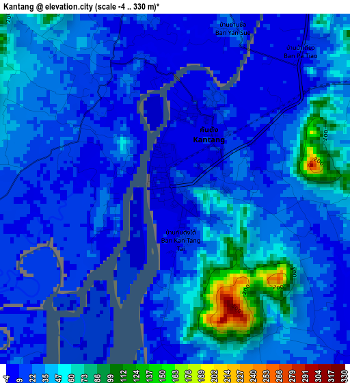
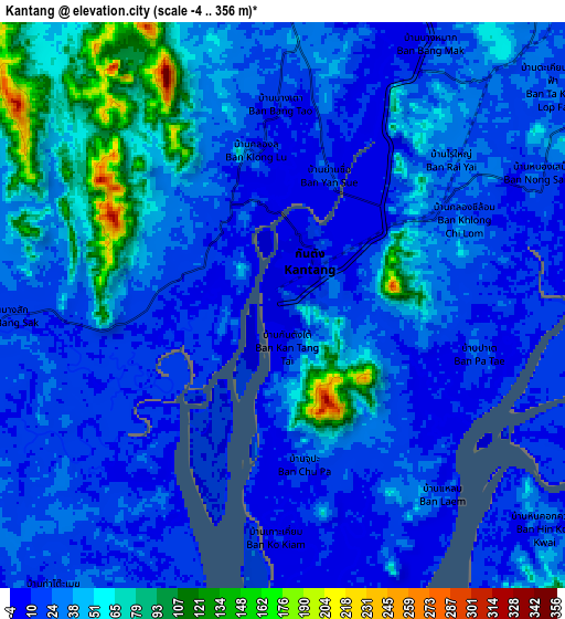
Below is the Elevation map of Kantang, which displays elevation range with different colors. Scale of the first map is from -4 to 330 m (-13 to 1083 ft) with average elevation of 29.5 meters (=97 ft) [note 1]
These maps also provides idea of topography and contour of this city, they are displayed at different zoom levels. More info about maps, scale and edge coordinates you can find below images.
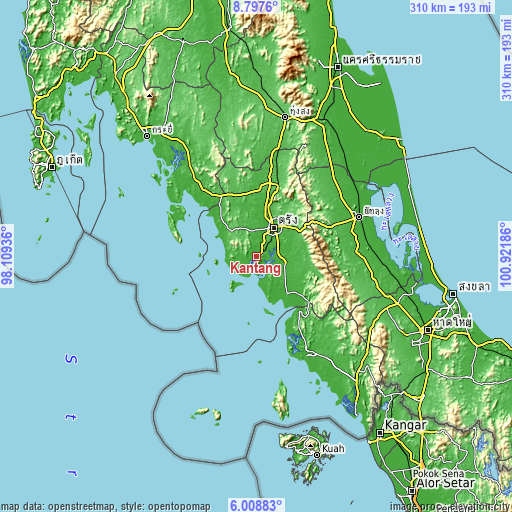
| \ | Map #1 | Map #2 | Topo.Map |
| Scale [m] | -4..330 m | -4..356 m | × |
| Scale [ft] | -13..1083 ft | -13..1168 ft | × |
| Average | 29.5 m = 97 ft | 34.5 m = 113 ft | × |
| Width | 9.69 km = 6 mi | 19.38 km = 12 mi | 310.1 km = 192.7 mi |
| Height | 9.69 km = 6 mi | 19.38 km = 12 mi | 310.1 km = 192.7 mi |
| ↑Max Latitude | 7.448997° | 7.492569° | 8.7976° |
| Latitude at center | 7.40542° | 7.40542° | 7.40542° |
| ↓Min Latitude | 7.361839° | 7.318254° | 6.00883° |
| ← Min Longitude | 99.471665° | 99.427719° | 98.10936° |
| Longitude center | 99.51561° | 99.51561° | 99.51561° |
| →Max Longitude | 99.559555° | 99.603501° | 100.92186° |
Nearby cities:
Cities around Kantang sort by population:
• Trang elevation 27 m
19.8 km,  32°
32°
• Huai Yot 54 m
44.7 km,  17°
17°
• Ko Lanta 51 m
49.4 km,  286°
286°
• Srinagarindra 51 m
50.6 km,  68°
68°
• Kong Ra 56 m
47.9 km,  90°
90°
• Thung Wa 16 m
42.2 km,  141°
141°
• Wang Wiset 35 m
39 km,  340°
340°
• Palian 32 m
32 km, 144°
• Sikao 20 m
26.4 km,  314°
314°
• Na Yong 31 m
26.3 km,  48°
48°
• Hat Samran 15 m
19.5 km,  159°
159°
• Yan Ta Khao 23 m
16.8 km,  97°
97°
Multilingual:
 En español:
Kantang elevación 11 m.
 En France:
Kantang élévation 11 m.


Sources and notes:
- [note 1] Map square and city borders are not equal. Map elevation data is calculated only from area inside that square.
- [src 1] Elevation data from geonames database provided with same terms of usage.
- [src 2] The elevation map of Kantang is generated using elevation data from NASA's 3 arcsec (90m) resolution SRTM data.
- [src 3] Base (background) map © OpenStreetMap contributors tiles are generated by Geofabrik and OpenTopoMap.
Copyright & License:
This Kantang Elevation Map is licensed under CC BY-SA. You may reuse any part from this page, if you give a proper credit by linking to this URL:
 More info on terms of use page.