Pran Buri elevation
Pran Buri (Prachuap Khiri Khan), Thailand elevation is 10 meters and Pran Buri elevation in feet is 33 ft above sea level [src 1]. Pran Buri is a seat of a second-order administrative division (feature code) with elevation that is 115 meters (377 ft) smaller than average city elevation in Thailand.
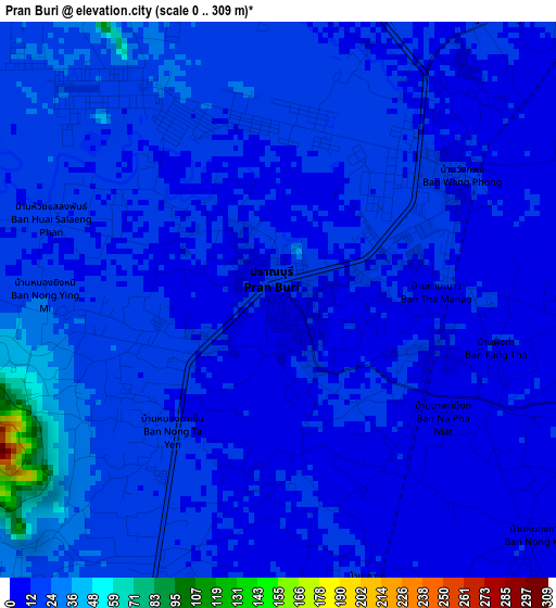
Below is the Elevation map of Pran Buri, which displays elevation range with different colors. Scale of the first map is from 0 to 309 m (0 to 1014 ft) with average elevation of 15.5 meters (=51 ft) [note 1]
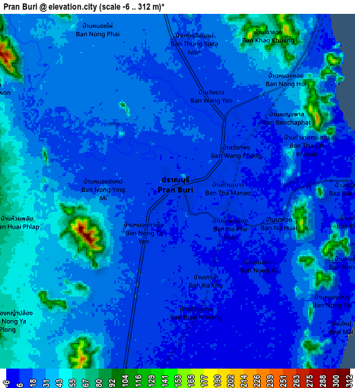
These maps also provides idea of topography and contour of this city, they are displayed at different zoom levels. More info about maps, scale and edge coordinates you can find below images.
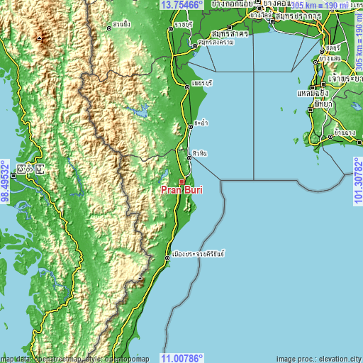
| \ | Map #1 | Map #2 | Topo.Map |
| Scale [m] | 0..309 m | -6..312 m | × |
| Scale [ft] | 0..1014 ft | -20..1024 ft | × |
| Average | 15.5 m = 51 ft | 26.2 m = 86 ft | × |
| Width | 9.55 km = 5.9 mi | 19.09 km = 11.9 mi | 305.4 km = 189.8 mi |
| Height | 9.55 km = 5.9 mi | 19.09 km = 11.9 mi | 305.4 km = 189.8 mi |
| ↑Max Latitude | 12.427789° | 12.470701° | 13.75466° |
| Latitude at center | 12.38487° | 12.38487° | 12.38487° |
| ↓Min Latitude | 12.341944° | 12.299011° | 11.00786° |
| ← Min Longitude | 99.857625° | 99.813679° | 98.49532° |
| Longitude center | 99.90157° | 99.90157° | 99.90157° |
| →Max Longitude | 99.945515° | 99.989461° | 101.30782° |
Nearby cities:
Cities around Pran Buri sort by population:
• Hua Hin elevation 10 m
21.6 km,  16°
16°
• Cha-am 5 m
46.7 km,  8°
8°
• Phetchaburi 7 m
81 km,  3°
3°
• Tha Yang 11 m
63.7 km, 0°
• Prachuap Khiri Khan 13 m
64 km,  191°
191°
• Sam Roi Yot 17 m
13.1 km, 194°
• Kui Buri 15 m
34 km, 188°
• Khao Yoi 13 m
95.5 km,  354°
354°
• Ban Laem 8 m
91.5 km, 5°
• Nong Ya Plong 77 m
89.3 km, 345°
• Ban Lat 14 m
74.1 km, 1°
• Kaeng Krachan 75 m
64.3 km,  334°
334°
Multilingual:
 En español:
Pran Buri elevación 10 m.
 En France:
Pran Buri élévation 10 m.
 Auf Deutsch:
Pran Buri höhe über dem Meeresspiegel ist 10 m.

Sources and notes:
- [note 1] Map square and city borders are not equal. Map elevation data is calculated only from area inside that square.
- [src 1] Elevation data from geonames database provided with same terms of usage.
- [src 2] The elevation map of Pran Buri is generated using elevation data from NASA's 3 arcsec (90m) resolution SRTM data.
- [src 3] Base (background) map © OpenStreetMap contributors tiles are generated by Geofabrik and OpenTopoMap.
Copyright & License:
This Pran Buri Elevation Map is licensed under CC BY-SA. You may reuse any part from this page, if you give a proper credit by linking to this URL:
 More info on terms of use page.