Si Nakhon elevation
Si Nakhon (Sukhothai), Thailand elevation is 62 meters and Si Nakhon elevation in feet is 203 ft above sea level [src 1]. Si Nakhon is a seat of a second-order administrative division (feature code) with elevation that is 63 meters (207 ft) smaller than average city elevation in Thailand.
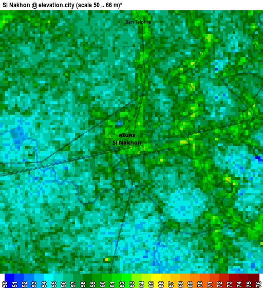
Below is the Elevation map of Si Nakhon, which displays elevation range with different colors. Scale of the first map is from 50 to 66 m (164 to 217 ft) with average elevation of 56.7 meters (=186 ft) [note 1]
These maps also provides idea of topography and contour of this city, they are displayed at different zoom levels. More info about maps, scale and edge coordinates you can find below images.
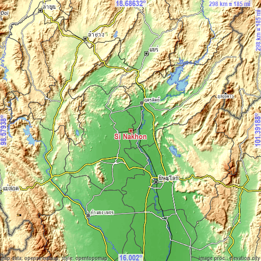
| \ | Map #1 | Topo.Map |
| Scale [m] | 50..66 m | × |
| Scale [ft] | 164..217 ft | × |
| Average | 56.7 m = 186 ft | × |
| Width | 9.33 km = 5.8 mi | 298.5 km = 185.5 mi |
| Height | 9.33 km = 5.8 mi | 298.5 km = 185.5 mi |
| ↑Max Latitude | 17.391011° | 18.68632° |
| Latitude at center | 17.34907° | 17.34907° |
| ↓Min Latitude | 17.307119° | 16.002° |
| ← Min Longitude | 99.941685° | 98.57938° |
| Longitude center | 99.98563° | 99.98563° |
| →Max Longitude | 100.029575° | 101.39188° |
Nearby cities:
Cities around Si Nakhon sort by population:
• Uttaradit elevation 68 m
32.8 km,  20°
20°
• Sukhothai 53 m
41.7 km,  204°
204°
• Si Satchanalai 77 m
30.4 km,  307°
307°
• Sawankhalok 67 m
16.7 km,  257°
257°
• Kong Krailat 46 m
44.2 km,  181°
181°
• Phrom Phiram 51 m
41.9 km,  146°
146°
• Thong Saen Khan 83 m
39.1 km,  69°
69°
• Lap Lae 85 m
34.2 km,  9°
9°
• Laplae 85 m
34.2 km, 9°
• Si Samrong 59 m
24.4 km,  212°
212°
• Tron 64 m
20 km,  42°
42°
• Phichai 60 m
12.7 km,  122°
122°
Multilingual:
 En español:
Si Nakhon elevación 62 m.
 En France:
Si Nakhon élévation 62 m.
 Auf Deutsch:
Si Nakhon höhe über dem Meeresspiegel ist 62 m.

Sources and notes:
- [note 1] Map square and city borders are not equal. Map elevation data is calculated only from area inside that square.
- [src 1] Elevation data from geonames database provided with same terms of usage.
- [src 2] The elevation map of Si Nakhon is generated using elevation data from NASA's 3 arcsec (90m) resolution SRTM data.
- [src 3] Base (background) map © OpenStreetMap contributors tiles are generated by Geofabrik and OpenTopoMap.
Copyright & License:
This Si Nakhon Elevation Map is licensed under CC BY-SA. You may reuse any part from this page, if you give a proper credit by linking to this URL:
 More info on terms of use page.