Chaloem Phra Kiat elevation
Chaloem Phra Kiat (Nan), Thailand elevation is 514 meters and Chaloem Phra Kiat elevation in feet is 1686 ft above sea level [src 1]. Chaloem Phra Kiat is a seat of a second-order administrative division (feature code) with elevation that is 389 meters (1276 ft) bigger than average city elevation in Thailand.
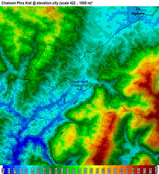
Below is the Elevation map of Chaloem Phra Kiat, which displays elevation range with different colors. Scale of the first map is from 422 to 1005 m (1385 to 3297 ft) with average elevation of 632.8 meters (=2076 ft) [note 1]
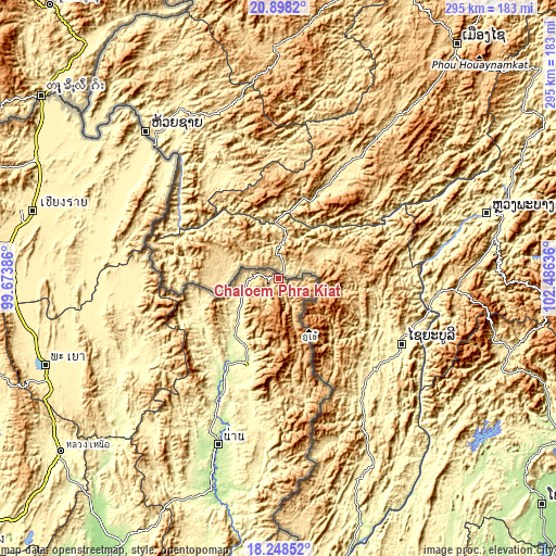
These maps also provides idea of topography and contour of this city, they are displayed at different zoom levels. More info about maps, scale and edge coordinates you can find below images.
| \ | Map #1 | Topo.Map |
| Scale [m] | 422..1005 m | × |
| Scale [ft] | 1385..3297 ft | × |
| Average | 632.8 m = 2076 ft | × |
| Width | 9.21 km = 5.7 mi | 294.6 km = 183.1 mi |
| Height | 9.21 km = 5.7 mi | 294.6 km = 183.1 mi |
| ↑Max Latitude | 19.620209° | 20.8982° |
| Latitude at center | 19.57881° | 19.57881° |
| ↓Min Latitude | 19.5374° | 18.24852° |
| ← Min Longitude | 101.036165° | 99.67386° |
| Longitude center | 101.08011° | 101.08011° |
| →Max Longitude | 101.124055° | 102.48636° |
Nearby cities:
Cities around Chaloem Phra Kiat sort by population:
• Chiang Kham elevation 396 m
82 km,  265°
265°
• Chiang Klang 266 m
39.1 km,  215°
215°
• Thoeng 370 m
93.5 km,  277°
277°
• Khun Tan 382 m
90.5 km,  288°
288°
• Wiang Kaen 362 m
83.9 km,  315°
315°
• Phu Sang 403 m
79.2 km, 271°
• Santi Suk 292 m
75.4 km,  191°
191°
• Tha Wang Pha 234 m
58.1 km,  209°
209°
• Bo Kluea 674 m
48.3 km,  170°
170°
• Pua 290 m
48.1 km,  200°
200°
• Song Khwae 299 m
46.7 km,  238°
238°
• Thung Chang 337 m
30.1 km,  225°
225°
Multilingual:
 En español:
Chaloem Phra Kiat elevación 514 m.
 En France:
Chaloem Phra Kiat élévation 514 m.
 Auf Deutsch:
Chaloem Phra Kiat höhe über dem Meeresspiegel ist 514 m.

Sources and notes:
- [note 1] Map square and city borders are not equal. Map elevation data is calculated only from area inside that square.
- [src 1] Elevation data from geonames database provided with same terms of usage.
- [src 2] The elevation map of Chaloem Phra Kiat is generated using elevation data from NASA's 3 arcsec (90m) resolution SRTM data.
- [src 3] Base (background) map © OpenStreetMap contributors tiles are generated by Geofabrik and OpenTopoMap.
Copyright & License:
This Chaloem Phra Kiat Elevation Map is licensed under CC BY-SA. You may reuse any part from this page, if you give a proper credit by linking to this URL:
 More info on terms of use page.