Chaiyo elevation
Chaiyo (Ang Thong), Thailand elevation is 14 meters and Chaiyo elevation in feet is 46 ft above sea level [src 1]. Chaiyo is a populated place (feature code) with elevation that is 111 meters (364 ft) smaller than average city elevation in Thailand.
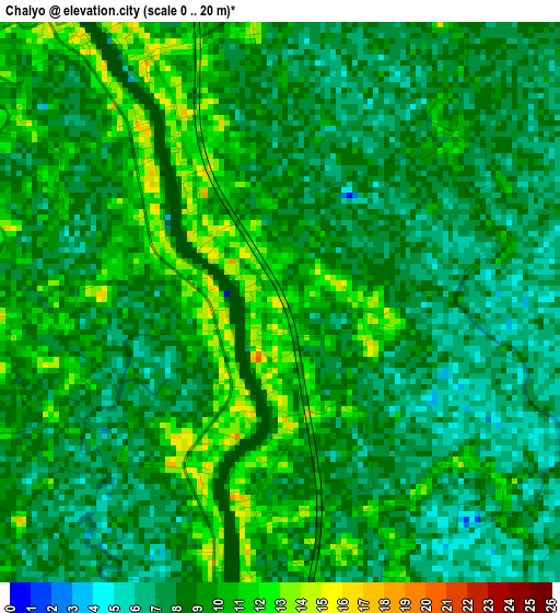
Below is the Elevation map of Chaiyo, which displays elevation range with different colors. Scale of the first map is from 0 to 20 m (0 to 66 ft) with average elevation of 8.4 meters (=28 ft) [note 1]
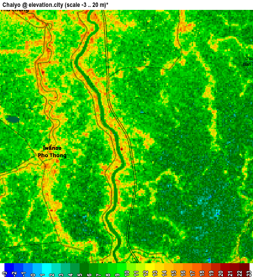
These maps also provides idea of topography and contour of this city, they are displayed at different zoom levels. More info about maps, scale and edge coordinates you can find below images.
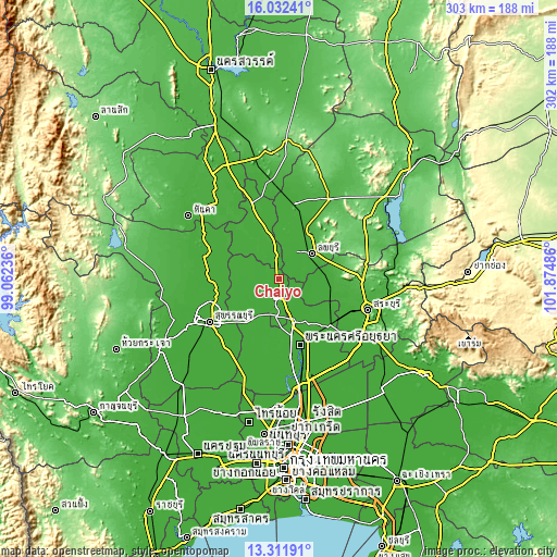
| \ | Map #1 | Map #2 | Topo.Map |
| Scale [m] | 0..20 m | -3..20 m | × |
| Scale [ft] | 0..66 ft | -10..66 ft | × |
| Average | 8.4 m = 28 ft | 8.3 m = 27 ft | × |
| Width | 9.45 km = 5.9 mi | 18.91 km = 11.8 mi | 302.5 km = 188 mi |
| Height | 9.45 km = 5.9 mi | 18.91 km = 11.8 mi | 302.5 km = 188 mi |
| ↑Max Latitude | 14.718897° | 14.761396° | 16.03241° |
| Latitude at center | 14.67639° | 14.67639° | 14.67639° |
| ↓Min Latitude | 14.633874° | 14.591351° | 13.31191° |
| ← Min Longitude | 100.424665° | 100.380719° | 99.06236° |
| Longitude center | 100.46861° | 100.46861° | 100.46861° |
| →Max Longitude | 100.512555° | 100.556501° | 101.87486° |
Nearby cities:
Cities around Chaiyo sort by population:
• Wiset Chaichan elevation 12 m
16.7 km,  237°
237°
• Ban Thai Tan 11 m
6.4 km,  161°
161°
• Ang Thong 12 m
9.9 km,  189°
189°
• Pho Thong 12 m
6.5 km,  261°
261°
• Sawaengha 15 m
17.6 km,  298°
298°
• Maha Rat 12 m
17.1 km, 158°
• Sawaeng Ha 10 m
16.9 km, 297°
• Tha Wung 11 m
15.4 km,  14°
14°
• Phrom Buri 13 m
12.8 km,  352°
352°
• Tha Chang 15 m
12.7 km,  318°
318°
• Ban Phraek 7 m
12 km,  105°
105°
• Chaiyo 9 m
3.3 km, 160°
Multilingual:
 En español:
Chaiyo elevación 14 m.
 En France:
Chaiyo élévation 14 m.


Sources and notes:
- [note 1] Map square and city borders are not equal. Map elevation data is calculated only from area inside that square.
- [src 1] Elevation data from geonames database provided with same terms of usage.
- [src 2] The elevation map of Chaiyo is generated using elevation data from NASA's 3 arcsec (90m) resolution SRTM data.
- [src 3] Base (background) map © OpenStreetMap contributors tiles are generated by Geofabrik and OpenTopoMap.
Copyright & License:
This Chaiyo Elevation Map is licensed under CC BY-SA. You may reuse any part from this page, if you give a proper credit by linking to this URL:
 More info on terms of use page.