Bafilo elevation
Bafilo (Kara), Togo elevation is 608 meters and Bafilo elevation in feet is 1995 ft above sea level [src 1]. Bafilo is a populated place (feature code) with elevation that is 341 meters (1119 ft) bigger than average city elevation in Togo.
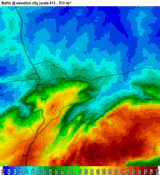
Below is the Elevation map of Bafilo, which displays elevation range with different colors. Scale of the first map is from 413 to 813 m (1355 to 2667 ft) with average elevation of 559.2 meters (=1835 ft) [note 1]
These maps also provides idea of topography and contour of this city, they are displayed at different zoom levels. More info about maps, scale and edge coordinates you can find below images.
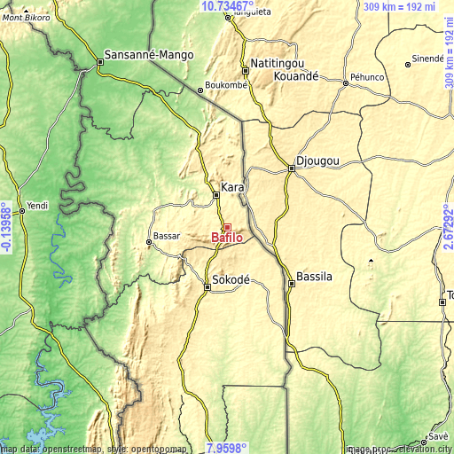
| \ | Map #1 | Map #2 | Topo.Map |
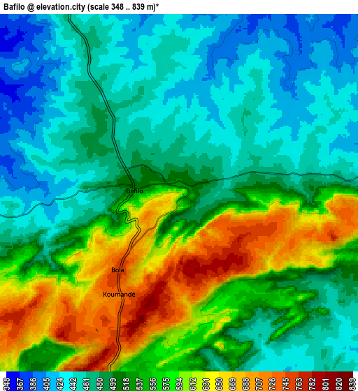
| Scale [m] | 413..813 m | 348..839 m | × |
| Scale [ft] | 1355..2667 ft | 1142..2753 ft | × |
| Average | 559.2 m = 1835 ft | 520.1 m = 1706 ft | × |
| Width | 9.64 km = 6 mi | 19.29 km = 12 mi | 308.5 km = 191.7 mi |
| Height | 9.64 km = 6 mi | 19.29 km = 12 mi | 308.6 km = 191.8 mi |
| ↑Max Latitude | 9.393359° | 9.436712° | 10.73467° |
| Latitude at center | 9.35° | 9.35° | 9.35° |
| ↓Min Latitude | 9.306636° | 9.263266° | 7.9598° |
| ← Min Longitude | 1.222725° | 1.178779° | -0.13958° |
| Longitude center | 1.26667° | 1.26667° | 1.26667° |
| →Max Longitude | 1.310615° | 1.354561° | 2.67292° |
Nearby cities:
Cities around Bafilo sort by population:
• Sokodé elevation 402 m
43.3 km,  199°
199°
• Kara 291 m
24 km,  338°
338°
• Atakpamé 361 m
202.5 km,  184°
184°
• Bassar 388 m
54.3 km,  258°
258°
• Sansanné-Mango 143 m
142.1 km,  322°
322°
• Dapaong 323 m
204.2 km,  325°
325°
• Tchamba 356 m
38.9 km,  154°
154°
• Badou 278 m
209.7 km, 200°
• Niamtougou 469 m
49.7 km, 339°
• Sotouboua 380 m
92.8 km, 199°
• Kandé 269 m
71.8 km, 340°
• Pagouda 415 m
45.3 km,  8°
8°
Multilingual:
 En español:
Bafilo elevación 608 m.
 En France:
Bafilo élévation 608 m.


Sources and notes:
- [note 1] Map square and city borders are not equal. Map elevation data is calculated only from area inside that square.
- [src 1] Elevation data from geonames database provided with same terms of usage.
- [src 2] The elevation map of Bafilo is generated using elevation data from NASA's 3 arcsec (90m) resolution SRTM data.
- [src 3] Base (background) map © OpenStreetMap contributors tiles are generated by Geofabrik and OpenTopoMap.
Copyright & License:
This Bafilo Elevation Map is licensed under CC BY-SA. You may reuse any part from this page, if you give a proper credit by linking to this URL:
 More info on terms of use page.