Iriba elevation
Iriba (Wadi Fira), Chad elevation is 932 meters and Iriba elevation in feet is 3058 ft above sea level [src 1]. Iriba is a populated place (feature code) with elevation that is 492 meters (1614 ft) bigger than average city elevation in Chad.
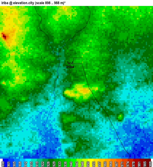
Below is the Elevation map of Iriba, which displays elevation range with different colors. Scale of the first map is from 898 to 988 m (2946 to 3241 ft) with average elevation of 926.7 meters (=3040 ft) [note 1]
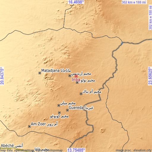
These maps also provides idea of topography and contour of this city, they are displayed at different zoom levels. More info about maps, scale and edge coordinates you can find below images.
| \ | Map #1 | Topo.Map |
| Scale [m] | 898..988 m | × |
| Scale [ft] | 2946..3241 ft | × |
| Average | 926.7 m = 3040 ft | × |
| Width | 9.43 km = 5.9 mi | 301.9 km = 187.6 mi |
| Height | 9.43 km = 5.9 mi | 301.9 km = 187.6 mi |
| ↑Max Latitude | 15.15909° | 16.4698° |
| Latitude at center | 15.11667° | 15.11667° |
| ↓Min Latitude | 15.074241° | 13.75485° |
| ← Min Longitude | 22.206055° | 20.84375° |
| Longitude center | 22.25° | 22.25° |
| →Max Longitude | 22.293945° | 23.65625° |
Nearby cities:
Cities around Iriba sort by population:
• Abéché elevation 545 m
209.3 km,  226°
226°
• Fada 567 m
240.9 km,  342°
342°
• Oum Hadjer 397 m
341.7 km, 233°
• Adré 797 m
183.6 km,  181°
181°
• Biltine 517 m
156.5 km,  245°
245°
• Goz Béïda 476 m
224.9 km, 234°
• Goz Beïda 568 m
334.1 km,  195°
195°
• Am Djarass 899 m
123.2 km,  31°
31°
Multilingual:
 En español:
Iriba elevación 932 m.
 En France:
Iriba élévation 932 m.


Sources and notes:
- [note 1] Map square and city borders are not equal. Map elevation data is calculated only from area inside that square.
- [src 1] Elevation data from geonames database provided with same terms of usage.
- [src 2] The elevation map of Iriba is generated using elevation data from NASA's 3 arcsec (90m) resolution SRTM data.
- [src 3] Base (background) map © OpenStreetMap contributors tiles are generated by Geofabrik and OpenTopoMap.
Copyright & License:
This Iriba Elevation Map is licensed under CC BY-SA. You may reuse any part from this page, if you give a proper credit by linking to this URL:
 More info on terms of use page.