Bousso elevation
Bousso (Chari-Baguirmi), Chad elevation is 337 meters and Bousso elevation in feet is 1106 ft above sea level [src 1]. Bousso is a populated place (feature code) with elevation that is 103 meters (338 ft) smaller than average city elevation in Chad.
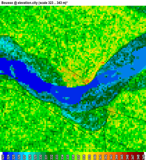
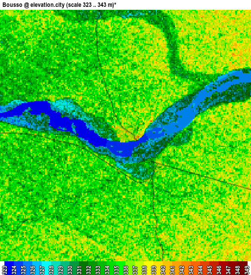
Below is the Elevation map of Bousso, which displays elevation range with different colors. Scale of the first map is from 323 to 343 m (1060 to 1125 ft) with average elevation of 332.9 meters (=1092 ft) [note 1]
These maps also provides idea of topography and contour of this city, they are displayed at different zoom levels. More info about maps, scale and edge coordinates you can find below images.
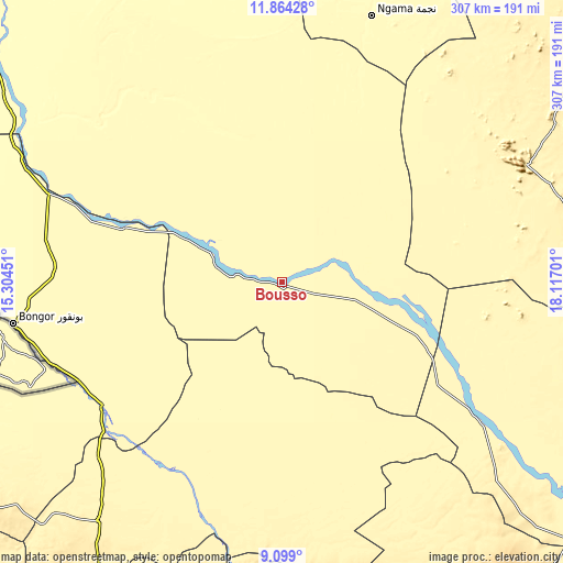
| \ | Map #1 | Map #2 | Topo.Map |
| Scale [m] | 323..343 m | 323..343 m | × |
| Scale [ft] | 1060..1125 ft | 1060..1125 ft | × |
| Average | 332.9 m = 1092 ft | 334.3 m = 1097 ft | × |
| Width | 9.61 km = 6 mi | 19.22 km = 11.9 mi | 307.5 km = 191.1 mi |
| Height | 9.61 km = 6 mi | 19.22 km = 11.9 mi | 307.5 km = 191.1 mi |
| ↑Max Latitude | 10.527939° | 10.571141° | 11.86428° |
| Latitude at center | 10.48473° | 10.48473° | 10.48473° |
| ↓Min Latitude | 10.441515° | 10.398295° | 9.099° |
| ← Min Longitude | 16.666815° | 16.622869° | 15.30451° |
| Longitude center | 16.71076° | 16.71076° | 16.71076° |
| →Max Longitude | 16.754705° | 16.798651° | 18.11701° |
Nearby cities:
Cities around Bousso sort by population:
• Kelo elevation 375 m
164 km,  217°
217°
• Bongor 334 m
148.1 km,  261°
261°
• Laï 363 m
129 km,  200°
200°
• Dourbali 305 m
173.4 km,  327°
327°
• Benoy 417 m
172.4 km,  194°
194°
• Béré 361 m
143.1 km,  205°
205°
• Ngama 326 m
152.7 km,  19°
19°
• Guelendeng 321 m
135.6 km,  290°
290°
• Goundi 377 m
143.9 km,  150°
150°
• Gounou Gaya 345 m
162 km,  234°
234°
• Melfi 399 m
148.3 km,  64°
64°
• Massenya 327 m
118 km, 330°
Multilingual:
 En español:
Bousso elevación 337 m.
 En France:
Bousso élévation 337 m.


Sources and notes:
- [note 1] Map square and city borders are not equal. Map elevation data is calculated only from area inside that square.
- [src 1] Elevation data from geonames database provided with same terms of usage.
- [src 2] The elevation map of Bousso is generated using elevation data from NASA's 3 arcsec (90m) resolution SRTM data.
- [src 3] Base (background) map © OpenStreetMap contributors tiles are generated by Geofabrik and OpenTopoMap.
Copyright & License:
This Bousso Elevation Map is licensed under CC BY-SA. You may reuse any part from this page, if you give a proper credit by linking to this URL:
 More info on terms of use page.