Ar Rastan elevation
Ar Rastan (Homs), Syria elevation is 411 meters and Ar Rastan elevation in feet is 1348 ft above sea level [src 1]. Ar Rastan is a seat of a second-order administrative division (feature code) with elevation that is 118 meters (387 ft) smaller than average city elevation in Syria.
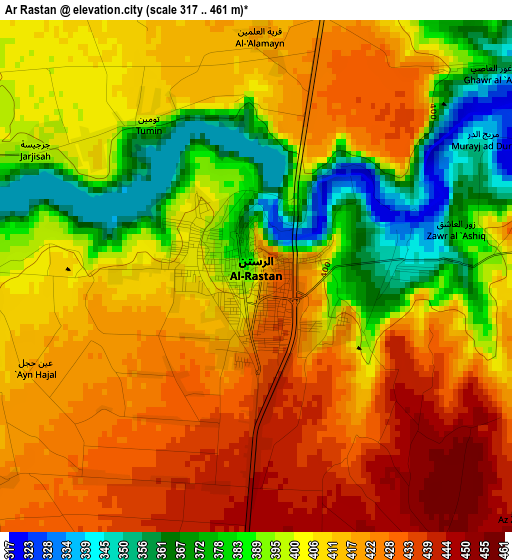
Below is the Elevation map of Ar Rastan, which displays elevation range with different colors. Scale of the first map is from 317 to 461 m (1040 to 1512 ft) with average elevation of 406.4 meters (=1333 ft) [note 1]
These maps also provides idea of topography and contour of this city, they are displayed at different zoom levels. More info about maps, scale and edge coordinates you can find below images.
| \ | Map #1 | Map #2 | Topo.Map |
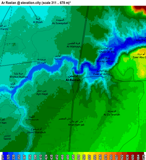
| Scale [m] | 317..461 m | 311..678 m | × |
| Scale [ft] | 1040..1512 ft | 1020..2224 ft | × |
| Average | 406.4 m = 1333 ft | 421.4 m = 1383 ft | × |
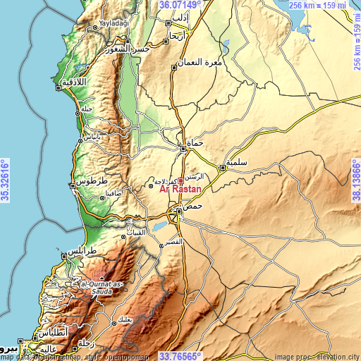
| Width | 8.01 km = 5 mi | 16.02 km = 10 mi | 256.4 km = 159.3 mi |
| Height | 8.01 km = 5 mi | 16.02 km = 10 mi | 256.4 km = 159.3 mi |
| ↑Max Latitude | 34.962692° | 34.998699° | 36.07149° |
| Latitude at center | 34.92667° | 34.92667° | 34.92667° |
| ↓Min Latitude | 34.890632° | 34.854578° | 33.76565° |
| ← Min Longitude | 36.688465° | 36.644519° | 35.32616° |
| Longitude center | 36.73241° | 36.73241° | 36.73241° |
| →Max Longitude | 36.776355° | 36.820301° | 38.13866° |
Nearby cities:
Cities around Ar Rastan sort by population:
• Homs elevation 513 m
22.2 km,  182°
182°
• Ḩamāh 270 m
22.9 km,  5°
5°
• As Salamīyah 461 m
30.7 km,  72°
72°
• Tallbīsah 460 m
9.6 km, 180°
• Kafr Lāhā 376 m
21.9 km,  260°
260°
• Al Ghanţū 455 m
12.1 km,  195°
195°
• ‘Awaj 611 m
30 km,  265°
265°
• Khirbat Tīn Nūr 550 m
29.8 km,  212°
212°
• Al Qabw 528 m
27 km,  249°
249°
• ‘Ayn an Nasr 476 m
20.2 km,  118°
118°
• Talldaww 375 m
19.8 km, 253°
• Ḩarbinafsah 377 m
10.1 km,  276°
276°
Multilingual:
 En español:
Ar Rastan elevación 411 m.
 En France:
Ar Rastan élévation 411 m.
 Auf Deutsch:
Ar Rastan höhe über dem Meeresspiegel ist 411 m.

Sources and notes:
- [note 1] Map square and city borders are not equal. Map elevation data is calculated only from area inside that square.
- [src 1] Elevation data from geonames database provided with same terms of usage.
- [src 2] The elevation map of Ar Rastan is generated using elevation data from NASA's 3 arcsec (90m) resolution SRTM data.
- [src 3] Base (background) map © OpenStreetMap contributors tiles are generated by Geofabrik and OpenTopoMap.
Copyright & License:
This Ar Rastan Elevation Map is licensed under CC BY-SA. You may reuse any part from this page, if you give a proper credit by linking to this URL:
 More info on terms of use page.