Nahuizalco elevation
Nahuizalco (Sonsonate), El Salvador elevation is 544 meters and Nahuizalco elevation in feet is 1785 ft above sea level [src 1]. Nahuizalco is a populated place (feature code) with elevation that is 73 meters (240 ft) bigger than average city elevation in El Salvador.
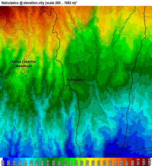
Below is the Elevation map of Nahuizalco, which displays elevation range with different colors. Scale of the first map is from 269 to 1082 m (883 to 3550 ft) with average elevation of 567.9 meters (=1863 ft) [note 1]
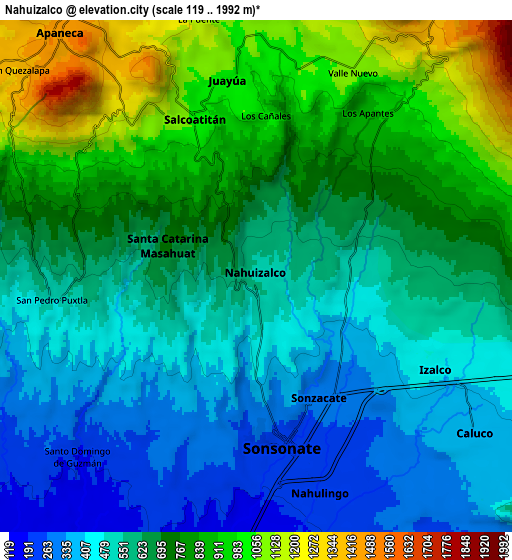
These maps also provides idea of topography and contour of this city, they are displayed at different zoom levels. More info about maps, scale and edge coordinates you can find below images.
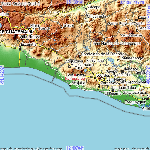
| \ | Map #1 | Map #2 | Topo.Map |
| Scale [m] | 269..1082 m | 119..1992 m | × |
| Scale [ft] | 883..3550 ft | 390..6535 ft | × |
| Average | 567.9 m = 1863 ft | 654.8 m = 2148 ft | × |
| Width | 9.49 km = 5.9 mi | 18.98 km = 11.8 mi | 303.7 km = 188.7 mi |
| Height | 9.49 km = 5.9 mi | 18.98 km = 11.8 mi | 303.7 km = 188.7 mi |
| ↑Max Latitude | 13.820177° | 13.862846° | 15.13918° |
| Latitude at center | 13.7775° | 13.7775° | 13.7775° |
| ↓Min Latitude | 13.734815° | 13.692123° | 12.40784° |
| ← Min Longitude | -89.780615° | -89.824561° | -91.14292° |
| Longitude center | -89.73667° | -89.73667° | -89.73667° |
| →Max Longitude | -89.692725° | -89.648779° | -88.33042° |
Nearby cities:
Cities around Nahuizalco sort by population:
• Sonsonate elevation 235 m
6.7 km,  168°
168°
• Ahuachapán 796 m
19.8 km,  323°
323°
• Chalchuapa 710 m
24 km,  14°
14°
• Acajutla 26 m
22.8 km,  205°
205°
• Izalco 422 m
7.8 km,  117°
117°
• Sonzacate 275 m
5.4 km,  153°
153°
• Juayúa 1037 m
7.2 km,  352°
352°
• Atiquizaya 615 m
22.2 km,  355°
355°
• San Antonio del Monte 224 m
6.8 km,  181°
181°
• Concepción de Ataco 1255 m
15.9 km,  310°
310°
• Jujutla 521 m
13.1 km,  274°
274°
• Guaymango 403 m
11.8 km,  255°
255°
Multilingual:
 En español:
Nahuizalco elevación 544 m.
 En France:
Nahuizalco élévation 544 m.
 Auf Deutsch:
Nahuizalco höhe über dem Meeresspiegel ist 544 m.

Sources and notes:
- [note 1] Map square and city borders are not equal. Map elevation data is calculated only from area inside that square.
- [src 1] Elevation data from geonames database provided with same terms of usage.
- [src 2] The elevation map of Nahuizalco is generated using elevation data from NASA's 3 arcsec (90m) resolution SRTM data.
- [src 3] Base (background) map © OpenStreetMap contributors tiles are generated by Geofabrik and OpenTopoMap.
Copyright & License:
This Nahuizalco Elevation Map is licensed under CC BY-SA. You may reuse any part from this page, if you give a proper credit by linking to this URL:
 More info on terms of use page.