Rosario de Mora elevation
Rosario de Mora (San Salvador), El Salvador elevation is 500 meters and Rosario de Mora elevation in feet is 1640 ft above sea level [src 1]. Rosario de Mora is a populated place (feature code) with elevation that is 29 meters (95 ft) bigger than average city elevation in El Salvador.
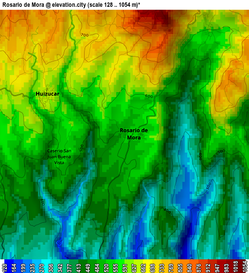
Below is the Elevation map of Rosario de Mora, which displays elevation range with different colors. Scale of the first map is from 128 to 1054 m (420 to 3458 ft) with average elevation of 513.6 meters (=1685 ft) [note 1]
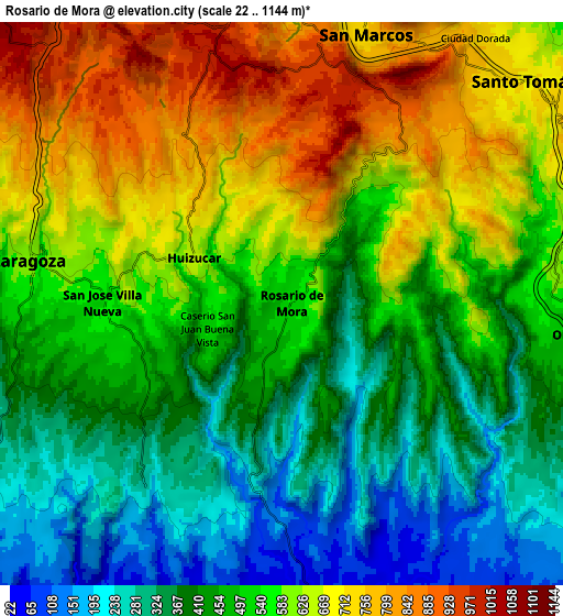
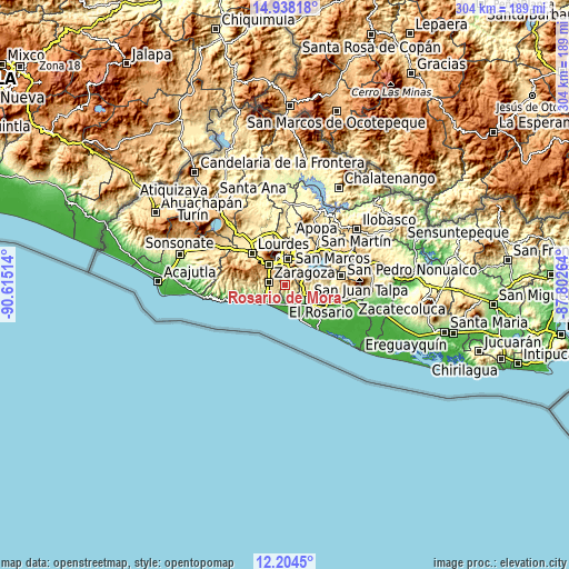
These maps also provides idea of topography and contour of this city, they are displayed at different zoom levels. More info about maps, scale and edge coordinates you can find below images.
| \ | Map #1 | Map #2 | Topo.Map |
| Scale [m] | 128..1054 m | 22..1144 m | × |
| Scale [ft] | 420..3458 ft | 72..3753 ft | × |
| Average | 513.6 m = 1685 ft | 519.1 m = 1703 ft | × |
| Width | 9.5 km = 5.9 mi | 19 km = 11.8 mi | 304 km = 188.9 mi |
| Height | 9.5 km = 5.9 mi | 19 km = 11.8 mi | 304 km = 188.9 mi |
| ↑Max Latitude | 13.617994° | 13.6607° | 14.93818° |
| Latitude at center | 13.57528° | 13.57528° | 13.57528° |
| ↓Min Latitude | 13.532559° | 13.489829° | 12.2045° |
| ← Min Longitude | -89.252835° | -89.296781° | -90.61514° |
| Longitude center | -89.20889° | -89.20889° | -89.20889° |
| →Max Longitude | -89.164945° | -89.120999° | -87.80264° |
Nearby cities:
Cities around Rosario de Mora sort by population:
• San Salvador elevation 653 m
12.9 km,  10°
10°
• Soyapango 634 m
16.8 km,  26°
26°
• Santa Tecla 935 m
13.7 km,  325°
325°
• Delgado 632 m
17.1 km, 14°
• San Marcos 738 m
9.7 km,  16°
16°
• Antiguo Cuscatlán 891 m
11.1 km, 334°
• La Libertad 13 m
15.6 km,  231°
231°
• Santo Tomás 712 m
10.9 km,  48°
48°
• Zaragoza 612 m
8.8 km,  280°
280°
• Panchimalco 603 m
5.2 km,  36°
36°
• Nuevo Cuscatlán 906 m
10.2 km,  323°
323°
• Olocuilta 485 m
9.9 km,  93°
93°
Multilingual:
 En español:
Rosario de Mora elevación 500 m.
 En France:
Rosario de Mora élévation 500 m.
 Auf Deutsch:
Rosario de Mora höhe über dem Meeresspiegel ist 500 m.

Sources and notes:
- [note 1] Map square and city borders are not equal. Map elevation data is calculated only from area inside that square.
- [src 1] Elevation data from geonames database provided with same terms of usage.
- [src 2] The elevation map of Rosario de Mora is generated using elevation data from NASA's 3 arcsec (90m) resolution SRTM data.
- [src 3] Base (background) map © OpenStreetMap contributors tiles are generated by Geofabrik and OpenTopoMap.
Copyright & License:
This Rosario de Mora Elevation Map is licensed under CC BY-SA. You may reuse any part from this page, if you give a proper credit by linking to this URL:
 More info on terms of use page.