Raja elevation
Raja (Lol), South Sudan elevation is 558 meters and Raja elevation in feet is 1831 ft above sea level [src 1]. Raja is a seat of a first-order administrative division (feature code) with elevation that is 69 meters (226 ft) bigger than average city elevation in South Sudan.
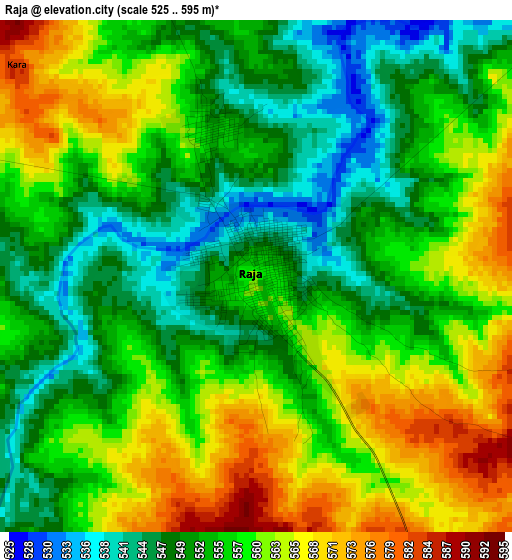
Below is the Elevation map of Raja, which displays elevation range with different colors. Scale of the first map is from 525 to 595 m (1722 to 1952 ft) with average elevation of 556.5 meters (=1826 ft) [note 1]
These maps also provides idea of topography and contour of this city, they are displayed at different zoom levels. More info about maps, scale and edge coordinates you can find below images.
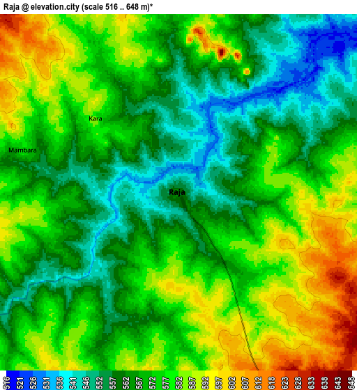
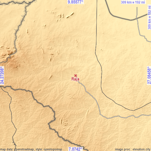
| \ | Map #1 | Map #2 | Topo.Map |
| Scale [m] | 525..595 m | 516..648 m | × |
| Scale [ft] | 1722..1952 ft | 1693..2126 ft | × |
| Average | 556.5 m = 1826 ft | 571.3 m = 1874 ft | × |
| Width | 9.67 km = 6 mi | 19.33 km = 12 mi | 309.3 km = 192.2 mi |
| Height | 9.67 km = 6 mi | 19.33 km = 12 mi | 309.3 km = 192.2 mi |
| ↑Max Latitude | 8.510964° | 8.554423° | 9.85577° |
| Latitude at center | 8.4675° | 8.4675° | 8.4675° |
| ↓Min Latitude | 8.424031° | 8.380558° | 7.0742° |
| ← Min Longitude | 25.634385° | 25.590439° | 24.27208° |
| Longitude center | 25.67833° | 25.67833° | 25.67833° |
| →Max Longitude | 25.722275° | 25.766221° | 27.08458° |
Nearby cities:
Cities around Raja sort by population:
• Winejok elevation 419 m
216.6 km,  73°
73°
• Wau 440 m
268.3 km,  108°
108°
• Aweil 425 m
191.2 km,  80°
80°
• Gogrial 414 m
266.4 km,  88°
88°
• Tonj 444 m
356 km, 111°
• Tambura 630 m
375 km,  148°
148°
• Cueibet 423 m
424.5 km, 112°
• Mayen Abun 406 m
302.4 km, 75°
• Kuacjok 428 m
253.8 km, 94°
Multilingual:
 En español:
Raja elevación 558 m.
 En France:
Raja élévation 558 m.


Sources and notes:
- [note 1] Map square and city borders are not equal. Map elevation data is calculated only from area inside that square.
- [src 1] Elevation data from geonames database provided with same terms of usage.
- [src 2] The elevation map of Raja is generated using elevation data from NASA's 3 arcsec (90m) resolution SRTM data.
- [src 3] Base (background) map © OpenStreetMap contributors tiles are generated by Geofabrik and OpenTopoMap.
Copyright & License:
This Raja Elevation Map is licensed under CC BY-SA. You may reuse any part from this page, if you give a proper credit by linking to this URL:
 More info on terms of use page.