Ziguinchor elevation
Ziguinchor, Senegal elevation is 19 meters and Ziguinchor elevation in feet is 62 ft above sea level [src 1]. Ziguinchor is a seat of a first-order administrative division (feature code) with elevation that is 6 meters (20 ft) smaller than average city elevation in Senegal.
Below is the Elevation map of Ziguinchor, which displays elevation range with different colors. Scale of the first map is from -4 to 37 m (-13 to 121 ft) with average elevation of 12.4 meters (=41 ft) [note 1]
These maps also provides idea of topography and contour of this city, they are displayed at different zoom levels. More info about maps, scale and edge coordinates you can find below images.
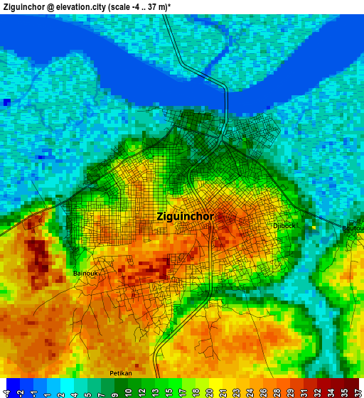
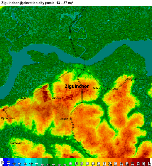
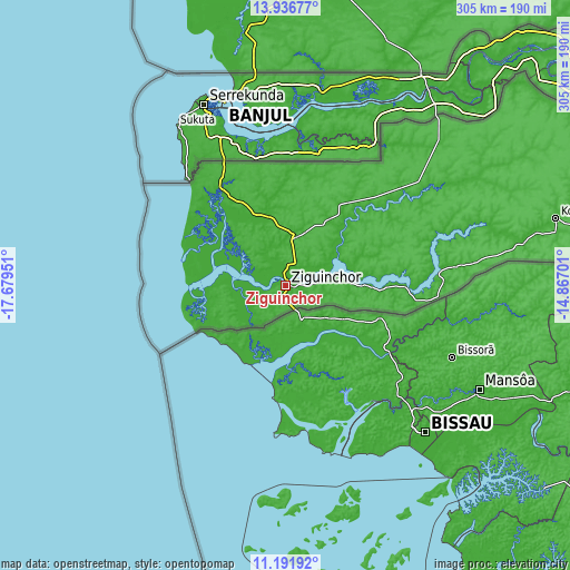
| \ | Map #1 | Map #2 | Topo.Map |
| Scale [m] | -4..37 m | -13..37 m | × |
| Scale [ft] | -13..121 ft | -43..121 ft | × |
| Average | 12.4 m = 41 ft | 10 m = 33 ft | × |
| Width | 9.54 km = 5.9 mi | 19.08 km = 11.9 mi | 305.2 km = 189.6 mi |
| Height | 9.54 km = 5.9 mi | 19.08 km = 11.9 mi | 305.2 km = 189.6 mi |
| ↑Max Latitude | 12.610899° | 12.65378° | 13.93677° |
| Latitude at center | 12.56801° | 12.56801° | 12.56801° |
| ↓Min Latitude | 12.525114° | 12.482211° | 11.19192° |
| ← Min Longitude | -16.317205° | -16.361151° | -17.67951° |
| Longitude center | -16.27326° | -16.27326° | -16.27326° |
| →Max Longitude | -16.229315° | -16.185369° | -14.86701° |
Nearby cities:
Cities around Ziguinchor sort by population:
• Kolda elevation 17 m
148.9 km,  75°
75°
• Bignona 30 m
27.4 km,  10°
10°
• Nioro du Rip 19 m
141.1 km,  21°
21°
• Sédhiou 21 m
79.3 km, 78°
• Sokone 14 m
146.6 km,  356°
356°
• Ndofane 22 m
154.4 km, 13°
• Tionk Essil 18 m
36.2 km,  311°
311°
• Marsassoum 19 m
42.9 km,  47°
47°
• Passi 15 m
157.4 km,  0°
0°
• Foundiougne 0 m
175.3 km,  353°
353°
• Oussouye 15 m
31.1 km,  252°
252°
• Adéane 13 m
28.7 km, 76°
Multilingual:
 En español:
Ziguinchor elevación 19 m.
 En France:
Ziguinchor élévation 19 m.
 Auf Deutsch:
Ziguinchor höhe über dem Meeresspiegel ist 19 m.

Sources and notes:
- [note 1] Map square and city borders are not equal. Map elevation data is calculated only from area inside that square.
- [src 1] Elevation data from geonames database provided with same terms of usage.
- [src 2] The elevation map of Ziguinchor is generated using elevation data from NASA's 3 arcsec (90m) resolution SRTM data.
- [src 3] Base (background) map © OpenStreetMap contributors tiles are generated by Geofabrik and OpenTopoMap.
Copyright & License:
This Ziguinchor Elevation Map is licensed under CC BY-SA. You may reuse any part from this page, if you give a proper credit by linking to this URL:
 More info on terms of use page.