Serravalle elevation
Serravalle, San Marino elevation is 119 meters and Serravalle elevation in feet is 390 ft above sea level [src 1]. Serravalle is a seat of a first-order administrative division (feature code) with elevation that is 268 meters (879 ft) smaller than average city elevation in San Marino.
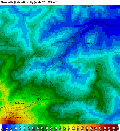
Below is the Elevation map of Serravalle, which displays elevation range with different colors. Scale of the first map is from 37 to 669 m (121 to 2195 ft) with average elevation of 182.7 meters (=599 ft) [note 1]
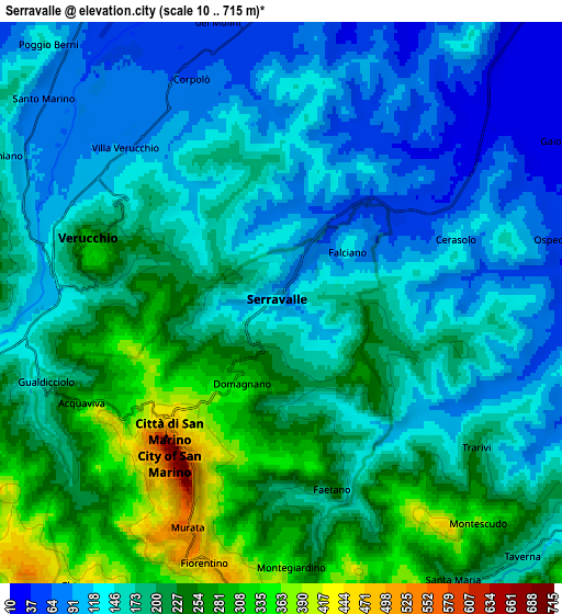
These maps also provides idea of topography and contour of this city, they are displayed at different zoom levels. More info about maps, scale and edge coordinates you can find below images.
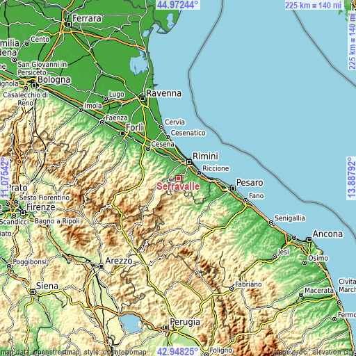
| \ | Map #1 | Map #2 | Topo.Map |
| Scale [m] | 37..669 m | 10..715 m | × |
| Scale [ft] | 121..2195 ft | 33..2346 ft | × |
| Average | 182.7 m = 599 ft | 177.8 m = 583 ft | × |
| Width | 7.03 km = 4.4 mi | 14.07 km = 8.7 mi | 225.1 km = 139.9 mi |
| Height | 7.03 km = 4.4 mi | 14.07 km = 8.7 mi | 225.1 km = 139.9 mi |
| ↑Max Latitude | 44.00059° | 44.032193° | 44.97244° |
| Latitude at center | 43.96897° | 43.96897° | 43.96897° |
| ↓Min Latitude | 43.937333° | 43.90568° | 42.94825° |
| ← Min Longitude | 12.437725° | 12.393779° | 11.07542° |
| Longitude center | 12.48167° | 12.48167° | 12.48167° |
| →Max Longitude | 12.525615° | 12.569561° | 13.88792° |
Nearby cities:
Cities around Serravalle sort by population:
• Borgo Maggiore elevation 481 m
4.1 km,  222°
222°
• San Marino 683 m
4.6 km, 218°
• Domagnano 341 m
2.4 km,  206°
206°
• Fiorentino 468 m
6.8 km,  196°
196°
• Acquaviva 289 m
5.7 km,  243°
243°
• Faetano 254 m
4.7 km,  163°
163°
• Poggio di Chiesanuova 475 m
8.6 km, 213°
• Monte Giardino 372 m
6.7 km,  179°
179°
Multilingual:
 En español:
Serravalle elevación 119 m.
 En France:
Serravalle élévation 119 m.
 Auf Deutsch:
Serravalle höhe über dem Meeresspiegel ist 119 m.

Sources and notes:
- [note 1] Map square and city borders are not equal. Map elevation data is calculated only from area inside that square.
- [src 1] Elevation data from geonames database provided with same terms of usage.
- [src 2] The elevation map of Serravalle is generated using elevation data from NASA's 3 arcsec (90m) resolution SRTM data.
- [src 3] Base (background) map © OpenStreetMap contributors tiles are generated by Geofabrik and OpenTopoMap.
Copyright & License:
This Serravalle Elevation Map is licensed under CC BY-SA. You may reuse any part from this page, if you give a proper credit by linking to this URL:
 More info on terms of use page.