Gandorhun elevation
Gandorhun (Southern Province), Sierra Leone elevation is 58 meters and Gandorhun elevation in feet is 190 ft above sea level [src 1]. Gandorhun is a populated place (feature code) with elevation that is 99 meters (325 ft) smaller than average city elevation in Sierra Leone.
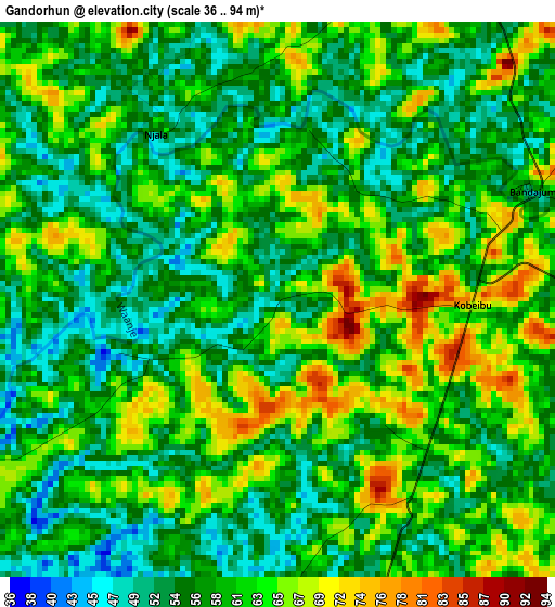
Below is the Elevation map of Gandorhun, which displays elevation range with different colors. Scale of the first map is from 36 to 94 m (118 to 308 ft) with average elevation of 59 meters (=194 ft) [note 1]
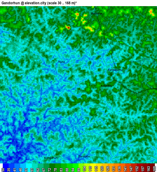
These maps also provides idea of topography and contour of this city, they are displayed at different zoom levels. More info about maps, scale and edge coordinates you can find below images.
| \ | Map #1 | Map #2 | Topo.Map |
| Scale [m] | 36..94 m | 30..168 m | × |
| Scale [ft] | 118..308 ft | 98..551 ft | × |
| Average | 59 m = 194 ft | 62.3 m = 204 ft | × |
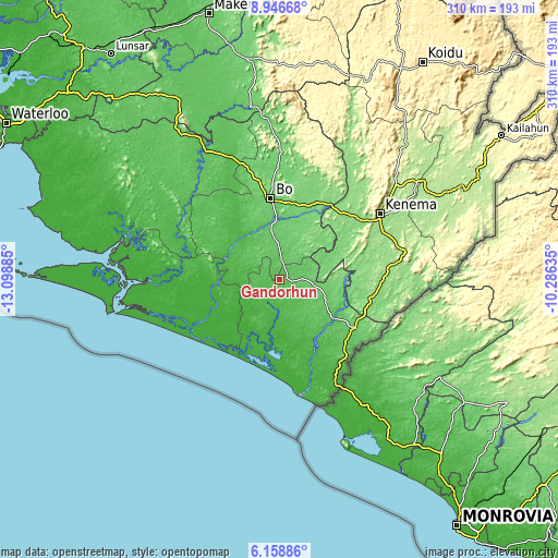
| Width | 9.69 km = 6 mi | 19.38 km = 12 mi | 310 km = 192.6 mi |
| Height | 9.69 km = 6 mi | 19.38 km = 12 mi | 310 km = 192.6 mi |
| ↑Max Latitude | 7.598582° | 7.642139° | 8.94668° |
| Latitude at center | 7.55502° | 7.55502° | 7.55502° |
| ↓Min Latitude | 7.511454° | 7.467884° | 6.15886° |
| ← Min Longitude | -11.736545° | -11.780491° | -13.09885° |
| Longitude center | -11.6926° | -11.6926° | -11.6926° |
| →Max Longitude | -11.648655° | -11.604709° | -10.28635° |
Nearby cities:
Cities around Gandorhun sort by population:
• Bo elevation 104 m
45.8 km,  353°
353°
• Bumpe 38 m
44.2 km,  327°
327°
• Gandorhun 33 m
16.6 km,  246°
246°
• Pujehun 26 m
22.1 km,  188°
188°
• Sumbuya 39 m
31.3 km,  289°
289°
• Foindu 58 m
23.1 km,  134°
134°
• Bomi 45 m
39 km,  151°
151°
• Potoru 85 m
24.2 km,  103°
103°
• Koribundu 79 m
17.2 km,  359°
359°
• Serabu 44 m
47.7 km,  303°
303°
• Gbewebu 79 m
9.4 km,  92°
92°
• Tongole 23 m
25.7 km,  243°
243°
Multilingual:
 En español:
Gandorhun elevación 58 m.
 En France:
Gandorhun élévation 58 m.
 Auf Deutsch:
Gandorhun höhe über dem Meeresspiegel ist 58 m.

Sources and notes:
- [note 1] Map square and city borders are not equal. Map elevation data is calculated only from area inside that square.
- [src 1] Elevation data from geonames database provided with same terms of usage.
- [src 2] The elevation map of Gandorhun is generated using elevation data from NASA's 3 arcsec (90m) resolution SRTM data.
- [src 3] Base (background) map © OpenStreetMap contributors tiles are generated by Geofabrik and OpenTopoMap.
Copyright & License:
This Gandorhun Elevation Map is licensed under CC BY-SA. You may reuse any part from this page, if you give a proper credit by linking to this URL:
 More info on terms of use page.