Rotifunk elevation
Rotifunk (Southern Province), Sierra Leone elevation is 14 meters and Rotifunk elevation in feet is 46 ft above sea level [src 1]. Rotifunk is a populated place (feature code) with elevation that is 143 meters (469 ft) smaller than average city elevation in Sierra Leone.
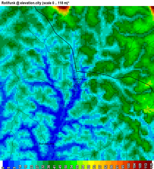
Below is the Elevation map of Rotifunk, which displays elevation range with different colors. Scale of the first map is from 0 to 118 m (0 to 387 ft) with average elevation of 27.9 meters (=92 ft) [note 1]
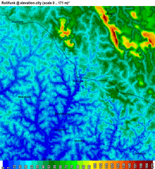
These maps also provides idea of topography and contour of this city, they are displayed at different zoom levels. More info about maps, scale and edge coordinates you can find below images.
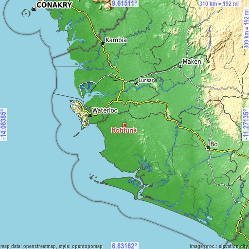
| \ | Map #1 | Map #2 | Topo.Map |
| Scale [m] | 0..118 m | 0..171 m | × |
| Scale [ft] | 0..387 ft | 0..561 ft | × |
| Average | 27.9 m = 92 ft | 33.7 m = 111 ft | × |
| Width | 9.67 km = 6 mi | 19.34 km = 12 mi | 309.5 km = 192.3 mi |
| Height | 9.67 km = 6 mi | 19.34 km = 12 mi | 309.5 km = 192.3 mi |
| ↑Max Latitude | 8.269401° | 8.312887° | 9.61511° |
| Latitude at center | 8.22591° | 8.22591° | 8.22591° |
| ↓Min Latitude | 8.182414° | 8.138914° | 6.83182° |
| ← Min Longitude | -12.721545° | -12.765491° | -14.08385° |
| Longitude center | -12.6776° | -12.6776° | -12.6776° |
| →Max Longitude | -12.633655° | -12.589709° | -11.27135° |
Nearby cities:
Cities around Rotifunk sort by population:
• Freetown elevation 21 m
67.9 km,  295°
295°
• Lunsar 64 m
53.3 km,  17°
17°
• Port Loko 51 m
61.3 km,  348°
348°
• Waterloo 23 m
45.1 km,  286°
286°
• Rokupr 83 m
59.1 km,  33°
33°
• Moyamba 58 m
28.1 km,  105°
105°
• Hastings 50 m
53.4 km, 288°
• Pepel 20 m
57.6 km,  314°
314°
• Yonibana 77 m
53.9 km,  63°
63°
• Largo 86 m
57.5 km,  84°
84°
• Mogbwemo 53 m
65.6 km,  141°
141°
• Kent 1 m
44.4 km, 285°
Multilingual:
 En español:
Rotifunk elevación 14 m.
 En France:
Rotifunk élévation 14 m.


Sources and notes:
- [note 1] Map square and city borders are not equal. Map elevation data is calculated only from area inside that square.
- [src 1] Elevation data from geonames database provided with same terms of usage.
- [src 2] The elevation map of Rotifunk is generated using elevation data from NASA's 3 arcsec (90m) resolution SRTM data.
- [src 3] Base (background) map © OpenStreetMap contributors tiles are generated by Geofabrik and OpenTopoMap.
Copyright & License:
This Rotifunk Elevation Map is licensed under CC BY-SA. You may reuse any part from this page, if you give a proper credit by linking to this URL:
 More info on terms of use page.