Tombodu elevation
Tombodu (Eastern Province), Sierra Leone elevation is 275 meters and Tombodu elevation in feet is 902 ft above sea level [src 1]. Tombodu is a populated place (feature code) with elevation that is 118 meters (387 ft) bigger than average city elevation in Sierra Leone.
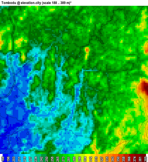
Below is the Elevation map of Tombodu, which displays elevation range with different colors. Scale of the first map is from 188 to 389 m (617 to 1276 ft) with average elevation of 254.8 meters (=836 ft) [note 1]
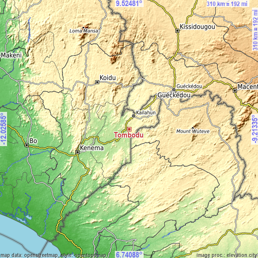
These maps also provides idea of topography and contour of this city, they are displayed at different zoom levels. More info about maps, scale and edge coordinates you can find below images.
| \ | Map #1 | Map #2 | Topo.Map |
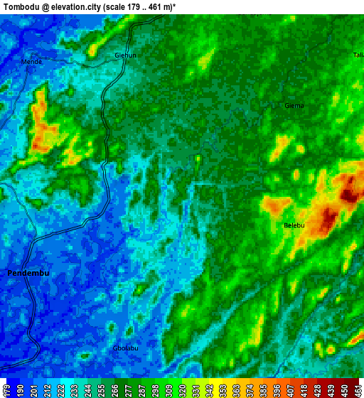
| Scale [m] | 188..389 m | 179..461 m | × |
| Scale [ft] | 617..1276 ft | 587..1512 ft | × |
| Average | 254.8 m = 836 ft | 258.5 m = 848 ft | × |
| Width | 9.67 km = 6 mi | 19.35 km = 12 mi | 309.5 km = 192.3 mi |
| Height | 9.67 km = 6 mi | 19.35 km = 12 mi | 309.6 km = 192.4 mi |
| ↑Max Latitude | 8.178761° | 8.222257° | 9.52481° |
| Latitude at center | 8.13526° | 8.13526° | 8.13526° |
| ↓Min Latitude | 8.091755° | 8.048244° | 6.74088° |
| ← Min Longitude | -10.663545° | -10.707491° | -12.02585° |
| Longitude center | -10.6196° | -10.6196° | -10.6196° |
| →Max Longitude | -10.575655° | -10.531709° | -9.21335° |
Nearby cities:
Cities around Tombodu sort by population:
• Segbwema elevation 180 m
39.6 km,  246°
246°
• Kailahun 309 m
16.8 km,  17°
17°
• Pendembu 204 m
9.2 km,  243°
243°
• Panguma 309 m
56.8 km,  275°
275°
• Bunumbu 188 m
27.3 km, 279°
• Daru 190 m
29.4 km, 236°
• Buedu 391 m
31.7 km,  59°
59°
• Manowa 201 m
14.8 km,  286°
286°
• Tombu 371 m
46.6 km,  344°
344°
• Mobai 200 m
21.6 km,  223°
223°
• Giehun 210 m
54.9 km, 239°
• Jojoima 198 m
34.2 km,  213°
213°
Multilingual:
 En español:
Tombodu elevación 275 m.
 En France:
Tombodu élévation 275 m.


Sources and notes:
- [note 1] Map square and city borders are not equal. Map elevation data is calculated only from area inside that square.
- [src 1] Elevation data from geonames database provided with same terms of usage.
- [src 2] The elevation map of Tombodu is generated using elevation data from NASA's 3 arcsec (90m) resolution SRTM data.
- [src 3] Base (background) map © OpenStreetMap contributors tiles are generated by Geofabrik and OpenTopoMap.
Copyright & License:
This Tombodu Elevation Map is licensed under CC BY-SA. You may reuse any part from this page, if you give a proper credit by linking to this URL:
 More info on terms of use page.