Ľubica elevation
Ľubica (Prešovský kraj, Okres Kežmarok), Slovakia elevation is 633 meters and Ľubica elevation in feet is 2077 ft above sea level [src 1]. Ľubica is a populated place (feature code) with elevation that is 313 meters (1027 ft) bigger than average city elevation in Slovakia.
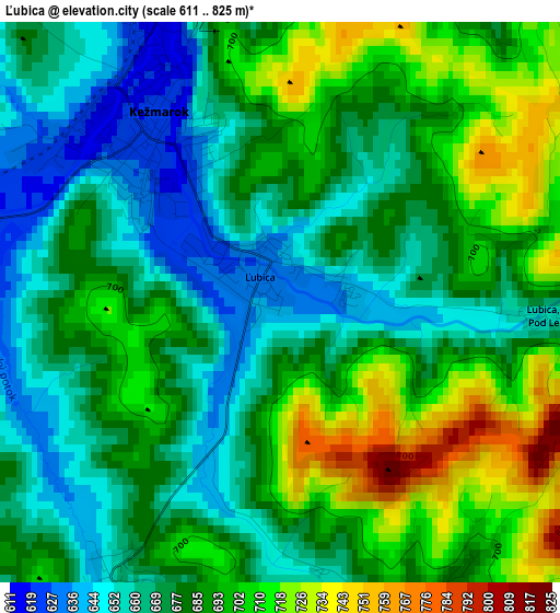
Below is the Elevation map of Ľubica, which displays elevation range with different colors. Scale of the first map is from 611 to 825 m (2005 to 2707 ft) with average elevation of 683.1 meters (=2241 ft) [note 1]
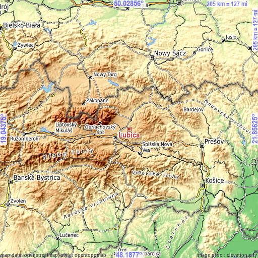
These maps also provides idea of topography and contour of this city, they are displayed at different zoom levels. More info about maps, scale and edge coordinates you can find below images.
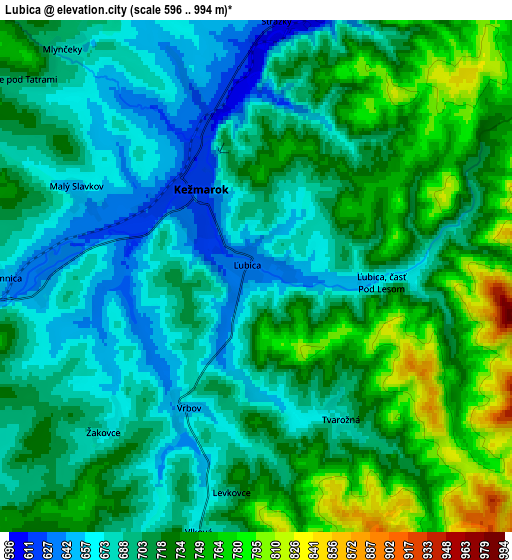
| \ | Map #1 | Map #2 | Topo.Map |
| Scale [m] | 611..825 m | 596..994 m | × |
| Scale [ft] | 2005..2707 ft | 1955..3261 ft | × |
| Average | 683.1 m = 2241 ft | 711.6 m = 2335 ft | × |
| Width | 6.4 km = 4 mi | 12.79 km = 7.9 mi | 204.7 km = 127.2 mi |
| Height | 6.4 km = 4 mi | 12.79 km = 7.9 mi | 204.7 km = 127.2 mi |
| ↑Max Latitude | 49.145425° | 49.174163° | 50.02856° |
| Latitude at center | 49.11667° | 49.11667° | 49.11667° |
| ↓Min Latitude | 49.087899° | 49.05911° | 48.1877° |
| ← Min Longitude | 20.406055° | 20.362109° | 19.04375° |
| Longitude center | 20.45° | 20.45° | 20.45° |
| →Max Longitude | 20.493945° | 20.537891° | 21.85625° |
Nearby cities:
Cities around Ľubica sort by population:
• Poprad elevation 668 m
12.7 km,  240°
240°
• Spišská Nová Ves 459 m
20.8 km,  156°
156°
• Kežmarok 615 m
2.4 km,  330°
330°
• Levoča 536 m
14.8 km,  135°
135°
• Svit 723 m
18.8 km,  250°
250°
• Spišská Belá 625 m
7.9 km,  5°
5°
• Vysoké Tatry 887 m
15.2 km,  278°
278°
• Podolínec 567 m
17 km,  21°
21°
• Nová Lesná 748 m
13.3 km,  272°
272°
• Vrbov 652 m
3.7 km,  209°
209°
• Ždiar 887 m
21.9 km,  321°
321°
• Vyšné Ružbachy 615 m
22.4 km, 21°
Multilingual:
 En español:
Ľubica elevación 633 m.
 En France:
Ľubica élévation 633 m.


Sources and notes:
- [note 1] Map square and city borders are not equal. Map elevation data is calculated only from area inside that square.
- [src 1] Elevation data from geonames database provided with same terms of usage.
- [src 2] The elevation map of Ľubica is generated using elevation data from NASA's 3 arcsec (90m) resolution SRTM data.
- [src 3] Base (background) map © OpenStreetMap contributors tiles are generated by Geofabrik and OpenTopoMap.
Copyright & License:
This Ľubica Elevation Map is licensed under CC BY-SA. You may reuse any part from this page, if you give a proper credit by linking to this URL:
 More info on terms of use page.