Stropkov elevation
Stropkov (Prešovský kraj, Okres Stropkov), Slovakia elevation is 201 meters and Stropkov elevation in feet is 659 ft above sea level [src 1]. Stropkov is a seat of a second-order administrative division (feature code) with elevation that is 119 meters (390 ft) smaller than average city elevation in Slovakia.
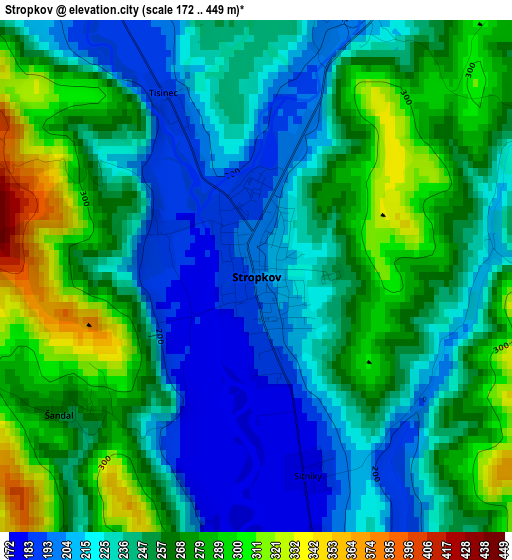
Below is the Elevation map of Stropkov, which displays elevation range with different colors. Scale of the first map is from 172 to 449 m (564 to 1473 ft) with average elevation of 249.4 meters (=818 ft) [note 1]
These maps also provides idea of topography and contour of this city, they are displayed at different zoom levels. More info about maps, scale and edge coordinates you can find below images.
| \ | Map #1 | Map #2 | Topo.Map |
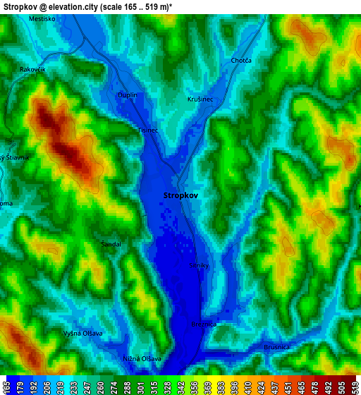
| Scale [m] | 172..449 m | 165..519 m | × |
| Scale [ft] | 564..1473 ft | 541..1703 ft | × |
| Average | 249.4 m = 818 ft | 277.8 m = 911 ft | × |
| Width | 6.39 km = 4 mi | 12.77 km = 7.9 mi | 204.3 km = 126.9 mi |
| Height | 6.39 km = 4 mi | 12.77 km = 7.9 mi | 204.3 km = 126.9 mi |
| ↑Max Latitude | 49.230815° | 49.259504° | 50.11242° |
| Latitude at center | 49.20211° | 49.20211° | 49.20211° |
| ↓Min Latitude | 49.173388° | 49.14465° | 48.27473° |
| ← Min Longitude | 21.608215° | 21.564269° | 20.24591° |
| Longitude center | 21.65216° | 21.65216° | 21.65216° |
| →Max Longitude | 21.696105° | 21.740051° | 23.05841° |
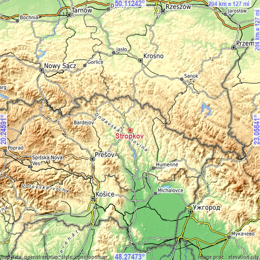
Nearby cities:
Cities around Stropkov sort by population:
• Prešov elevation 247 m
37.9 km,  233°
233°
• Humenné 152 m
35.2 km,  146°
146°
• Bardejov 283 m
29.3 km,  289°
289°
• Vranov nad Topľou 131 m
35 km,  176°
176°
• Snina 215 m
43.4 km,  123°
123°
• Svidník 229 m
13.2 km,  333°
333°
• Sabinov 318 m
41.7 km,  254°
254°
• Chlmec 213 m
40.9 km, 149°
• Medzilaborce 326 m
19.6 km,  66°
66°
• Strážske 134 m
38.9 km,  159°
159°
• Giraltovce 189 m
13.9 km, 225°
• Vinné 150 m
49.3 km, 152°
Multilingual:
 En español:
Stropkov elevación 201 m.
 En France:
Stropkov élévation 201 m.
 Auf Deutsch:
Stropkov höhe über dem Meeresspiegel ist 201 m.

Sources and notes:
- [note 1] Map square and city borders are not equal. Map elevation data is calculated only from area inside that square.
- [src 1] Elevation data from geonames database provided with same terms of usage.
- [src 2] The elevation map of Stropkov is generated using elevation data from NASA's 3 arcsec (90m) resolution SRTM data.
- [src 3] Base (background) map © OpenStreetMap contributors tiles are generated by Geofabrik and OpenTopoMap.
Copyright & License:
This Stropkov Elevation Map is licensed under CC BY-SA. You may reuse any part from this page, if you give a proper credit by linking to this URL:
 More info on terms of use page.