Bratislava - Vajnory elevation
Bratislava - Vajnory (Bratislavský kraj, Okres Bratislava III), Slovakia elevation is 133 meters and Bratislava - Vajnory elevation in feet is 436 ft above sea level [src 1]. Bratislava - Vajnory is a section of populated place (feature code) with elevation that is 187 meters (614 ft) smaller than average city elevation in Slovakia.
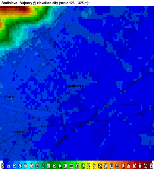
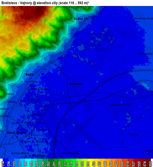
Below is the Elevation map of Bratislava - Vajnory, which displays elevation range with different colors. Scale of the first map is from 123 to 325 m (404 to 1066 ft) with average elevation of 135.7 meters (=445 ft) [note 1]
These maps also provides idea of topography and contour of this city, they are displayed at different zoom levels. More info about maps, scale and edge coordinates you can find below images.
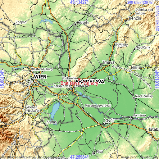
| \ | Map #1 | Map #2 | Topo.Map |
| Scale [m] | 123..325 m | 116..592 m | × |
| Scale [ft] | 404..1066 ft | 381..1942 ft | × |
| Average | 135.7 m = 445 ft | 177.8 m = 583 ft | × |
| Width | 6.51 km = 4 mi | 13.03 km = 8.1 mi | 208.4 km = 129.5 mi |
| Height | 6.51 km = 4 mi | 13.03 km = 8.1 mi | 208.4 km = 129.5 mi |
| ↑Max Latitude | 48.234909° | 48.264172° | 49.13427° |
| Latitude at center | 48.20563° | 48.20563° | 48.20563° |
| ↓Min Latitude | 48.176334° | 48.147021° | 47.25984° |
| ← Min Longitude | 17.163645° | 17.119699° | 15.80134° |
| Longitude center | 17.20759° | 17.20759° | 17.20759° |
| →Max Longitude | 17.251535° | 17.295481° | 18.61384° |
Nearby cities:
Cities around Bratislava - Vajnory sort by population:
• Bratislava elevation 157 m
9.8 km,  229°
229°
• Pezinok 162 m
10.3 km,  25°
25°
• Malacky 164 m
29.1 km,  331°
331°
• Senec 127 m
14.4 km,  83°
83°
• Šamorín 125 m
20.9 km,  158°
158°
• Modra 173 m
16.1 km, 27°
• Stupava 179 m
15.1 km,  300°
300°
• Ivanka pri Dunaji 132 m
4.1 km,  120°
120°
• Svätý Jur 152 m
5.2 km,  6°
6°
• Dunajská Lužná 129 m
14.1 km, 163°
• Marianka 233 m
11.7 km,  294°
294°
• Vinosady 145 m
13.3 km, 27°
Multilingual:
 En español:
Bratislava - Vajnory elevación 133 m.
 En France:
Bratislava - Vajnory élévation 133 m.
 Auf Deutsch:
Weinern höhe über dem Meeresspiegel ist 133 m.
 На русском:
Bratislava - Vajnory высота над уровнем моря 133 м
Sources and notes:
- [note 1] Map square and city borders are not equal. Map elevation data is calculated only from area inside that square.
- [src 1] Elevation data from geonames database provided with same terms of usage.
- [src 2] The elevation map of Bratislava - Vajnory is generated using elevation data from NASA's 3 arcsec (90m) resolution SRTM data.
- [src 3] Base (background) map © OpenStreetMap contributors tiles are generated by Geofabrik and OpenTopoMap.
Copyright & License:
This Bratislava - Vajnory Elevation Map is licensed under CC BY-SA. You may reuse any part from this page, if you give a proper credit by linking to this URL:
 More info on terms of use page.