Tisovec elevation
Tisovec (Banskobystrický kraj, Okres Rimavská Sobota), Slovakia elevation is 400 meters and Tisovec elevation in feet is 1312 ft above sea level [src 1]. Tisovec is a populated place (feature code) with elevation that is 80 meters (262 ft) bigger than average city elevation in Slovakia.
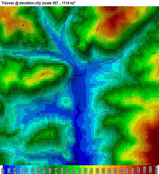
Below is the Elevation map of Tisovec, which displays elevation range with different colors. Scale of the first map is from 357 to 1114 m (1171 to 3655 ft) with average elevation of 607.5 meters (=1993 ft) [note 1]
These maps also provides idea of topography and contour of this city, they are displayed at different zoom levels. More info about maps, scale and edge coordinates you can find below images.
| \ | Map #1 | Map #2 | Topo.Map |
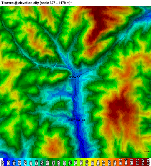
| Scale [m] | 357..1114 m | 327..1179 m | × |
| Scale [ft] | 1171..3655 ft | 1073..3868 ft | × |
| Average | 607.5 m = 1993 ft | 708.3 m = 2324 ft | × |
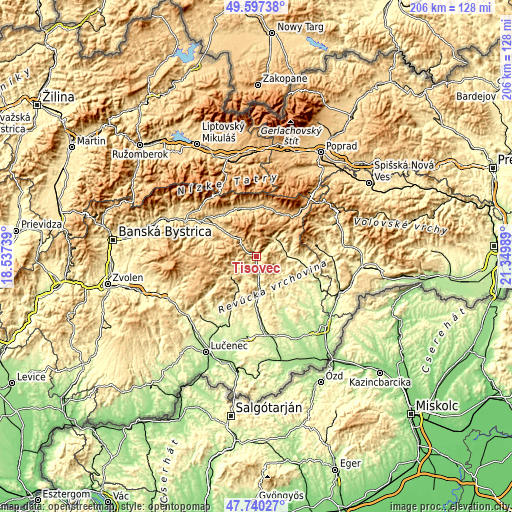
| Width | 6.45 km = 4 mi | 12.91 km = 8 mi | 206.5 km = 128.3 mi |
| Height | 6.45 km = 4 mi | 12.91 km = 8 mi | 206.5 km = 128.3 mi |
| ↑Max Latitude | 48.706389° | 48.735381° | 49.59738° |
| Latitude at center | 48.67738° | 48.67738° | 48.67738° |
| ↓Min Latitude | 48.648355° | 48.619313° | 47.74027° |
| ← Min Longitude | 19.899695° | 19.855749° | 18.53739° |
| Longitude center | 19.94364° | 19.94364° | 19.94364° |
| →Max Longitude | 19.987585° | 20.031531° | 21.34989° |
Nearby cities:
Cities around Tisovec sort by population:
• Lučenec elevation 187 m
43.4 km,  207°
207°
• Rimavská Sobota 208 m
33.3 km,  169°
169°
• Brezno 492 m
26.6 km,  302°
302°
• Detva 414 m
40.6 km,  251°
251°
• Revúca 318 m
12.8 km,  86°
86°
• Hriňová 476 m
32.6 km, 250°
• Liptovský Hrádok 645 m
43.4 km,  338°
338°
• Poltár 246 m
29.5 km,  201°
201°
• Čierny Balog 530 m
22.8 km,  289°
289°
• Dobšiná 456 m
35.1 km,  62°
62°
• Štrba 866 m
43.6 km,  13°
13°
• Hybe 693 m
41.7 km,  348°
348°
Multilingual:
 En español:
Tisovec elevación 400 m.
 En France:
Tisovec élévation 400 m.


Sources and notes:
- [note 1] Map square and city borders are not equal. Map elevation data is calculated only from area inside that square.
- [src 1] Elevation data from geonames database provided with same terms of usage.
- [src 2] The elevation map of Tisovec is generated using elevation data from NASA's 3 arcsec (90m) resolution SRTM data.
- [src 3] Base (background) map © OpenStreetMap contributors tiles are generated by Geofabrik and OpenTopoMap.
Copyright & License:
This Tisovec Elevation Map is licensed under CC BY-SA. You may reuse any part from this page, if you give a proper credit by linking to this URL:
 More info on terms of use page.