Lucija elevation
Lucija (Piran-Pirano), Slovenia elevation is 2 meters and Lucija elevation in feet is 7 ft above sea level [src 1]. Lucija is a populated place (feature code) with elevation that is 312 meters (1024 ft) smaller than average city elevation in Slovenia.
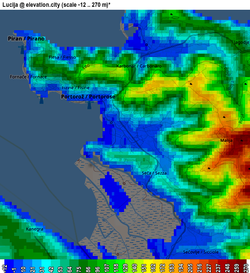
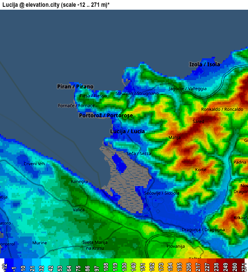
Below is the Elevation map of Lucija, which displays elevation range with different colors. Scale of the first map is from -12 to 270 m (-39 to 886 ft) with average elevation of 70.1 meters (=230 ft) [note 1]
These maps also provides idea of topography and contour of this city, they are displayed at different zoom levels. More info about maps, scale and edge coordinates you can find below images.
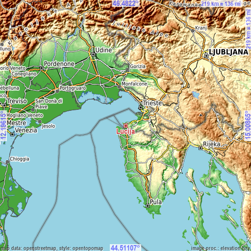
| \ | Map #1 | Map #2 | Topo.Map |
| Scale [m] | -12..270 m | -12..271 m | × |
| Scale [ft] | -39..886 ft | -39..889 ft | × |
| Average | 70.1 m = 230 ft | 76 m = 249 ft | × |
| Width | 6.85 km = 4.3 mi | 13.7 km = 8.5 mi | 219.2 km = 136.2 mi |
| Height | 6.85 km = 4.3 mi | 13.7 km = 8.5 mi | 219.2 km = 136.2 mi |
| ↑Max Latitude | 45.53605° | 45.566824° | 46.4822° |
| Latitude at center | 45.50526° | 45.50526° | 45.50526° |
| ↓Min Latitude | 45.474453° | 45.443629° | 44.51107° |
| ← Min Longitude | 13.558455° | 13.514509° | 12.19615° |
| Longitude center | 13.6024° | 13.6024° | 13.6024° |
| →Max Longitude | 13.646345° | 13.690291° | 15.00865° |
Nearby cities:
Cities around Lucija sort by population:
• Koper elevation 15 m
10.9 km,  64°
64°
• Izola 5 m
5.8 km,  52°
52°
• Piran 46 m
3.5 km,  315°
315°
• Ankaran 12 m
13.2 km, 51°
• Portorož 6 m
1.3 km, 321°
• Jagodje 29 m
4.3 km, 53°
• Dekani 71 m
17.2 km,  73°
73°
• Spodnje Škofije 74 m
16.5 km, 63°
• Hrvatini 160 m
14.8 km, 54°
• Pobegi 91 m
15.6 km,  75°
75°
• Seča 17 m
1.4 km,  137°
137°
• Prade 66 m
14.1 km, 74°
Multilingual:
 En español:
Lucija elevación 2 m.
 En France:
Lucija élévation 2 m.


Sources and notes:
- [note 1] Map square and city borders are not equal. Map elevation data is calculated only from area inside that square.
- [src 1] Elevation data from geonames database provided with same terms of usage.
- [src 2] The elevation map of Lucija is generated using elevation data from NASA's 3 arcsec (90m) resolution SRTM data.
- [src 3] Base (background) map © OpenStreetMap contributors tiles are generated by Geofabrik and OpenTopoMap.
Copyright & License:
This Lucija Elevation Map is licensed under CC BY-SA. You may reuse any part from this page, if you give a proper credit by linking to this URL:
 More info on terms of use page.