Trzin elevation
Trzin, Slovenia elevation is 296 meters and Trzin elevation in feet is 971 ft above sea level [src 1]. Trzin is a seat of a first-order administrative division (feature code) with elevation that is 18 meters (59 ft) smaller than average city elevation in Slovenia.
Below is the Elevation map of Trzin, which displays elevation range with different colors. Scale of the first map is from 278 to 606 m (912 to 1988 ft) with average elevation of 327.2 meters (=1073 ft) [note 1]
These maps also provides idea of topography and contour of this city, they are displayed at different zoom levels. More info about maps, scale and edge coordinates you can find below images.
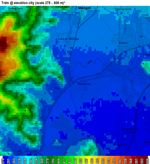
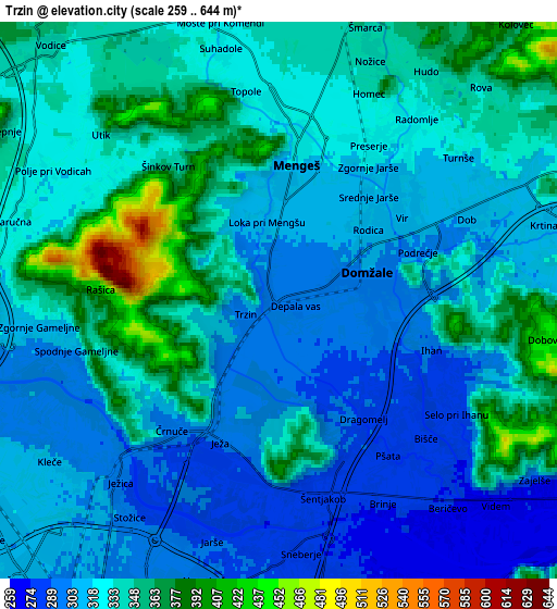
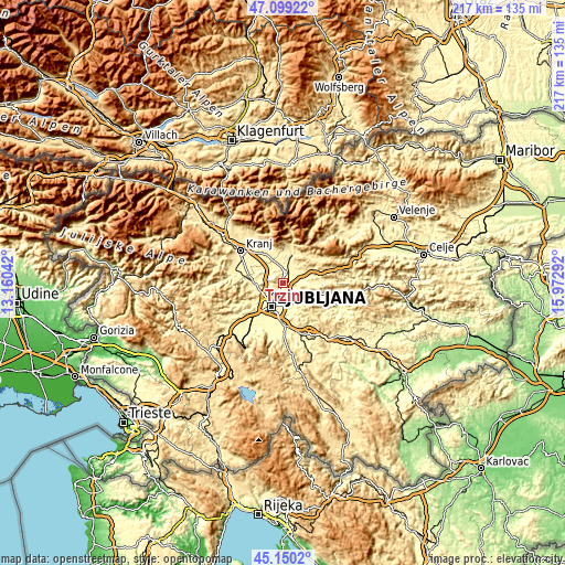
| \ | Map #1 | Map #2 | Topo.Map |
| Scale [m] | 278..606 m | 259..644 m | × |
| Scale [ft] | 912..1988 ft | 850..2113 ft | × |
| Average | 327.2 m = 1073 ft | 327.5 m = 1074 ft | × |
| Width | 6.77 km = 4.2 mi | 13.54 km = 8.4 mi | 216.7 km = 134.7 mi |
| Height | 6.77 km = 4.2 mi | 13.54 km = 8.4 mi | 216.7 km = 134.7 mi |
| ↑Max Latitude | 46.163775° | 46.194203° | 47.09922° |
| Latitude at center | 46.13333° | 46.13333° | 46.13333° |
| ↓Min Latitude | 46.102868° | 46.07239° | 45.1502° |
| ← Min Longitude | 14.522725° | 14.478779° | 13.16042° |
| Longitude center | 14.56667° | 14.56667° | 14.56667° |
| →Max Longitude | 14.610615° | 14.654561° | 15.97292° |
Nearby cities:
Cities around Trzin sort by population:
• Ljubljana elevation 295 m
10.3 km,  207°
207°
• Domžale 301 m
2.1 km,  76°
76°
• Mengeš 324 m
3.8 km,  9°
9°
• Vir 308 m
3.8 km,  54°
54°
• Radomlje 328 m
5.7 km,  38°
38°
• Vodice 338 m
8.4 km,  318°
318°
• Dob 306 m
5.2 km,  66°
66°
• Preserje pri Radomljah 323 m
4.6 km,  30°
30°
• Šmarca 346 m
7.1 km,  19°
19°
• Moste 335 m
7 km,  350°
350°
• Komenda 338 m
8.2 km,  344°
344°
• Dol pri Ljubljani 278 m
5.6 km,  152°
152°
Multilingual:
 En español:
Trzin elevación 296 m.
 En France:
Trzin élévation 296 m.


Sources and notes:
- [note 1] Map square and city borders are not equal. Map elevation data is calculated only from area inside that square.
- [src 1] Elevation data from geonames database provided with same terms of usage.
- [src 2] The elevation map of Trzin is generated using elevation data from NASA's 3 arcsec (90m) resolution SRTM data.
- [src 3] Base (background) map © OpenStreetMap contributors tiles are generated by Geofabrik and OpenTopoMap.
Copyright & License:
This Trzin Elevation Map is licensed under CC BY-SA. You may reuse any part from this page, if you give a proper credit by linking to this URL:
 More info on terms of use page.