Älta elevation
Älta (Stockholm, Nacka Kommun), Sweden elevation is 46 meters and Älta elevation in feet is 151 ft above sea level [src 1]. Älta is a populated place (feature code) with elevation that is 29 meters (95 ft) smaller than average city elevation in Sweden.
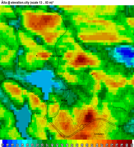
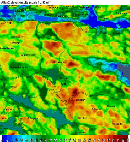
Below is the Elevation map of Älta, which displays elevation range with different colors. Scale of the first map is from 13 to 83 m (43 to 272 ft) with average elevation of 46.9 meters (=154 ft) [note 1]
These maps also provides idea of topography and contour of this city, they are displayed at different zoom levels. More info about maps, scale and edge coordinates you can find below images.
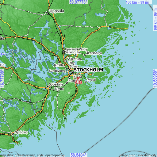
| \ | Map #1 | Map #2 | Topo.Map |
| Scale [m] | 13..83 m | 1..83 m | × |
| Scale [ft] | 43..272 ft | 3..272 ft | × |
| Average | 46.9 m = 154 ft | 40.9 m = 134 ft | × |
| Width | 4.99 km = 3.1 mi | 9.99 km = 6.2 mi | 159.8 km = 99.3 mi |
| Height | 4.99 km = 3.1 mi | 9.99 km = 6.2 mi | 159.8 km = 99.3 mi |
| ↑Max Latitude | 59.289121° | 59.311556° | 59.97778° |
| Latitude at center | 59.26667° | 59.26667° | 59.26667° |
| ↓Min Latitude | 59.244205° | 59.221724° | 58.5404° |
| ← Min Longitude | 18.139385° | 18.095439° | 16.77708° |
| Longitude center | 18.18333° | 18.18333° | 18.18333° |
| →Max Longitude | 18.227275° | 18.271221° | 19.58958° |
Nearby cities:
Cities around Älta sort by population:
• Stockholm elevation 28 m
9.9 km,  317°
317°
• Södermalm 39 m
8 km,  310°
310°
• Kungsholmen 28 m
10.8 km, 311°
• Östermalm 30 m
9.8 km,  325°
325°
• Nacka 49 m
5 km,  347°
347°
• Boo 37 m
9.3 km,  37°
37°
• Årsta 39 m
8.3 km,  294°
294°
• Saltsjöbaden 14 m
6.9 km,  74°
74°
• Fisksätra 30 m
4.9 km,  55°
55°
• Brevik 41 m
9.3 km,  5°
5°
• Gamla Stan 28 m
9.1 km, 316°
• Bollmora 41 m
3.7 km,  137°
137°
Multilingual:
 En español:
Älta elevación 46 m.
 En France:
Älta élévation 46 m.


Sources and notes:
- [note 1] Map square and city borders are not equal. Map elevation data is calculated only from area inside that square.
- [src 1] Elevation data from geonames database provided with same terms of usage.
- [src 2] The elevation map of Älta is generated using elevation data from NASA's 3 arcsec (90m) resolution SRTM data.
- [src 3] Base (background) map © OpenStreetMap contributors tiles are generated by Geofabrik and OpenTopoMap.
Copyright & License:
This Älta Elevation Map is licensed under CC BY-SA. You may reuse any part from this page, if you give a proper credit by linking to this URL:
 More info on terms of use page.