Alvesta elevation
Alvesta (Kronoberg, Alvesta Kommun), Sweden elevation is 152 meters and Alvesta elevation in feet is 499 ft above sea level [src 1]. Alvesta is a seat of a second-order administrative division (feature code) with elevation that is 77 meters (253 ft) bigger than average city elevation in Sweden.
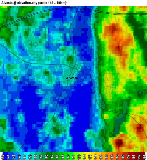
Below is the Elevation map of Alvesta, which displays elevation range with different colors. Scale of the first map is from 142 to 199 m (466 to 653 ft) with average elevation of 156.7 meters (=514 ft) [note 1]
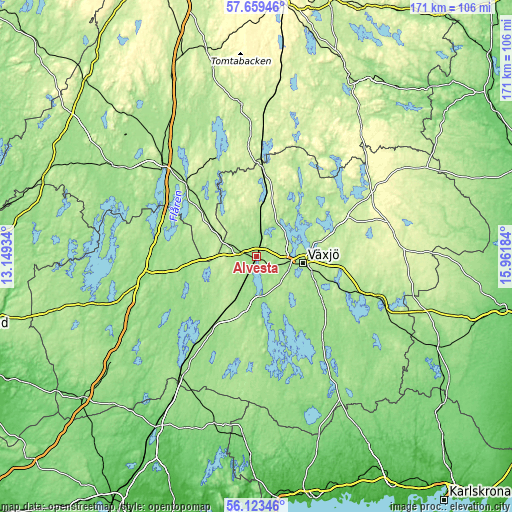
These maps also provides idea of topography and contour of this city, they are displayed at different zoom levels. More info about maps, scale and edge coordinates you can find below images.
| \ | Map #1 | Map #2 | Topo.Map |
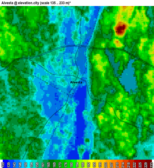
| Scale [m] | 142..199 m | 135..233 m | × |
| Scale [ft] | 466..653 ft | 443..764 ft | × |
| Average | 156.7 m = 514 ft | 163.5 m = 536 ft | × |
| Width | 5.34 km = 3.3 mi | 10.67 km = 6.6 mi | 170.8 km = 106.1 mi |
| Height | 5.34 km = 3.3 mi | 10.67 km = 6.6 mi | 170.8 km = 106.1 mi |
| ↑Max Latitude | 56.923341° | 56.947317° | 57.65946° |
| Latitude at center | 56.89935° | 56.89935° | 56.89935° |
| ↓Min Latitude | 56.875343° | 56.851321° | 56.12346° |
| ← Min Longitude | 14.511645° | 14.467699° | 13.14934° |
| Longitude center | 14.55559° | 14.55559° | 14.55559° |
| →Max Longitude | 14.599535° | 14.643481° | 15.96184° |
Nearby cities:
Cities around Alvesta sort by population:
• Växjö elevation 169 m
15.6 km,  98°
98°
• Hovmantorp 152 m
37.7 km,  109°
109°
• Rottne 190 m
24.6 km,  58°
58°
• Moheda 170 m
11.2 km,  3°
3°
• Vislanda 164 m
14.4 km,  206°
206°
• Ingelstad 160 m
27.5 km,  127°
127°
• Lammhult 210 m
29.8 km, 3°
• Braås 188 m
35.3 km, 58°
• Rydaholm 202 m
17.7 km,  302°
302°
• Lagan 148 m
34.8 km,  273°
273°
• Gemla 156 m
6.4 km,  123°
123°
• Bor 169 m
33.7 km,  315°
315°
Multilingual:
 En español:
Alvesta elevación 152 m.
 En France:
Alvesta élévation 152 m.


Sources and notes:
- [note 1] Map square and city borders are not equal. Map elevation data is calculated only from area inside that square.
- [src 1] Elevation data from geonames database provided with same terms of usage.
- [src 2] The elevation map of Alvesta is generated using elevation data from NASA's 3 arcsec (90m) resolution SRTM data.
- [src 3] Base (background) map © OpenStreetMap contributors tiles are generated by Geofabrik and OpenTopoMap.
Copyright & License:
This Alvesta Elevation Map is licensed under CC BY-SA. You may reuse any part from this page, if you give a proper credit by linking to this URL:
 More info on terms of use page.