Brunna elevation
Brunna (Stockholm, Upplands-Bro Kommun), Sweden elevation is 22 meters and Brunna elevation in feet is 72 ft above sea level [src 1]. Brunna is a populated place (feature code) with elevation that is 53 meters (174 ft) smaller than average city elevation in Sweden.
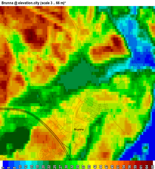
Below is the Elevation map of Brunna, which displays elevation range with different colors. Scale of the first map is from 3 to 66 m (10 to 217 ft) with average elevation of 35.7 meters (=117 ft) [note 1]
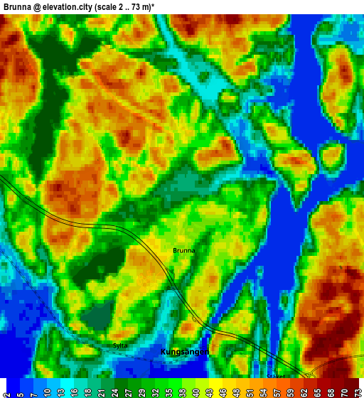
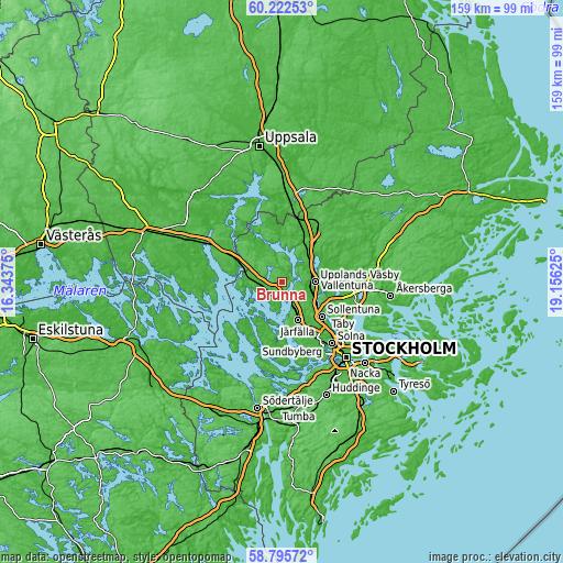
These maps also provides idea of topography and contour of this city, they are displayed at different zoom levels. More info about maps, scale and edge coordinates you can find below images.
| \ | Map #1 | Map #2 | Topo.Map |
| Scale [m] | 3..66 m | 2..73 m | × |
| Scale [ft] | 10..217 ft | 7..240 ft | × |
| Average | 35.7 m = 117 ft | 33.4 m = 110 ft | × |
| Width | 4.96 km = 3.1 mi | 9.91 km = 6.2 mi | 158.6 km = 98.5 mi |
| Height | 4.96 km = 3.1 mi | 9.91 km = 6.2 mi | 158.6 km = 98.5 mi |
| ↑Max Latitude | 59.538956° | 59.561226° | 60.22253° |
| Latitude at center | 59.51667° | 59.51667° | 59.51667° |
| ↓Min Latitude | 59.49437° | 59.472055° | 58.79572° |
| ← Min Longitude | 17.706055° | 17.662109° | 16.34375° |
| Longitude center | 17.75° | 17.75° | 17.75° |
| →Max Longitude | 17.793945° | 17.837891° | 19.15625° |
Nearby cities:
Cities around Brunna sort by population:
• Sollentuna elevation 25 m
15 km,  130°
130°
• Upplands Väsby 17 m
9.1 km,  88°
88°
• Märsta 19 m
13.1 km,  26°
26°
• Jakobsberg 25 m
11.5 km,  155°
155°
• Tensta 32 m
16.1 km,  147°
147°
• Bålsta 14 m
13.7 km,  294°
294°
• Kista 27 m
16.7 km,  138°
138°
• Kungsängen 39 m
4.2 km,  181°
181°
• Sigtuna 16 m
11.3 km,  352°
352°
• Bro 21 m
6.6 km,  270°
270°
• Akalla 42 m
14.6 km, 140°
• Rosersberg 32 m
10.6 km,  45°
45°
Multilingual:
 En español:
Brunna elevación 22 m.
 En France:
Brunna élévation 22 m.


Sources and notes:
- [note 1] Map square and city borders are not equal. Map elevation data is calculated only from area inside that square.
- [src 1] Elevation data from geonames database provided with same terms of usage.
- [src 2] The elevation map of Brunna is generated using elevation data from NASA's 3 arcsec (90m) resolution SRTM data.
- [src 3] Base (background) map © OpenStreetMap contributors tiles are generated by Geofabrik and OpenTopoMap.
Copyright & License:
This Brunna Elevation Map is licensed under CC BY-SA. You may reuse any part from this page, if you give a proper credit by linking to this URL:
 More info on terms of use page.