Hudiksvall elevation
Hudiksvall (Gävleborg, Hudiksvalls Kommun), Sweden elevation is 2 meters and Hudiksvall elevation in feet is 7 ft above sea level [src 1]. Hudiksvall is a seat of a second-order administrative division (feature code) with elevation that is 73 meters (240 ft) smaller than average city elevation in Sweden.
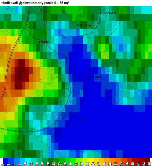
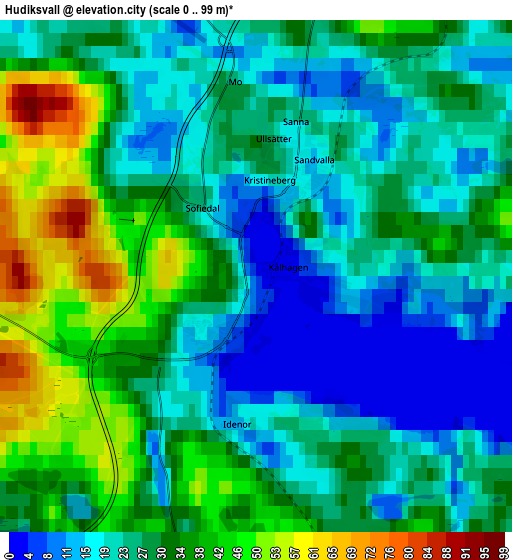
Below is the Elevation map of Hudiksvall, which displays elevation range with different colors. Scale of the first map is from 0 to 66 m (0 to 217 ft) with average elevation of 16.9 meters (=55 ft) [note 1]
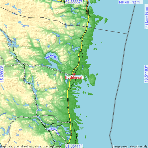
These maps also provides idea of topography and contour of this city, they are displayed at different zoom levels. More info about maps, scale and edge coordinates you can find below images.
| \ | Map #1 | Map #2 | Topo.Map |
| Scale [m] | 0..66 m | 0..99 m | × |
| Scale [ft] | 0..217 ft | 0..325 ft | × |
| Average | 16.9 m = 55 ft | 28.1 m = 92 ft | × |
| Width | 4.63 km = 2.9 mi | 9.26 km = 5.8 mi | 148.1 km = 92 mi |
| Height | 4.63 km = 2.9 mi | 9.26 km = 5.8 mi | 148.1 km = 92 mi |
| ↑Max Latitude | 61.748248° | 61.769043° | 62.38637° |
| Latitude at center | 61.72744° | 61.72744° | 61.72744° |
| ↓Min Latitude | 61.706618° | 61.685781° | 61.05411° |
| ← Min Longitude | 17.061635° | 17.017689° | 15.69933° |
| Longitude center | 17.10558° | 17.10558° | 17.10558° |
| →Max Longitude | 17.149525° | 17.193471° | 18.51183° |
Nearby cities:
Cities around Hudiksvall sort by population:
• Bollnäs elevation 38 m
56.5 km,  221°
221°
• Söderhamn 2 m
47.2 km,  182°
182°
• Ljusdal 132 m
54.5 km,  281°
281°
• Iggesund 30 m
9.6 km,  189°
189°
• Delsbo 62 m
30.1 km,  285°
285°
• Arbrå 107 m
48 km,  232°
232°
• Ljusne 2 m
57.4 km, 178°
• Sandarne 1 m
52.2 km, 177°
• Sörforsa 54 m
6.5 km, 275°
• Järvsö 111 m
49.5 km,  268°
268°
• Bergsjö 27 m
28.4 km,  355°
355°
• Gnarp 30 m
36.6 km,  12°
12°
Multilingual:
 En español:
Hudiksvall elevación 2 m.
 En France:
Hudiksvall élévation 2 m.
 Auf Deutsch:
Hudiksvall höhe über dem Meeresspiegel ist 2 m.

Sources and notes:
- [note 1] Map square and city borders are not equal. Map elevation data is calculated only from area inside that square.
- [src 1] Elevation data from geonames database provided with same terms of usage.
- [src 2] The elevation map of Hudiksvall is generated using GMTED2010 database with 7.5 arcsec (225m) resolution.
- [src 3] Base (background) map © OpenStreetMap contributors tiles are generated by Geofabrik and OpenTopoMap.
Copyright & License:
This Hudiksvall Elevation Map is licensed under CC BY-SA. You may reuse any part from this page, if you give a proper credit by linking to this URL:
 More info on terms of use page.