Morgongåva elevation
Morgongåva (Uppsala, Heby kommun), Sweden elevation is 75 meters and Morgongåva elevation in feet is 246 ft above sea level [src 1]. Morgongåva is a populated place (feature code) with elevation that is 0 meters (0 ft) bigger than average city elevation in Sweden.
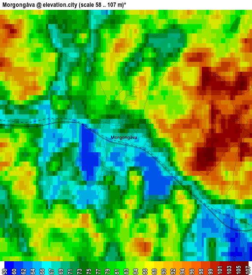
Below is the Elevation map of Morgongåva, which displays elevation range with different colors. Scale of the first map is from 58 to 107 m (190 to 351 ft) with average elevation of 80.6 meters (=264 ft) [note 1]
These maps also provides idea of topography and contour of this city, they are displayed at different zoom levels. More info about maps, scale and edge coordinates you can find below images.
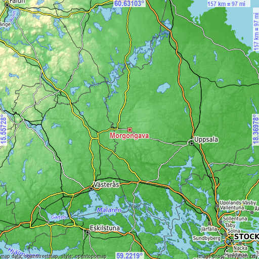
| \ | Map #1 | Topo.Map |
| Scale [m] | 58..107 m | × |
| Scale [ft] | 190..351 ft | × |
| Average | 80.6 m = 264 ft | × |
| Width | 4.9 km = 3 mi | 156.7 km = 97.4 mi |
| Height | 4.9 km = 3 mi | 156.7 km = 97.4 mi |
| ↑Max Latitude | 59.955959° | 60.63103° |
| Latitude at center | 59.93395° | 59.93395° |
| ↓Min Latitude | 59.911926° | 59.2219° |
| ← Min Longitude | 16.919585° | 15.55728° |
| Longitude center | 16.96353° | 16.96353° |
| →Max Longitude | 17.007475° | 18.36978° |
Nearby cities:
Cities around Morgongåva sort by population:
• Enköping elevation 16 m
33.7 km,  169°
169°
• Sala 62 m
20 km,  265°
265°
• Björklinge 25 m
34.4 km,  71°
71°
• Hökåsen 59 m
36.5 km,  215°
215°
• Heby 55 m
5.7 km, 274°
• Irsta 31 m
26.1 km,  183°
183°
• Bälinge 37 m
31.8 km,  86°
86°
• Tillberga 37 m
34 km,  214°
214°
• Östervåla 34 m
30.3 km,  23°
23°
• Lövstalöt 34 m
34.3 km, 85°
• Örsundsbro 15 m
29.2 km,  139°
139°
• Tärnsjö 53 m
24.1 km,  356°
356°
Multilingual:
 En español:
Morgongåva elevación 75 m.
 En France:
Morgongåva élévation 75 m.
 Auf Deutsch:
Morgongåva höhe über dem Meeresspiegel ist 75 m.

Sources and notes:
- [note 1] Map square and city borders are not equal. Map elevation data is calculated only from area inside that square.
- [src 1] Elevation data from geonames database provided with same terms of usage.
- [src 2] The elevation map of Morgongåva is generated using elevation data from NASA's 3 arcsec (90m) resolution SRTM data.
- [src 3] Base (background) map © OpenStreetMap contributors tiles are generated by Geofabrik and OpenTopoMap.
Copyright & License:
This Morgongåva Elevation Map is licensed under CC BY-SA. You may reuse any part from this page, if you give a proper credit by linking to this URL:
 More info on terms of use page.