Norrköping elevation
Norrköping (Östergötland, Norrköpings Kommun), Sweden elevation is 12 meters and Norrköping elevation in feet is 39 ft above sea level [src 1]. Norrköping is a seat of a second-order administrative division (feature code) with elevation that is 63 meters (207 ft) smaller than average city elevation in Sweden.
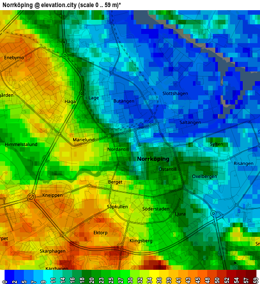
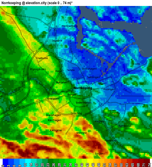
Below is the Elevation map of Norrköping, which displays elevation range with different colors. Scale of the first map is from 0 to 59 m (0 to 194 ft) with average elevation of 21.8 meters (=72 ft) [note 1]
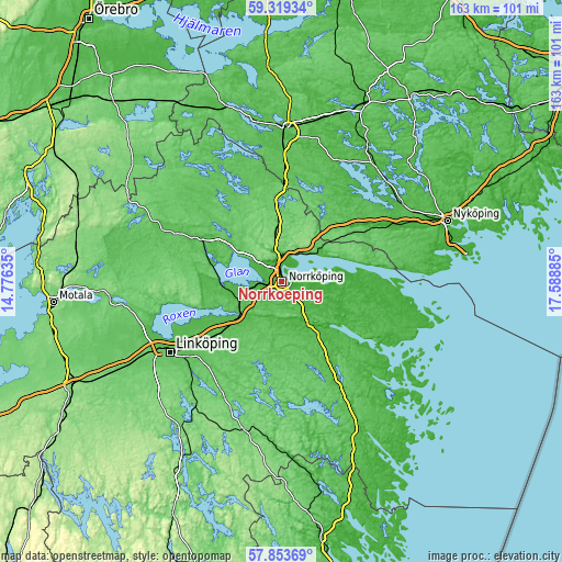
These maps also provides idea of topography and contour of this city, they are displayed at different zoom levels. More info about maps, scale and edge coordinates you can find below images.
| \ | Map #1 | Map #2 | Topo.Map |
| Scale [m] | 0..59 m | 0..74 m | × |
| Scale [ft] | 0..194 ft | 0..243 ft | × |
| Average | 21.8 m = 72 ft | 25.3 m = 83 ft | × |
| Width | 5.09 km = 3.2 mi | 10.18 km = 6.3 mi | 163 km = 101.3 mi |
| Height | 5.09 km = 3.2 mi | 10.18 km = 6.3 mi | 162.9 km = 101.2 mi |
| ↑Max Latitude | 58.617082° | 58.639959° | 59.31934° |
| Latitude at center | 58.59419° | 58.59419° | 58.59419° |
| ↓Min Latitude | 58.571283° | 58.548361° | 57.85369° |
| ← Min Longitude | 16.138655° | 16.094709° | 14.77635° |
| Longitude center | 16.1826° | 16.1826° | 16.1826° |
| →Max Longitude | 16.226545° | 16.270491° | 17.58885° |
Nearby cities:
Cities around Norrköping sort by population:
• Finspång elevation 46 m
27 km,  297°
297°
• Söderköping 8 m
15 km,  147°
147°
• Åby 27 m
8.1 km,  0°
0°
• Krokek 45 m
13.8 km,  50°
50°
• Lindö 5 m
4.6 km,  57°
57°
• Skärblacka 46 m
16.7 km,  259°
259°
• Svärtinge 92 m
11.2 km,  307°
307°
• Tallboda 48 m
34.6 km,  237°
237°
• Linghem 56 m
29.3 km,  232°
232°
• Ekängen 40 m
34.9 km,  246°
246°
• Jursla 27 m
8.1 km, 0°
• Kimstad 44 m
13.7 km, 248°
Multilingual:
 En español:
Norrköping elevación 12 m.
 En France:
Norrköping élévation 12 m.
 Auf Deutsch:
Norrköping höhe über dem Meeresspiegel ist 12 m.

Sources and notes:
- [note 1] Map square and city borders are not equal. Map elevation data is calculated only from area inside that square.
- [src 1] Elevation data from geonames database provided with same terms of usage.
- [src 2] The elevation map of Norrköping is generated using elevation data from NASA's 3 arcsec (90m) resolution SRTM data.
- [src 3] Base (background) map © OpenStreetMap contributors tiles are generated by Geofabrik and OpenTopoMap.
Copyright & License:
This Norrköping Elevation Map is licensed under CC BY-SA. You may reuse any part from this page, if you give a proper credit by linking to this URL:
 More info on terms of use page.