Staffanstorp elevation
Staffanstorp (Skåne, Staffanstorps Kommun), Sweden elevation is 17 meters and Staffanstorp elevation in feet is 56 ft above sea level [src 1]. Staffanstorp is a seat of a second-order administrative division (feature code) with elevation that is 58 meters (190 ft) smaller than average city elevation in Sweden.
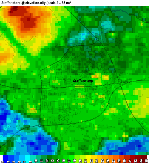
Below is the Elevation map of Staffanstorp, which displays elevation range with different colors. Scale of the first map is from 2 to 35 m (7 to 115 ft) with average elevation of 15.5 meters (=51 ft) [note 1]
These maps also provides idea of topography and contour of this city, they are displayed at different zoom levels. More info about maps, scale and edge coordinates you can find below images.
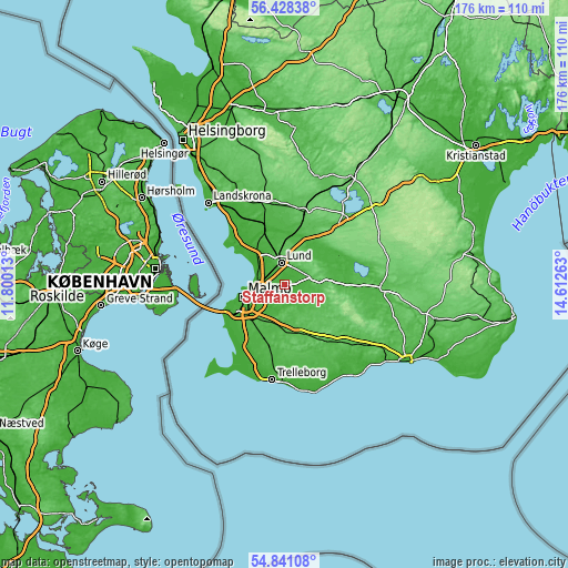
| \ | Map #1 | Map #2 | Topo.Map |
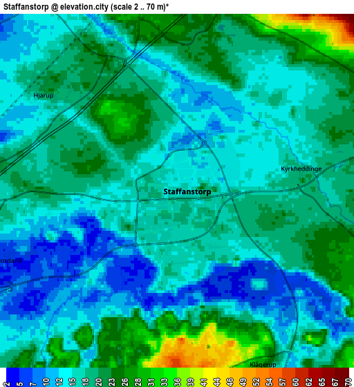
| Scale [m] | 2..35 m | 2..70 m | × |
| Scale [ft] | 7..115 ft | 7..230 ft | × |
| Average | 15.5 m = 51 ft | 17.9 m = 59 ft | × |
| Width | 5.52 km = 3.4 mi | 11.03 km = 6.9 mi | 176.5 km = 109.7 mi |
| Height | 5.52 km = 3.4 mi | 11.03 km = 6.9 mi | 176.5 km = 109.7 mi |
| ↑Max Latitude | 55.667563° | 55.69234° | 56.42838° |
| Latitude at center | 55.64277° | 55.64277° | 55.64277° |
| ↓Min Latitude | 55.617962° | 55.593137° | 54.84108° |
| ← Min Longitude | 13.162435° | 13.118489° | 11.80013° |
| Longitude center | 13.20638° | 13.20638° | 13.20638° |
| →Max Longitude | 13.250325° | 13.294271° | 14.61263° |
Nearby cities:
Cities around Staffanstorp sort by population:
• Lund elevation 51 m
7.1 km,  353°
353°
• Oxie 36 m
13.4 km,  211°
211°
• Lomma 1 m
9.3 km,  290°
290°
• Arlöv 7 m
8.5 km,  262°
262°
• Södra Sandby 31 m
12 km,  46°
46°
• Dalby 76 m
9.4 km,  73°
73°
• Åkarp 8 m
6.1 km,  281°
281°
• Hjärup 20 m
5.1 km,  304°
304°
• Bara 31 m
7 km,  194°
194°
• Genarp 41 m
13 km,  111°
111°
• Stångby 47 m
12 km,  357°
357°
• Klågerup 30 m
5.9 km,  155°
155°
Multilingual:
 En español:
Staffanstorp elevación 17 m.
 En France:
Staffanstorp élévation 17 m.
 Auf Deutsch:
Staffanstorp höhe über dem Meeresspiegel ist 17 m.

Sources and notes:
- [note 1] Map square and city borders are not equal. Map elevation data is calculated only from area inside that square.
- [src 1] Elevation data from geonames database provided with same terms of usage.
- [src 2] The elevation map of Staffanstorp is generated using elevation data from NASA's 3 arcsec (90m) resolution SRTM data.
- [src 3] Base (background) map © OpenStreetMap contributors tiles are generated by Geofabrik and OpenTopoMap.
Copyright & License:
This Staffanstorp Elevation Map is licensed under CC BY-SA. You may reuse any part from this page, if you give a proper credit by linking to this URL:
 More info on terms of use page.