Stenungsund elevation
Stenungsund (Västra Götaland, Stenungsunds Kommun), Sweden elevation is 6 meters and Stenungsund elevation in feet is 20 ft above sea level [src 1]. Stenungsund is a seat of a second-order administrative division (feature code) with elevation that is 69 meters (226 ft) smaller than average city elevation in Sweden.
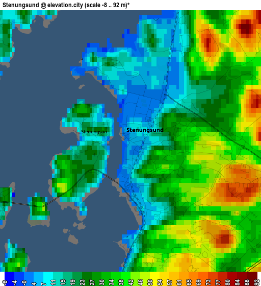
Below is the Elevation map of Stenungsund, which displays elevation range with different colors. Scale of the first map is from -8 to 92 m (-26 to 302 ft) with average elevation of 29.3 meters (=96 ft) [note 1]
These maps also provides idea of topography and contour of this city, they are displayed at different zoom levels. More info about maps, scale and edge coordinates you can find below images.
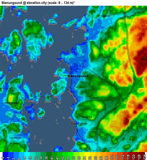
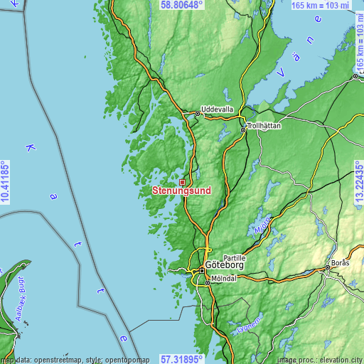
| \ | Map #1 | Map #2 | Topo.Map |
| Scale [m] | -8..92 m | -8..134 m | × |
| Scale [ft] | -26..302 ft | -26..440 ft | × |
| Average | 29.3 m = 96 ft | 41.7 m = 137 ft | × |
| Width | 5.17 km = 3.2 mi | 10.34 km = 6.4 mi | 165.4 km = 102.8 mi |
| Height | 5.17 km = 3.2 mi | 10.34 km = 6.4 mi | 165.4 km = 102.8 mi |
| ↑Max Latitude | 58.093694° | 58.116913° | 58.80648° |
| Latitude at center | 58.07046° | 58.07046° | 58.07046° |
| ↓Min Latitude | 58.047211° | 58.023946° | 57.31895° |
| ← Min Longitude | 11.774155° | 11.730209° | 10.41185° |
| Longitude center | 11.8181° | 11.8181° | 11.8181° |
| →Max Longitude | 11.862045° | 11.905991° | 13.22435° |
Nearby cities:
Cities around Stenungsund sort by population:
• Lilla Edet elevation 41 m
19.8 km,  69°
69°
• Ljungskile 4 m
18.1 km,  19°
19°
• Skärhamn 9 m
18 km,  238°
238°
• Stora Höga 11 m
6 km,  171°
171°
• Svanesund 25 m
8.1 km,  0°
0°
• Höviksnäs 1 m
5.1 km,  216°
216°
• Kode 27 m
14.3 km, 172°
• Jörlanda 18 m
9.4 km,  175°
175°
• Myggenäs 22 m
4.2 km,  256°
256°
• Ödsmål 16 m
3.8 km,  29°
29°
• Tjuvkil 26 m
19.6 km,  194°
194°
• Göta 46 m
20.1 km,  78°
78°
Multilingual:
 En español:
Stenungsund elevación 6 m.
 En France:
Stenungsund élévation 6 m.
 Auf Deutsch:
Stenungsund höhe über dem Meeresspiegel ist 6 m.

Sources and notes:
- [note 1] Map square and city borders are not equal. Map elevation data is calculated only from area inside that square.
- [src 1] Elevation data from geonames database provided with same terms of usage.
- [src 2] The elevation map of Stenungsund is generated using elevation data from NASA's 3 arcsec (90m) resolution SRTM data.
- [src 3] Base (background) map © OpenStreetMap contributors tiles are generated by Geofabrik and OpenTopoMap.
Copyright & License:
This Stenungsund Elevation Map is licensed under CC BY-SA. You may reuse any part from this page, if you give a proper credit by linking to this URL:
 More info on terms of use page.