Surahammar elevation
Surahammar (Västmanland, Surahammars Kommun), Sweden elevation is 72 meters and Surahammar elevation in feet is 236 ft above sea level [src 1]. Surahammar is a seat of a second-order administrative division (feature code) with elevation that is 3 meters (10 ft) smaller than average city elevation in Sweden.
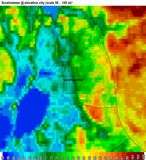
Below is the Elevation map of Surahammar, which displays elevation range with different colors. Scale of the first map is from 56 to 105 m (184 to 344 ft) with average elevation of 76.4 meters (=251 ft) [note 1]
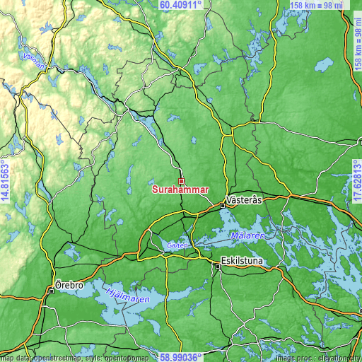
These maps also provides idea of topography and contour of this city, they are displayed at different zoom levels. More info about maps, scale and edge coordinates you can find below images.
| \ | Map #1 | Map #2 | Topo.Map |
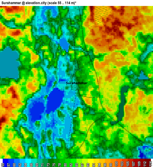
| Scale [m] | 56..105 m | 55..114 m | × |
| Scale [ft] | 184..344 ft | 180..374 ft | × |
| Average | 76.4 m = 251 ft | 80.8 m = 265 ft | × |
| Width | 4.93 km = 3.1 mi | 9.86 km = 6.1 mi | 157.8 km = 98.1 mi |
| Height | 4.93 km = 3.1 mi | 9.86 km = 6.1 mi | 157.7 km = 98 mi |
| ↑Max Latitude | 59.729409° | 59.751554° | 60.40911° |
| Latitude at center | 59.70725° | 59.70725° | 59.70725° |
| ↓Min Latitude | 59.685076° | 59.662887° | 58.99036° |
| ← Min Longitude | 16.177935° | 16.133989° | 14.81563° |
| Longitude center | 16.22188° | 16.22188° | 16.22188° |
| →Max Longitude | 16.265825° | 16.309771° | 17.62813° |
Nearby cities:
Cities around Surahammar sort by population:
• Västerås elevation 16 m
21.2 km,  118°
118°
• Köping 14 m
25.1 km,  210°
210°
• Hallstahammar 35 m
10.4 km,  177°
177°
• Skultuna 30 m
11 km,  84°
84°
• Hökåsen 59 m
20.8 km,  102°
102°
• Kolsva 47 m
24.9 km,  241°
241°
• Tillberga 37 m
22.3 km, 96°
• Kolbäck 24 m
15.8 km, 178°
• Barkarö 21 m
23.8 km,  137°
137°
• Ramnäs 76 m
6.7 km,  349°
349°
• Enhagen-Ekbacken 11 m
23.4 km,  132°
132°
• Dingtuna 21 m
17.6 km,  148°
148°
Multilingual:
 En español:
Surahammar elevación 72 m.
 En France:
Surahammar élévation 72 m.
 Auf Deutsch:
Surahammar höhe über dem Meeresspiegel ist 72 m.

Sources and notes:
- [note 1] Map square and city borders are not equal. Map elevation data is calculated only from area inside that square.
- [src 1] Elevation data from geonames database provided with same terms of usage.
- [src 2] The elevation map of Surahammar is generated using elevation data from NASA's 3 arcsec (90m) resolution SRTM data.
- [src 3] Base (background) map © OpenStreetMap contributors tiles are generated by Geofabrik and OpenTopoMap.
Copyright & License:
This Surahammar Elevation Map is licensed under CC BY-SA. You may reuse any part from this page, if you give a proper credit by linking to this URL:
 More info on terms of use page.