Viken elevation
Viken (Skåne, Höganäs Kommun), Sweden elevation is 7 meters and Viken elevation in feet is 23 ft above sea level [src 1]. Viken is a populated place (feature code) with elevation that is 68 meters (223 ft) smaller than average city elevation in Sweden.
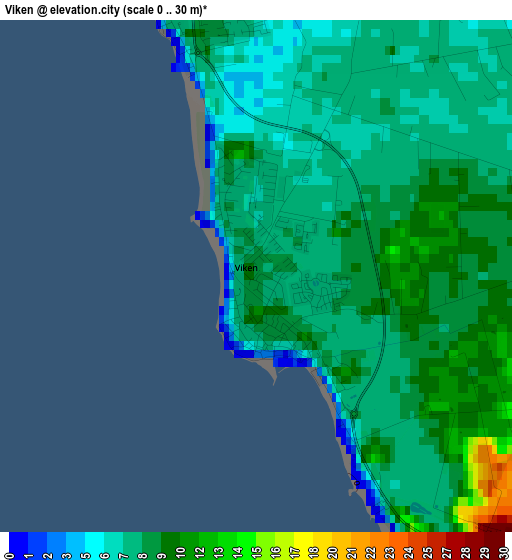
Below is the Elevation map of Viken, which displays elevation range with different colors. Scale of the first map is from 0 to 30 m (0 to 98 ft) with average elevation of 8.2 meters (=27 ft) [note 1]
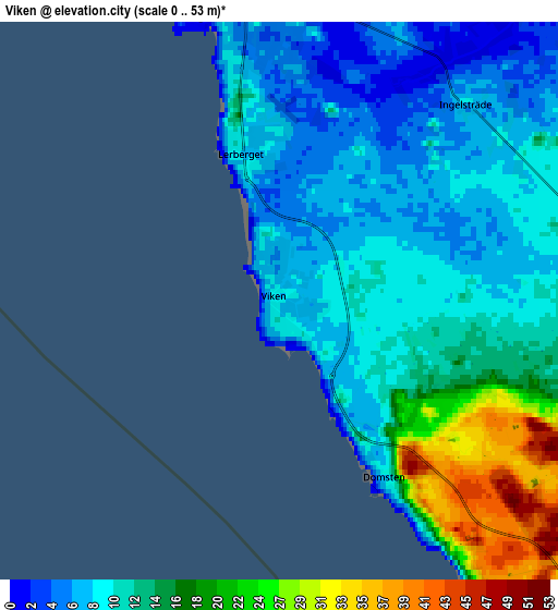
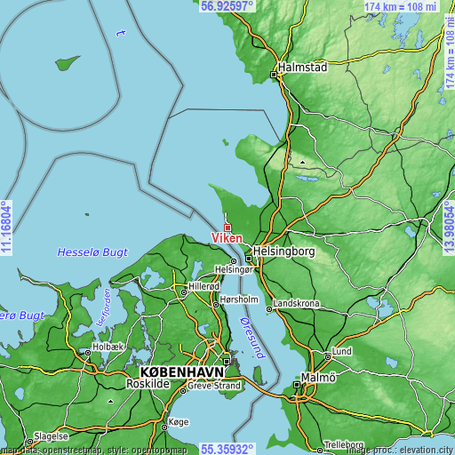
These maps also provides idea of topography and contour of this city, they are displayed at different zoom levels. More info about maps, scale and edge coordinates you can find below images.
| \ | Map #1 | Map #2 | Topo.Map |
| Scale [m] | 0..30 m | 0..53 m | × |
| Scale [ft] | 0..98 ft | 0..174 ft | × |
| Average | 8.2 m = 27 ft | 12.6 m = 41 ft | × |
| Width | 5.44 km = 3.4 mi | 10.89 km = 6.8 mi | 174.2 km = 108.2 mi |
| Height | 5.44 km = 3.4 mi | 10.89 km = 6.8 mi | 174.2 km = 108.2 mi |
| ↑Max Latitude | 56.1751° | 56.199555° | 56.92597° |
| Latitude at center | 56.15063° | 56.15063° | 56.15063° |
| ↓Min Latitude | 56.126144° | 56.101643° | 55.35932° |
| ← Min Longitude | 12.530345° | 12.486399° | 11.16804° |
| Longitude center | 12.57429° | 12.57429° | 12.57429° |
| →Max Longitude | 12.618235° | 12.662181° | 13.98054° |
Nearby cities:
Cities around Viken sort by population:
• Helsingborg elevation 13 m
13.7 km,  147°
147°
• Ängelholm 11 m
20.5 km,  60°
60°
• Höganäs 6 m
5.6 km,  349°
349°
• Ödåkra 29 m
11.9 km,  115°
115°
• Hittarp 5 m
6.7 km, 146°
• Påarp 54 m
19.9 km,  130°
130°
• Vejbystrand 14 m
22.1 km,  32°
32°
• Bårslöv 49 m
21.3 km,  137°
137°
• Hyllinge 13 m
18 km,  108°
108°
• Jonstorp 11 m
11 km, 33°
• Mörarp 50 m
21.6 km, 118°
• Strövelstorp 13 m
16.5 km,  82°
82°
Multilingual:
 En español:
Viken elevación 7 m.
 En France:
Viken élévation 7 m.


Sources and notes:
- [note 1] Map square and city borders are not equal. Map elevation data is calculated only from area inside that square.
- [src 1] Elevation data from geonames database provided with same terms of usage.
- [src 2] The elevation map of Viken is generated using elevation data from NASA's 3 arcsec (90m) resolution SRTM data.
- [src 3] Base (background) map © OpenStreetMap contributors tiles are generated by Geofabrik and OpenTopoMap.
Copyright & License:
This Viken Elevation Map is licensed under CC BY-SA. You may reuse any part from this page, if you give a proper credit by linking to this URL:
 More info on terms of use page.