Virserum elevation
Virserum (Kalmar, Hultsfreds Kommun), Sweden elevation is 129 meters and Virserum elevation in feet is 423 ft above sea level [src 1]. Virserum is a populated place (feature code) with elevation that is 54 meters (177 ft) bigger than average city elevation in Sweden.
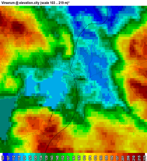
Below is the Elevation map of Virserum, which displays elevation range with different colors. Scale of the first map is from 103 to 219 m (338 to 719 ft) with average elevation of 154.5 meters (=507 ft) [note 1]
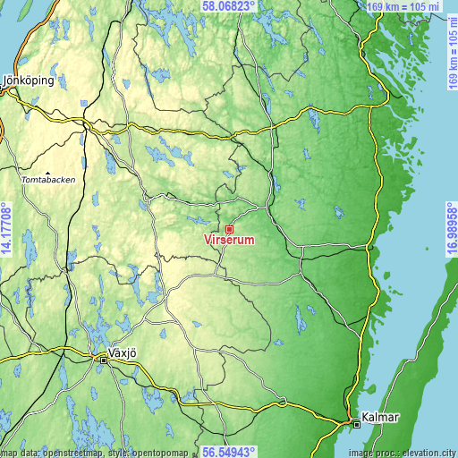
These maps also provides idea of topography and contour of this city, they are displayed at different zoom levels. More info about maps, scale and edge coordinates you can find below images.
| \ | Map #1 | Topo.Map |
| Scale [m] | 103..219 m | × |
| Scale [ft] | 338..719 ft | × |
| Average | 154.5 m = 507 ft | × |
| Width | 5.28 km = 3.3 mi | 168.9 km = 104.9 mi |
| Height | 5.28 km = 3.3 mi | 168.9 km = 104.9 mi |
| ↑Max Latitude | 57.340393° | 58.06823° |
| Latitude at center | 57.31667° | 57.31667° |
| ↓Min Latitude | 57.292932° | 56.54943° |
| ← Min Longitude | 15.539385° | 14.17708° |
| Longitude center | 15.58333° | 15.58333° |
| →Max Longitude | 15.627275° | 16.98958° |
Nearby cities:
Cities around Virserum sort by population:
• Vetlanda elevation 187 m
32.8 km,  292°
292°
• Vimmerby 124 m
42.1 km,  22°
22°
• Hultsfred 104 m
24.6 km,  39°
39°
• Åseda 238 m
21.7 km,  221°
221°
• Högsby 72 m
31.4 km,  122°
122°
• Lenhovda 266 m
39.6 km,  207°
207°
• Ekenässjön 227 m
38.8 km,  300°
300°
• Mariannelund 147 m
33.4 km,  358°
358°
• Landsbro 205 m
41.4 km,  277°
277°
• Målilla 97 m
15.6 km,  59°
59°
• Kristdala 73 m
38.4 km,  75°
75°
• Storebro 111 m
33.7 km,  28°
28°
Multilingual:
 En español:
Virserum elevación 129 m.
 En France:
Virserum élévation 129 m.
 Auf Deutsch:
Virserum höhe über dem Meeresspiegel ist 129 m.

Sources and notes:
- [note 1] Map square and city borders are not equal. Map elevation data is calculated only from area inside that square.
- [src 1] Elevation data from geonames database provided with same terms of usage.
- [src 2] The elevation map of Virserum is generated using elevation data from NASA's 3 arcsec (90m) resolution SRTM data.
- [src 3] Base (background) map © OpenStreetMap contributors tiles are generated by Geofabrik and OpenTopoMap.
Copyright & License:
This Virserum Elevation Map is licensed under CC BY-SA. You may reuse any part from this page, if you give a proper credit by linking to this URL:
 More info on terms of use page.