Wad az Zāki elevation
Wad az Zāki (White Nile), Sudan elevation is 390 meters and Wad az Zāki elevation in feet is 1280 ft above sea level [src 1]. Wad az Zāki is a populated place (feature code) with elevation that is 59 meters (194 ft) smaller than average city elevation in Sudan.
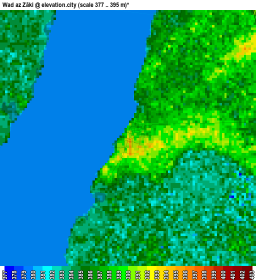
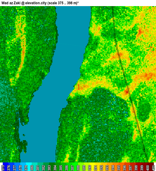
Below is the Elevation map of Wad az Zāki, which displays elevation range with different colors. Scale of the first map is from 377 to 395 m (1237 to 1296 ft) with average elevation of 383.5 meters (=1258 ft) [note 1]
These maps also provides idea of topography and contour of this city, they are displayed at different zoom levels. More info about maps, scale and edge coordinates you can find below images.
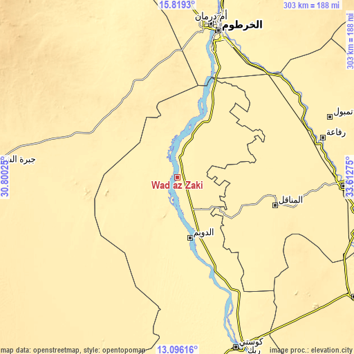
| \ | Map #1 | Map #2 | Topo.Map |
| Scale [m] | 377..395 m | 375..398 m | × |
| Scale [ft] | 1237..1296 ft | 1230..1306 ft | × |
| Average | 383.5 m = 1258 ft | 384.4 m = 1261 ft | × |
| Width | 9.46 km = 5.9 mi | 18.93 km = 11.8 mi | 302.8 km = 188.2 mi |
| Height | 9.46 km = 5.9 mi | 18.93 km = 11.8 mi | 302.8 km = 188.2 mi |
| ↑Max Latitude | 14.504449° | 14.546989° | 15.8193° |
| Latitude at center | 14.4619° | 14.4619° | 14.4619° |
| ↓Min Latitude | 14.419343° | 14.376778° | 13.09616° |
| ← Min Longitude | 32.162555° | 32.118609° | 30.80025° |
| Longitude center | 32.2065° | 32.2065° | 32.2065° |
| →Max Longitude | 32.250445° | 32.294391° | 33.61275° |
Nearby cities:
Cities around Wad az Zāki sort by population:
• Khartoum elevation 381 m
126.1 km,  16°
16°
• Al Manāqil 413 m
87.7 km,  105°
105°
• Ad Douiem 385 m
52.5 km,  167°
167°
• Al Hasaheisa 401 m
121.8 km,  74°
74°
• Kināna 437 m
114.2 km, 114°
• Al Qiţena 387 m
48 km, 21°
• Al Hilāliyya 398 m
122.6 km,  64°
64°
• Wad Rāwah 394 m
126.9 km,  52°
52°
• Al Kawa 385 m
85.6 km,  158°
158°
• Al Kiremit al ‘Arakiyyīn 405 m
80.4 km,  99°
99°
• Al Masallamiyya 407 m
122.4 km,  84°
84°
• Um Jar Al Gharbiyya 384 m
76.6 km, 163°
Multilingual:
 En español:
Wad az Zāki elevación 390 m.
 En France:
Wad az Zāki élévation 390 m.
 Auf Deutsch:
Wad az Zāki höhe über dem Meeresspiegel ist 390 m.

Sources and notes:
- [note 1] Map square and city borders are not equal. Map elevation data is calculated only from area inside that square.
- [src 1] Elevation data from geonames database provided with same terms of usage.
- [src 2] The elevation map of Wad az Zāki is generated using elevation data from NASA's 3 arcsec (90m) resolution SRTM data.
- [src 3] Base (background) map © OpenStreetMap contributors tiles are generated by Geofabrik and OpenTopoMap.
Copyright & License:
This Wad az Zāki Elevation Map is licensed under CC BY-SA. You may reuse any part from this page, if you give a proper credit by linking to this URL:
 More info on terms of use page.