Al Awjām elevation
Al Awjām (Eastern Province), Saudi Arabia elevation is 14 meters and Al Awjām elevation in feet is 46 ft above sea level [src 1]. Al Awjām is a populated place (feature code) with elevation that is 506 meters (1660 ft) smaller than average city elevation in Saudi Arabia.
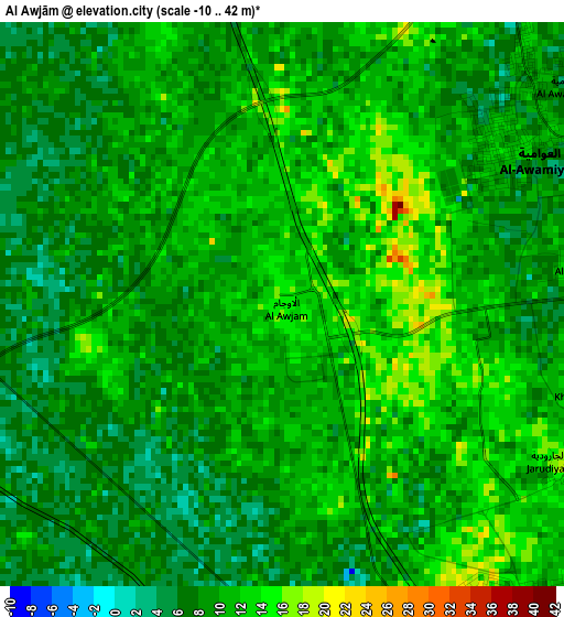
Below is the Elevation map of Al Awjām, which displays elevation range with different colors. Scale of the first map is from -10 to 42 m (-33 to 138 ft) with average elevation of 9.5 meters (=31 ft) [note 1]
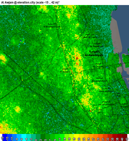
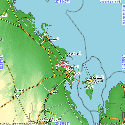
These maps also provides idea of topography and contour of this city, they are displayed at different zoom levels. More info about maps, scale and edge coordinates you can find below images.
| \ | Map #1 | Map #2 | Topo.Map |
| Scale [m] | -10..42 m | -15..42 m | × |
| Scale [ft] | -33..138 ft | -49..138 ft | × |
| Average | 9.5 m = 31 ft | 7.3 m = 24 ft | × |
| Width | 8.74 km = 5.4 mi | 17.48 km = 10.9 mi | 279.7 km = 173.8 mi |
| Height | 8.74 km = 5.4 mi | 17.48 km = 10.9 mi | 279.7 km = 173.8 mi |
| ↑Max Latitude | 26.60254° | 26.641826° | 27.81407° |
| Latitude at center | 26.56324° | 26.56324° | 26.56324° |
| ↓Min Latitude | 26.523927° | 26.4846° | 25.29861° |
| ← Min Longitude | 49.899365° | 49.855419° | 48.53706° |
| Longitude center | 49.94331° | 49.94331° | 49.94331° |
| →Max Longitude | 49.987255° | 50.031201° | 51.34956° |
Nearby cities:
Cities around Al Awjām sort by population:
• Dammam elevation 10 m
21.4 km,  131°
131°
• Al Jubayl 5 m
59.7 km,  327°
327°
• Khobar 8 m
41.1 km,  140°
140°
• Dhahran 44 m
34.9 km,  150°
150°
• Al Qaţīf 3 m
6.5 km,  87°
87°
• Tārūt 4 m
9.7 km,  83°
83°
• Sayhāt 3 m
13.7 km, 130°
• Şafwá 18 m
9.7 km,  7°
7°
• Raḩīmah 7 m
19.9 km,  36°
36°
• Abqaiq 103 m
75.1 km,  201°
201°
• Umm as Sāhik 9 m
10.4 km,  345°
345°
• At Tūbī 11 m
4.8 km,  97°
97°
Multilingual:
 En español:
Al Awjām elevación 14 m.
 En France:
Al Awjām élévation 14 m.


Sources and notes:
- [note 1] Map square and city borders are not equal. Map elevation data is calculated only from area inside that square.
- [src 1] Elevation data from geonames database provided with same terms of usage.
- [src 2] The elevation map of Al Awjām is generated using elevation data from NASA's 3 arcsec (90m) resolution SRTM data.
- [src 3] Base (background) map © OpenStreetMap contributors tiles are generated by Geofabrik and OpenTopoMap.
Copyright & License:
This Al Awjām Elevation Map is licensed under CC BY-SA. You may reuse any part from this page, if you give a proper credit by linking to this URL:
 More info on terms of use page.