As Sulayyil elevation
As Sulayyil (Ar Riyāḑ), Saudi Arabia elevation is 606 meters and As Sulayyil elevation in feet is 1988 ft above sea level [src 1]. As Sulayyil is a populated place (feature code) with elevation that is 86 meters (282 ft) bigger than average city elevation in Saudi Arabia.
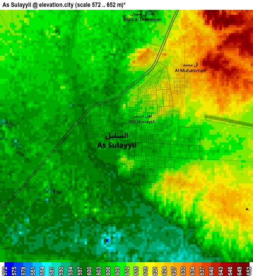
Below is the Elevation map of As Sulayyil, which displays elevation range with different colors. Scale of the first map is from 572 to 652 m (1877 to 2139 ft) with average elevation of 609 meters (=1998 ft) [note 1]
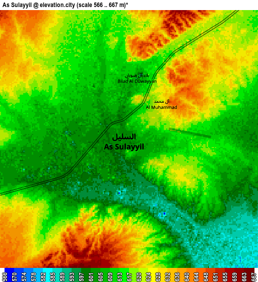
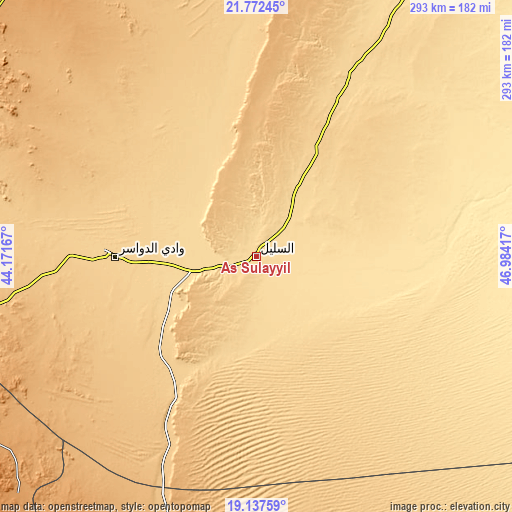
These maps also provides idea of topography and contour of this city, they are displayed at different zoom levels. More info about maps, scale and edge coordinates you can find below images.
| \ | Map #1 | Map #2 | Topo.Map |
| Scale [m] | 572..652 m | 566..667 m | × |
| Scale [ft] | 1877..2139 ft | 1857..2188 ft | × |
| Average | 609 m = 1998 ft | 615.6 m = 2020 ft | × |
| Width | 9.16 km = 5.7 mi | 18.31 km = 11.4 mi | 293 km = 182.1 mi |
| Height | 9.16 km = 5.7 mi | 18.31 km = 11.4 mi | 293 km = 182.1 mi |
| ↑Max Latitude | 20.501837° | 20.542994° | 21.77245° |
| Latitude at center | 20.46067° | 20.46067° | 20.46067° |
| ↓Min Latitude | 20.419492° | 20.378302° | 19.13759° |
| ← Min Longitude | 45.533975° | 45.490029° | 44.17167° |
| Longitude center | 45.57792° | 45.57792° | 45.57792° |
| →Max Longitude | 45.621865° | 45.665811° | 46.98417° |
Nearby cities:
Cities around As Sulayyil sort by population:
• Khamis Mushait elevation 1998 m
383 km,  231°
231°
• Najrān 1310 m
363.5 km,  204°
204°
• Abha 2228 m
407.6 km, 232°
• Qal‘at Bīshah 1168 m
314.3 km,  260°
260°
• Ad Dilam 453 m
425 km,  22°
22°
• An Nimāş 2385 m
390.2 km,  247°
247°
• Al Majāridah 429 m
411.4 km, 248°
• Tabālah 1233 m
336.4 km, 260°
Multilingual:
 En español:
As Sulayyil elevación 606 m.
 En France:
As Sulayyil élévation 606 m.
 Auf Deutsch:
As Sulayyil höhe über dem Meeresspiegel ist 606 m.

Sources and notes:
- [note 1] Map square and city borders are not equal. Map elevation data is calculated only from area inside that square.
- [src 1] Elevation data from geonames database provided with same terms of usage.
- [src 2] The elevation map of As Sulayyil is generated using elevation data from NASA's 3 arcsec (90m) resolution SRTM data.
- [src 3] Base (background) map © OpenStreetMap contributors tiles are generated by Geofabrik and OpenTopoMap.
Copyright & License:
This As Sulayyil Elevation Map is licensed under CC BY-SA. You may reuse any part from this page, if you give a proper credit by linking to this URL:
 More info on terms of use page.