Şabyā elevation
Şabyā (Jizan), Saudi Arabia elevation is 36 meters and Şabyā elevation in feet is 118 ft above sea level [src 1]. Şabyā is a populated place (feature code) with elevation that is 484 meters (1588 ft) smaller than average city elevation in Saudi Arabia.
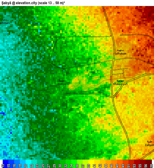
Below is the Elevation map of Şabyā, which displays elevation range with different colors. Scale of the first map is from 13 to 58 m (43 to 190 ft) with average elevation of 34.1 meters (=112 ft) [note 1]
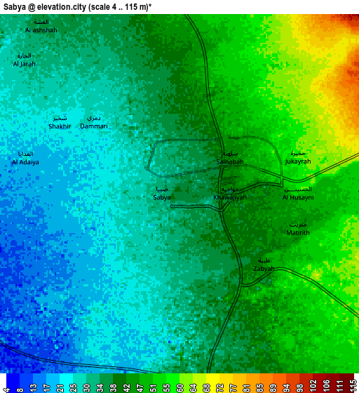
These maps also provides idea of topography and contour of this city, they are displayed at different zoom levels. More info about maps, scale and edge coordinates you can find below images.
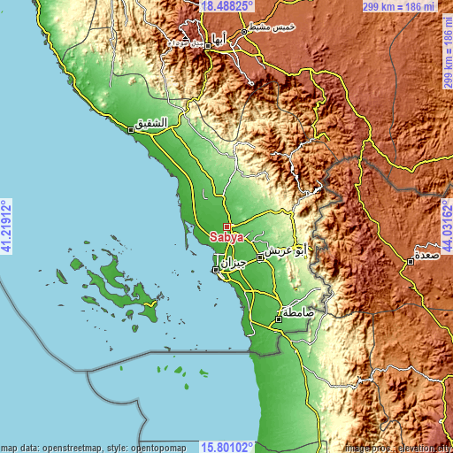
| \ | Map #1 | Map #2 | Topo.Map |
| Scale [m] | 13..58 m | 4..115 m | × |
| Scale [ft] | 43..190 ft | 13..377 ft | × |
| Average | 34.1 m = 112 ft | 37.6 m = 123 ft | × |
| Width | 9.34 km = 5.8 mi | 18.68 km = 11.6 mi | 298.8 km = 185.7 mi |
| Height | 9.34 km = 5.8 mi | 18.68 km = 11.6 mi | 298.8 km = 185.7 mi |
| ↑Max Latitude | 17.191487° | 17.233464° | 18.48825° |
| Latitude at center | 17.1495° | 17.1495° | 17.1495° |
| ↓Min Latitude | 17.107504° | 17.065498° | 15.80102° |
| ← Min Longitude | 42.581425° | 42.537479° | 41.21912° |
| Longitude center | 42.62537° | 42.62537° | 42.62537° |
| →Max Longitude | 42.669315° | 42.713261° | 44.03162° |
Nearby cities:
Cities around Şabyā sort by population:
• Khamis Mushait elevation 1998 m
128.4 km,  5°
5°
• Najrān 1310 m
164 km,  76°
76°
• Abha 2228 m
119.3 km,  353°
353°
• Jizan 19 m
30 km,  195°
195°
• Abū ‘Arīsh 69 m
29.8 km,  132°
132°
• Şāmitah 62 m
70.3 km,  151°
151°
• An Nimāş 2385 m
228.3 km, 346°
• Farasān 22 m
73.4 km,  227°
227°
• Al Jarādīyah 49 m
70.4 km, 154°
• Mislīyah 127 m
35.3 km, 348°
• Mizhirah 21 m
37.7 km,  162°
162°
• Ad Darb 73 m
75 km,  328°
328°
Multilingual:
 En español:
Şabyā elevación 36 m.
 En France:
Şabyā élévation 36 m.


Sources and notes:
- [note 1] Map square and city borders are not equal. Map elevation data is calculated only from area inside that square.
- [src 1] Elevation data from geonames database provided with same terms of usage.
- [src 2] The elevation map of Şabyā is generated using elevation data from NASA's 3 arcsec (90m) resolution SRTM data.
- [src 3] Base (background) map © OpenStreetMap contributors tiles are generated by Geofabrik and OpenTopoMap.
Copyright & License:
This Şabyā Elevation Map is licensed under CC BY-SA. You may reuse any part from this page, if you give a proper credit by linking to this URL:
 More info on terms of use page.