Belokurikha elevation
Belokurikha (Altai Krai), Russia elevation is 251 meters and Belokurikha elevation in feet is 823 ft above sea level [src 1]. Belokurikha is a populated place (feature code) with elevation that is 52 meters (171 ft) bigger than average city elevation in Russia.
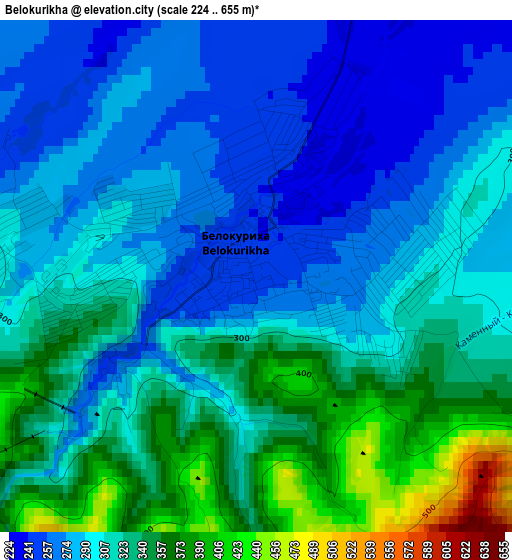
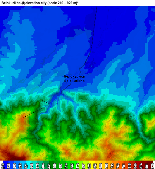
Below is the Elevation map of Belokurikha, which displays elevation range with different colors. Scale of the first map is from 224 to 655 m (735 to 2149 ft) with average elevation of 309.6 meters (=1016 ft) [note 1]
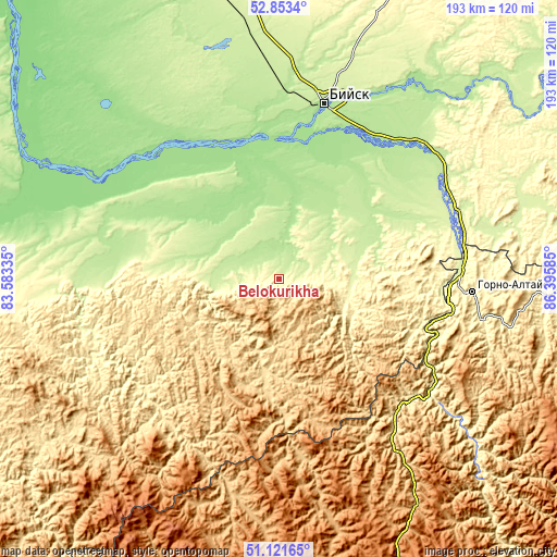
These maps also provides idea of topography and contour of this city, they are displayed at different zoom levels. More info about maps, scale and edge coordinates you can find below images.
| \ | Map #1 | Map #2 | Topo.Map |
| Scale [m] | 224..655 m | 210..929 m | × |
| Scale [ft] | 735..2149 ft | 689..3048 ft | × |
| Average | 309.6 m = 1016 ft | 369.6 m = 1213 ft | × |
| Width | 6.02 km = 3.7 mi | 12.03 km = 7.5 mi | 192.6 km = 119.7 mi |
| Height | 6.02 km = 3.7 mi | 12.03 km = 7.5 mi | 192.5 km = 119.6 mi |
| ↑Max Latitude | 52.02295° | 52.049983° | 52.8534° |
| Latitude at center | 51.9959° | 51.9959° | 51.9959° |
| ↓Min Latitude | 51.968834° | 51.941751° | 51.12165° |
| ← Min Longitude | 84.945655° | 84.901709° | 83.58335° |
| Longitude center | 84.9896° | 84.9896° | 84.9896° |
| →Max Longitude | 85.033545° | 85.077491° | 86.39585° |
Nearby cities:
Cities around Belokurikha sort by population:
• Altayskoye elevation 288 m
24 km,  101°
101°
• Smolenskoye 181 m
34.8 km,  10°
10°
• Sovetskoye 207 m
43.3 km,  41°
41°
• Bystryy Istok 155 m
58.5 km,  315°
315°
• Aya 270 m
55.9 km, 95°
• Sychëvka 207 m
15.7 km,  293°
293°
• Verkh-Katunskoye 192 m
58.8 km,  30°
30°
• Lesnoye 190 m
55.7 km,  18°
18°
• Novotyryshkino 198 m
11.2 km,  330°
330°
• Manzherok 282 m
56.9 km,  108°
108°
• Starobelokurikha 213 m
9.2 km,  47°
47°
• Krasnyy Yar 181 m
46.7 km, 30°
Multilingual:
 En español:
Belokúrija elevación 251 m.
 En France:
Belokourikha élévation 251 m.
 Auf Deutsch:
Belokuricha höhe über dem Meeresspiegel ist 251 m.

Sources and notes:
- [note 1] Map square and city borders are not equal. Map elevation data is calculated only from area inside that square.
- [src 1] Elevation data from geonames database provided with same terms of usage.
- [src 2] The elevation map of Belokurikha is generated using elevation data from NASA's 3 arcsec (90m) resolution SRTM data.
- [src 3] Base (background) map © OpenStreetMap contributors tiles are generated by Geofabrik and OpenTopoMap.
Copyright & License:
This Belokurikha Elevation Map is licensed under CC BY-SA. You may reuse any part from this page, if you give a proper credit by linking to this URL:
 More info on terms of use page.