Igarka elevation
Igarka (Krasnoyarskiy), Russia elevation is 30 meters and Igarka elevation in feet is 98 ft above sea level [src 1]. Igarka is a populated place (feature code) with elevation that is 169 meters (554 ft) smaller than average city elevation in Russia.
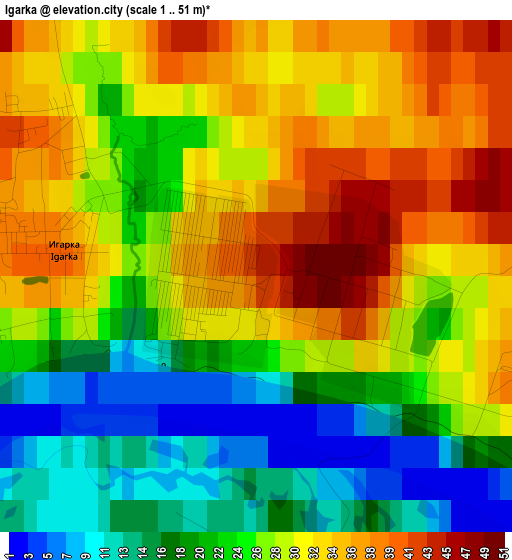
Below is the Elevation map of Igarka, which displays elevation range with different colors. Scale of the first map is from 1 to 51 m (3 to 167 ft) with average elevation of 26.8 meters (=88 ft) [note 1]
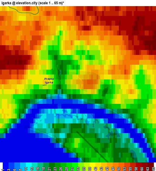
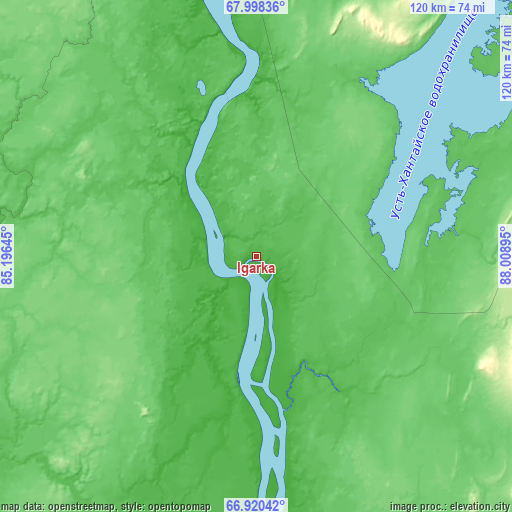
These maps also provides idea of topography and contour of this city, they are displayed at different zoom levels. More info about maps, scale and edge coordinates you can find below images.
| \ | Map #1 | Map #2 | Topo.Map |
| Scale [m] | 1..51 m | 1..65 m | × |
| Scale [ft] | 3..167 ft | 3..213 ft | × |
| Average | 26.8 m = 88 ft | 32.7 m = 107 ft | × |
| Width | 3.75 km = 2.3 mi | 7.49 km = 4.7 mi | 119.9 km = 74.5 mi |
| Height | 3.75 km = 2.3 mi | 7.49 km = 4.7 mi | 119.8 km = 74.4 mi |
| ↑Max Latitude | 67.482336° | 67.499159° | 67.99836° |
| Latitude at center | 67.4655° | 67.4655° | 67.4655° |
| ↓Min Latitude | 67.448652° | 67.431793° | 66.92042° |
| ← Min Longitude | 86.558755° | 86.514809° | 85.19645° |
| Longitude center | 86.6027° | 86.6027° | 86.6027° |
| →Max Longitude | 86.646645° | 86.690591° | 88.00895° |
Nearby cities:
Cities around Igarka sort by population:
• Norilsk elevation 76 m
219.9 km,  17°
17°
• Talnakh 56 m
236.3 km, 18°
• Kayyerkan 62 m
217.8 km,  12°
12°
• Dudinka 24 m
216.4 km,  355°
355°
• Turukhansk 39 m
195 km,  162°
162°
• Svetlogorsk 84 m
95.5 km,  127°
127°
• Snezhnogorsk 37 m
84.6 km,  34°
34°
Multilingual:
 En español:
Igarka elevación 30 m.
 En France:
Igarka élévation 30 m.


Sources and notes:
- [note 1] Map square and city borders are not equal. Map elevation data is calculated only from area inside that square.
- [src 1] Elevation data from geonames database provided with same terms of usage.
- [src 2] The elevation map of Igarka is generated using GMTED2010 database with 7.5 arcsec (225m) resolution.
- [src 3] Base (background) map © OpenStreetMap contributors tiles are generated by Geofabrik and OpenTopoMap.
Copyright & License:
This Igarka Elevation Map is licensed under CC BY-SA. You may reuse any part from this page, if you give a proper credit by linking to this URL:
 More info on terms of use page.