Mikhaylovskoye elevation
Mikhaylovskoye (Altai Krai), Russia elevation is 172 meters and Mikhaylovskoye elevation in feet is 564 ft above sea level [src 1]. Mikhaylovskoye is a populated place (feature code) with elevation that is 27 meters (89 ft) smaller than average city elevation in Russia.
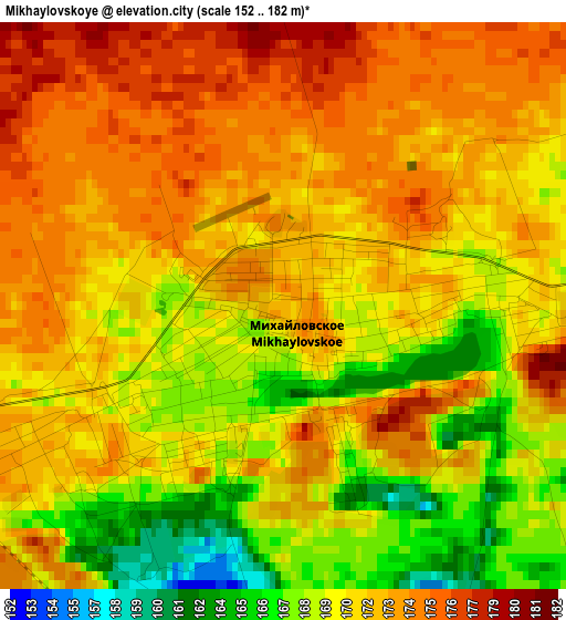
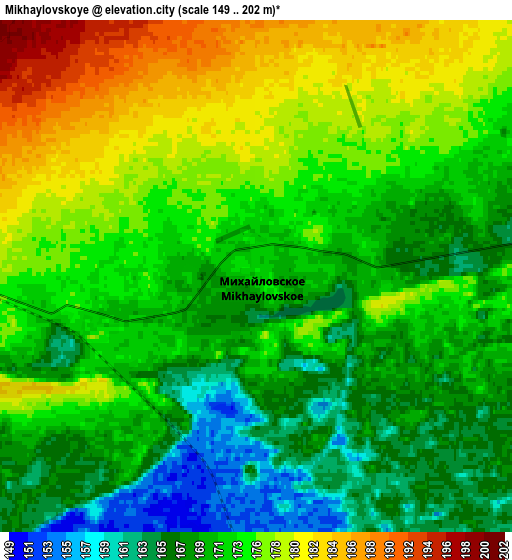
Below is the Elevation map of Mikhaylovskoye, which displays elevation range with different colors. Scale of the first map is from 152 to 182 m (499 to 597 ft) with average elevation of 171.2 meters (=562 ft) [note 1]
These maps also provides idea of topography and contour of this city, they are displayed at different zoom levels. More info about maps, scale and edge coordinates you can find below images.
| \ | Map #1 | Map #2 | Topo.Map |
| Scale [m] | 152..182 m | 149..202 m | × |
| Scale [ft] | 499..597 ft | 489..663 ft | × |
| Average | 171.2 m = 562 ft | 172.6 m = 566 ft | × |
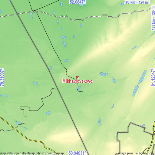
| Width | 6.04 km = 3.8 mi | 12.08 km = 7.5 mi | 193.3 km = 120.1 mi |
| Height | 6.04 km = 3.8 mi | 12.08 km = 7.5 mi | 193.3 km = 120.1 mi |
| ↑Max Latitude | 51.851044° | 51.878181° | 52.6847° |
| Latitude at center | 51.82389° | 51.82389° | 51.82389° |
| ↓Min Latitude | 51.79672° | 51.769534° | 50.94631° |
| ← Min Longitude | 79.673275° | 79.629329° | 78.31097° |
| Longitude center | 79.71722° | 79.71722° | 79.71722° |
| →Max Longitude | 79.761165° | 79.805111° | 81.12347° |
Nearby cities:
Cities around Mikhaylovskoye sort by population:
• Rubtsovsk elevation 220 m
108.3 km,  108°
108°
• Kulunda 136 m
98.1 km,  327°
327°
• Blagoveshchenka 109 m
112.7 km,  5°
5°
• Volchikha 206 m
48.7 km,  64°
64°
• Rodino 162 m
81.9 km,  23°
23°
• Klyuchi 143 m
60.7 km,  321°
321°
• Veseloyarsk 231 m
113.1 km,  121°
121°
• Uglovskoye 189 m
61.6 km,  147°
147°
• Malinovoye Ozero 156 m
17.1 km,  164°
164°
• Severka 143 m
45.5 km, 319°
• Nikolayevka 149 m
23.6 km,  298°
298°
• Bastan 182 m
17.1 km,  283°
283°
Multilingual:
 En español:
Mikhaylovskoye elevación 172 m.
 En France:
Mikhaylovskoye élévation 172 m.
 Auf Deutsch:
Mikhaylovskoye höhe über dem Meeresspiegel ist 172 m.
 На русском:
Михайловский, Михайловское высота над уровнем моря 172 м
Sources and notes:
- [note 1] Map square and city borders are not equal. Map elevation data is calculated only from area inside that square.
- [src 1] Elevation data from geonames database provided with same terms of usage.
- [src 2] The elevation map of Mikhaylovskoye is generated using elevation data from NASA's 3 arcsec (90m) resolution SRTM data.
- [src 3] Base (background) map © OpenStreetMap contributors tiles are generated by Geofabrik and OpenTopoMap.
Copyright & License:
This Mikhaylovskoye Elevation Map is licensed under CC BY-SA. You may reuse any part from this page, if you give a proper credit by linking to this URL:
 More info on terms of use page.