Rudnichnyy elevation
Rudnichnyy (Kemerovo Oblast), Russia elevation is 154 meters and Rudnichnyy elevation in feet is 505 ft above sea level [src 1]. Rudnichnyy is a populated place (feature code) with elevation that is 45 meters (148 ft) smaller than average city elevation in Russia.
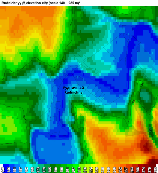
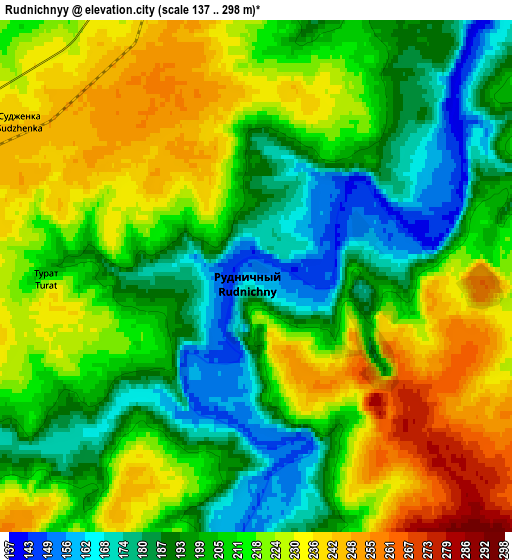
Below is the Elevation map of Rudnichnyy, which displays elevation range with different colors. Scale of the first map is from 140 to 285 m (459 to 935 ft) with average elevation of 190.5 meters (=625 ft) [note 1]
These maps also provides idea of topography and contour of this city, they are displayed at different zoom levels. More info about maps, scale and edge coordinates you can find below images.
| \ | Map #1 | Map #2 | Topo.Map |
| Scale [m] | 140..285 m | 137..298 m | × |
| Scale [ft] | 459..935 ft | 449..978 ft | × |
| Average | 190.5 m = 625 ft | 210.1 m = 689 ft | × |
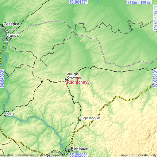
| Width | 5.45 km = 3.4 mi | 10.91 km = 6.8 mi | 174.5 km = 108.4 mi |
| Height | 5.45 km = 3.4 mi | 10.91 km = 6.8 mi | 174.5 km = 108.4 mi |
| ↑Max Latitude | 56.109202° | 56.133699° | 56.86137° |
| Latitude at center | 56.08469° | 56.08469° | 56.08469° |
| ↓Min Latitude | 56.060162° | 56.035619° | 55.29203° |
| ← Min Longitude | 86.205935° | 86.161989° | 84.84363° |
| Longitude center | 86.24988° | 86.24988° | 86.24988° |
| →Max Longitude | 86.293825° | 86.337771° | 87.65613° |
Nearby cities:
Cities around Rudnichnyy sort by population:
• Kemerovo elevation 135 m
84.2 km,  187°
187°
• Anzhero-Sudzhensk 204 m
13.7 km,  268°
268°
• Berëzovskiy 227 m
54 km,  183°
183°
• Tayga 261 m
39 km, 266°
• Kedrovka 187 m
62.6 km, 191°
• Yashkino 256 m
56.3 km,  245°
245°
• Yaya 141 m
17.9 km,  41°
41°
• Promyshlennovskiy 197 m
66.9 km, 182°
• Izhmorskiy 240 m
27.1 km,  63°
63°
• Borovoy 169 m
73.2 km, 188°
• Bogashevo 187 m
75.3 km,  294°
294°
• Barzas 260 m
39.8 km,  173°
173°
Multilingual:
 En español:
Rudnichnyy elevación 154 m.
 En France:
Rudnichnyy élévation 154 m.
 Auf Deutsch:
Rudnichnyy höhe über dem Meeresspiegel ist 154 m.

Sources and notes:
- [note 1] Map square and city borders are not equal. Map elevation data is calculated only from area inside that square.
- [src 1] Elevation data from geonames database provided with same terms of usage.
- [src 2] The elevation map of Rudnichnyy is generated using elevation data from NASA's 3 arcsec (90m) resolution SRTM data.
- [src 3] Base (background) map © OpenStreetMap contributors tiles are generated by Geofabrik and OpenTopoMap.
Copyright & License:
This Rudnichnyy Elevation Map is licensed under CC BY-SA. You may reuse any part from this page, if you give a proper credit by linking to this URL:
 More info on terms of use page.