Sharypovo elevation
Sharypovo (Krasnoyarskiy), Russia elevation is 305 meters and Sharypovo elevation in feet is 1001 ft above sea level [src 1]. Sharypovo is a populated place (feature code) with elevation that is 106 meters (348 ft) bigger than average city elevation in Russia.
Below is the Elevation map of Sharypovo, which displays elevation range with different colors. Scale of the first map is from 293 to 337 m (961 to 1106 ft) with average elevation of 314.3 meters (=1031 ft) [note 1]
These maps also provides idea of topography and contour of this city, they are displayed at different zoom levels. More info about maps, scale and edge coordinates you can find below images.
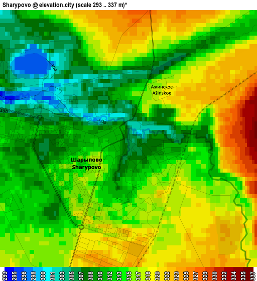
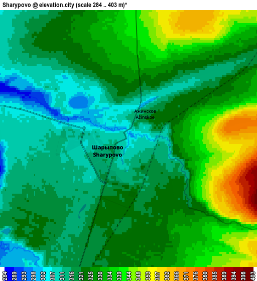
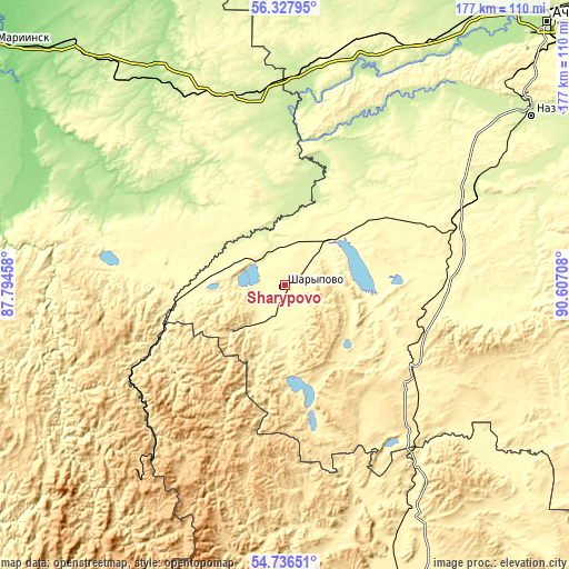
| \ | Map #1 | Map #2 | Topo.Map |
| Scale [m] | 293..337 m | 284..403 m | × |
| Scale [ft] | 961..1106 ft | 932..1322 ft | × |
| Average | 314.3 m = 1031 ft | 325.1 m = 1067 ft | × |
| Width | 5.53 km = 3.4 mi | 11.06 km = 6.9 mi | 177 km = 110 mi |
| Height | 5.53 km = 3.4 mi | 11.06 km = 6.9 mi | 176.9 km = 109.9 mi |
| ↑Max Latitude | 55.565138° | 55.589979° | 56.32795° |
| Latitude at center | 55.54028° | 55.54028° | 55.54028° |
| ↓Min Latitude | 55.515407° | 55.490518° | 54.73651° |
| ← Min Longitude | 89.156885° | 89.112939° | 87.79458° |
| Longitude center | 89.20083° | 89.20083° | 89.20083° |
| →Max Longitude | 89.244775° | 89.288721° | 90.60708° |
Nearby cities:
Cities around Sharypovo sort by population:
• Achinsk elevation 207 m
114.6 km,  44°
44°
• Nazarovo 253 m
91.5 km,  55°
55°
• Bogotol 300 m
77.1 km,  15°
15°
• Uzhur 373 m
47.3 km,  122°
122°
• Tyazhinskiy 210 m
76.8 km,  326°
326°
• Dubinino 298 m
11.2 km,  321°
321°
• Tisul’ 200 m
60.9 km,  293°
293°
• Verkh-Chebula 155 m
112.8 km,  298°
298°
• Tyukhtet 203 m
111.3 km,  3°
3°
• Itatskiy 240 m
59.8 km,  350°
350°
• Belogorsk 703 m
73.5 km,  217°
217°
• Suslovo 192 m
101.1 km, 318°
Multilingual:
 En español:
Šarypovo elevación 305 m.
 En France:
Charypovo élévation 305 m.
 Auf Deutsch:
Scharypowo höhe über dem Meeresspiegel ist 305 m.

Sources and notes:
- [note 1] Map square and city borders are not equal. Map elevation data is calculated only from area inside that square.
- [src 1] Elevation data from geonames database provided with same terms of usage.
- [src 2] The elevation map of Sharypovo is generated using elevation data from NASA's 3 arcsec (90m) resolution SRTM data.
- [src 3] Base (background) map © OpenStreetMap contributors tiles are generated by Geofabrik and OpenTopoMap.
Copyright & License:
This Sharypovo Elevation Map is licensed under CC BY-SA. You may reuse any part from this page, if you give a proper credit by linking to this URL:
 More info on terms of use page.