Vlasikha elevation
Vlasikha (Altai Krai, Barnaul Urban Okrug), Russia elevation is 176 meters and Vlasikha elevation in feet is 577 ft above sea level [src 1]. Vlasikha is a populated place (feature code) with elevation that is 23 meters (75 ft) smaller than average city elevation in Russia.
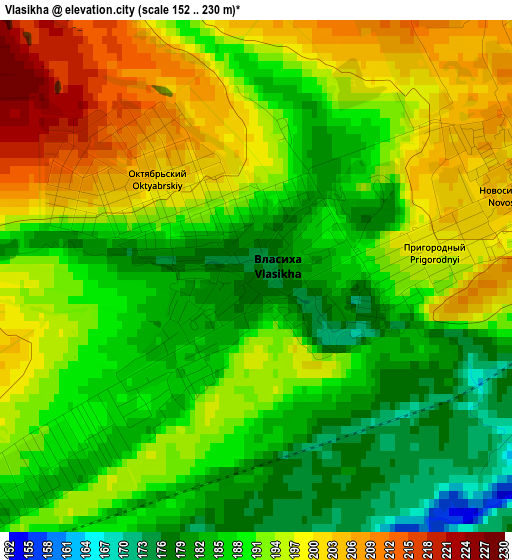
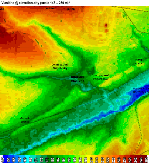
Below is the Elevation map of Vlasikha, which displays elevation range with different colors. Scale of the first map is from 152 to 230 m (499 to 755 ft) with average elevation of 191.2 meters (=627 ft) [note 1]
These maps also provides idea of topography and contour of this city, they are displayed at different zoom levels. More info about maps, scale and edge coordinates you can find below images.
| \ | Map #1 | Map #2 | Topo.Map |
| Scale [m] | 152..230 m | 147..250 m | × |
| Scale [ft] | 499..755 ft | 482..820 ft | × |
| Average | 191.2 m = 627 ft | 199.5 m = 655 ft | × |
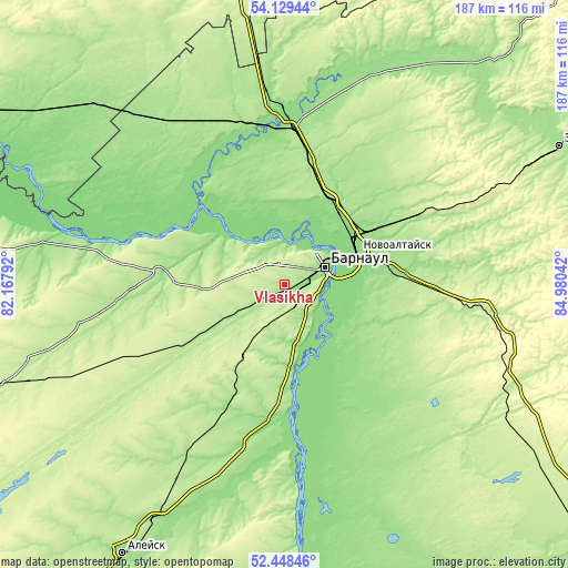
| Width | 5.84 km = 3.6 mi | 11.68 km = 7.3 mi | 186.9 km = 116.1 mi |
| Height | 5.84 km = 3.6 mi | 11.68 km = 7.3 mi | 186.9 km = 116.1 mi |
| ↑Max Latitude | 53.323476° | 53.349717° | 54.12944° |
| Latitude at center | 53.29722° | 53.29722° | 53.29722° |
| ↓Min Latitude | 53.270947° | 53.244659° | 52.44846° |
| ← Min Longitude | 83.530225° | 83.486279° | 82.16792° |
| Longitude center | 83.57417° | 83.57417° | 83.57417° |
| →Max Longitude | 83.618115° | 83.662061° | 84.98042° |
Nearby cities:
Cities around Vlasikha sort by population:
• Barnaul elevation 189 m
14.4 km,  60°
60°
• Novoaltaysk 147 m
26.2 km,  66°
66°
• Yuzhnyy 213 m
9.3 km,  121°
121°
• Novosilikatnyy 201 m
3.6 km, 67°
• Lebyazh’ye 214 m
8 km,  138°
138°
• Novyye Zori 197 m
11.3 km,  241°
241°
• Zaton 132 m
15.5 km,  91°
91°
• Bobrovka 135 m
23.7 km, 122°
• Nauchnyy Gorodok 174 m
14.1 km,  345°
345°
• Gon’ba 164 m
13.3 km,  0°
0°
• Shakhi 251 m
14.7 km,  287°
287°
• Stukovo 190 m
18.3 km, 239°
Multilingual:
 En español:
Vlasikha elevación 176 m.
 En France:
Vlasikha élévation 176 m.
 Auf Deutsch:
Vlasikha höhe über dem Meeresspiegel ist 176 m.

Sources and notes:
- [note 1] Map square and city borders are not equal. Map elevation data is calculated only from area inside that square.
- [src 1] Elevation data from geonames database provided with same terms of usage.
- [src 2] The elevation map of Vlasikha is generated using elevation data from NASA's 3 arcsec (90m) resolution SRTM data.
- [src 3] Base (background) map © OpenStreetMap contributors tiles are generated by Geofabrik and OpenTopoMap.
Copyright & License:
This Vlasikha Elevation Map is licensed under CC BY-SA. You may reuse any part from this page, if you give a proper credit by linking to this URL:
 More info on terms of use page.