Yurga elevation
Yurga (Kemerovo Oblast), Russia elevation is 156 meters and Yurga elevation in feet is 512 ft above sea level [src 1]. Yurga is a historical populated place (feature code) with elevation that is 43 meters (141 ft) smaller than average city elevation in Russia.
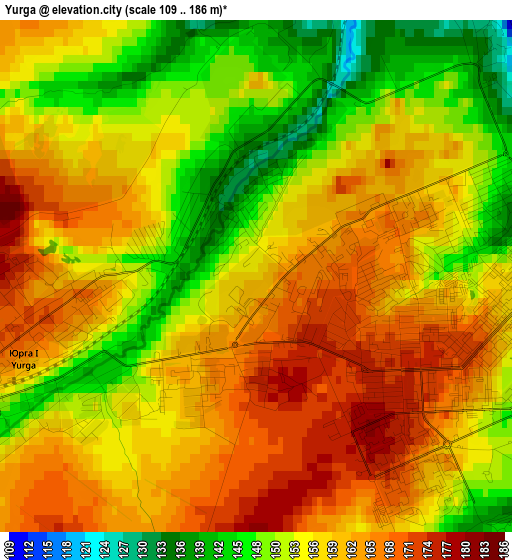
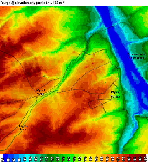
Below is the Elevation map of Yurga, which displays elevation range with different colors. Scale of the first map is from 109 to 186 m (358 to 610 ft) with average elevation of 157.5 meters (=517 ft) [note 1]
These maps also provides idea of topography and contour of this city, they are displayed at different zoom levels. More info about maps, scale and edge coordinates you can find below images.
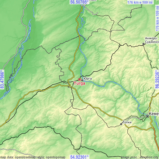
| \ | Map #1 | Map #2 | Topo.Map |
| Scale [m] | 109..186 m | 84..192 m | × |
| Scale [ft] | 358..610 ft | 276..630 ft | × |
| Average | 157.5 m = 517 ft | 148 m = 486 ft | × |
| Width | 5.5 km = 3.4 mi | 11.01 km = 6.8 mi | 176.1 km = 109.4 mi |
| Height | 5.5 km = 3.4 mi | 11.01 km = 6.8 mi | 176.1 km = 109.4 mi |
| ↑Max Latitude | 55.747802° | 55.772528° | 56.50705° |
| Latitude at center | 55.72306° | 55.72306° | 55.72306° |
| ↓Min Latitude | 55.698302° | 55.673529° | 54.92301° |
| ← Min Longitude | 84.842165° | 84.798219° | 83.47986° |
| Longitude center | 84.88611° | 84.88611° | 84.88611° |
| →Max Longitude | 84.930055° | 84.974001° | 86.29236° |
Nearby cities:
Cities around Yurga sort by population:
• Anzhero-Sudzhensk elevation 204 m
81.6 km,  60°
60°
• Topki 281 m
67.6 km,  137°
137°
• Tayga 261 m
59.5 km,  50°
50°
• Toguchin 149 m
62.7 km,  210°
210°
• Kedrovka 187 m
76 km,  106°
106°
• Bolotnoye 203 m
31.1 km,  259°
259°
• Yashkino 256 m
37.7 km, 63°
• Pioner 157 m
80.8 km,  123°
123°
• Borovoy 169 m
81.9 km, 113°
• Stantsionno-Oyashinskiy 175 m
72.5 km,  246°
246°
• Bogashevo 187 m
73.5 km,  12°
12°
• Kaltay 112 m
61.8 km,  359°
359°
Multilingual:
 En español:
Yurga elevación 156 m.
 En France:
Yurga élévation 156 m.


Sources and notes:
- [note 1] Map square and city borders are not equal. Map elevation data is calculated only from area inside that square.
- [src 1] Elevation data from geonames database provided with same terms of usage.
- [src 2] The elevation map of Yurga is generated using elevation data from NASA's 3 arcsec (90m) resolution SRTM data.
- [src 3] Base (background) map © OpenStreetMap contributors tiles are generated by Geofabrik and OpenTopoMap.
Copyright & License:
This Yurga Elevation Map is licensed under CC BY-SA. You may reuse any part from this page, if you give a proper credit by linking to this URL:
 More info on terms of use page.